푸쿠리아
Pukhuria푸쿠리아 | |
|---|---|
마을 | |
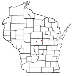
 푸쿠리아 인도 웨스트벵골의 위치  푸쿠리아 푸쿠리아 (인도)  푸쿠리아 푸쿠리아 (아시아) | |
| 좌표: 25°08′01″N 88°01′42″E / 25.133661°N 88.028377°E좌표: 25°08′01″N 88°01′42″E / 25.133661°N 88.028377°E/ | |
| 나라 | |
| 주 | 웨스트벵골 |
| 구 | 말다 |
| 인구 (2011) | |
| • 합계 | 22,550 |
| 언어들 | |
| • 공식 | 벵골어[1][2] |
| • 추가 관계자 | 영어[1] |
| 시간대 | UTC+5:30(IST) |
| 핀 | 732213 |
| STD/전화 코드 | 03512 |
| 롯 사바 선거구 | 몰다하 우타르 |
| 비단 사바 선거구 | 라투아 |
| 웹사이트 | malda |
푸쿠리아(Puchuria)는 인도 서벵골 주 말다 지구의 찬찰 구획에 있는 라투아 2세 CD 블록에 있는 마을이다.
지리
M: 시립 도시, CT: 인구 조사 도시, R: 시골/도시 중심, F: 시설, H: 역사 중심
작은 지도에서의 공간 제약 때문에, 더 큰 지도에서의 실제 위치는 약간 다를 수 있다.
위치
북후리아는 25°0에 위치한다.8′01″N 88°01′42″E / 25.133661°N 88.028377°E.
마하난다는 근처에 흐른다. 푸쿠리아에는 강을 건너는 다리가 있다.[3]
영역 개요
인접한 지도에 표시된 지역은 동쪽의 바린드와 서쪽의 탈이라는 두 개의 생리학적 지역을 포함한다. 동부는 비교적 높고(곳곳에서 평균 해발 40m까지) 울퉁불퉁하다. 동부 지역의 토양은 "붉은 빛깔의 단단하고 짠 밀조류로 땅이 쇠처럼 단단하게 구워진다"고 되어 있다. 그것은 마하나다 강 동쪽에 있다. 마하나다 강 서쪽에 놓여 있는 부락은 평평한 낮은 땅이며 "무수히 많은 습지, 바리, 황소호"가 흩어져 있다. 그 부적은 지방 강물에 의해 범람하기 쉽다.[4]전체 면적은 압도적으로 시골이다.[5][6]이 지역에는 판두아와 자가지반푸르라는 두 개의 중요한 역사적/고고적 유적지가 있다.[7]
참고: 지도와 함께 이 지역에서 주목할 만한 위치를 표시한다. 지도에 표시된 모든 장소는 더 큰 전체 화면 지도에 연결된다.
시민행정
경찰서
웨스트벵골 경찰 산하 푸쿠후리아 경찰서는 라투아 2세 CD 블록을 관할한다.[8][9]
CD 블록 HQ
라투아 2세 CD 블록의 본사는 푸쿠리아에 있다.[8][10][11]
인구통계학
2011년 인도 인구조사에 따르면 푸쿠리아 인구는 2만2550명으로 이 중 1만1457명(51%)이 남성이고 1만1093명(49%)이 여성이었다. 0~6세의 인구는 3,348명이다. 부쿠후리아의 전체 문맹자는 10,782명(6년 이상 인구의 56.15%)이었다.[12]
교육
1932년에 설립된 푸쿠리아 고등학교는 벵골-중급 고등 중등학교로, 6학급부터 12학급까지의 교편을 마련하였다. 2000여권의 책과 12대의 컴퓨터, 놀이공간이 있는 도서관을 갖추고 있다. 그것은 관청에 소장되어 있다.[13]
헬스케어
참조
- ^ a b "Fact and Figures". www.wb.gov.in. Retrieved 15 January 2019.
- ^ "52nd REPORT OF THE COMMISSIONER FOR LINGUISTIC MINORITIES IN INDIA" (PDF). nclm.nic.in. Ministry of Minority Affairs. p. 85. Archived from the original (PDF) on 25 May 2017. Retrieved 16 January 2019.
- ^ 구글 지도
- ^ "District Census Handbook Maldah, Series 20, Part XII A" (PDF). Census of India 2011, Pages 13-15: Physiography. Directorate of Census Operations, West Bengal. Retrieved 9 November 2018.
- ^ "District Statistical Handbook 2014 Malda". Table 2.1 , 2.2, 2.4b. Department of Statistics and Programme Implementation, Government of West Bengal. Retrieved 9 November 2018.
- ^ "C.D. Block Wise Primary Census Abstract Data(PCA)". West Bengal – District-wise CD Blocks. Registrar General and Census Commissioner, India. Retrieved 9 November 2018.
- ^ "District Census Handbook Maldah, Series 20, Part XII A" (PDF). Census of India 2011, Page 98: Brief Description of Places of Religious, Historical or Archaeological Importance and Places of Tourist Interest of the District. Directorate of Census Operations, West Bengal. Retrieved 9 November 2018.
- ^ a b "District Statistical Handbook 2014 Malda". Table 2.1, 2.2, 2.4b. Department of Statistics and Programme Implementation, Government of West Bengal. Archived from the original on 21 January 2019. Retrieved 9 November 2018.
- ^ "Malda District Police". Telephone Numbers. District Police. Archived from the original on 9 November 2018. Retrieved 9 November 2018.
- ^ "District Census Handbook: Maldah, Series 20 Part XII A" (PDF). Map of Maldah with CD Block HQs and Police Stations (on the fourth page). Directorate of Census Operations, West Bengal, 2011. Retrieved 9 November 2018.
- ^ "BDO Offices under Malda District". Department of Mass Education Extension & Library Services, Government of West Bengal. West Bengal Public Library Network. Retrieved 8 November 2018.
- ^ "2011 Census – Primary Census Abstract Data Tables". West Bengal – District-wise. Registrar General and Census Commissioner, India. Retrieved 11 November 2018.
- ^ "Pukuhuria High School". ICBSE. Retrieved 16 November 2018.
- ^ "Health & Family Welfare Department". Health Statistics. Government of West Bengal. Retrieved 14 November 2018.