푸에르토리코 토아바하 팔로세코
Palo Seco, Toa Baja, Puerto Rico팔로세코 | |
|---|---|
바리오 | |
 팔로세코에서 본 산후안의 모습 | |
 붉은색으로 표시된 토아바하 시내의 팔로세코의 위치 | |
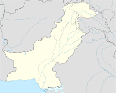
 팔로세코 푸에르토리코의 위치 | |
| 좌표:18°28′12″N 66°08′12″w/18.47005°N 66.136674°W좌표: 18°28′12″N 66°08′12″W / 18.47005°N 66.136674°W/ [1] | |
| 영연방 | |
| 시 | |
| 면적 | |
| • 합계 | 12.60 sq mi(4.1km) |
| • 육지 | 0.49 sq mi(1.3km2) |
| • 물 | 1.11 sq mi(2.9 km2) |
| 표고 | 0 ft(0m) |
| 인구 (2010) | |
| • 합계 | 288 |
| • 밀도 | 587.8/sq mi(227.0/km2) |
| 출처: 2010년 인구조사 | |
| 시간대 | UTC-4(AST) |
팔로 세코는 푸에르토리코 토아바하 시의 바리오이다.2010년의 인구는 288명이다.[3][4][5]
팔로세코 발전소
푸에르토리코에 전력을 공급하는 주요 발전소 중 하나가 토아바자 팔로세코 인근에 위치한 팔로세코 연료유 발전소다.[6][7]2017년 9월 허리케인 이르마와 허리케인 마리아가 푸에르토리코를 강타하기 전 팔로 세코 공장은 폐쇄될 예정이었다.[8]
| 역사인구 | |||
|---|---|---|---|
| 인구조사 | Pop. | %± | |
| 1980 | 439 | — | |
| 1990 | 385 | −12.3% | |
| 2000 | 325 | −15.6% | |
| 2010 | 288 | −11.4% | |
| 미국 십수년 인구[9] 조사 1899년 (1990년 ~[10] 1900년) 1910년[11] 1930-1950[12] 1980-2000[13] 2010[14] | |||
갤러리

팔로세코 해안에서 침몰한 배

2017년 푸에르토리코에서 허리케인이 2차례 발생한 후 팔로세코 발전소에서


참고 항목
참조
- ^ a b "US Gazetteer 2019". US Census. US Government.
- ^ 미국 지질조사국 지리적 이름 정보 시스템:팔로세코바리오
- ^ Picó, Rafael; Buitrago de Santiago, Zayda; Berrios, Hector H. Nueva geografía de Puerto Rico: física, económica, y social, por Rafael Picó. Con la colaboración de Zayda Buitrago de Santiago y Héctor H. Berrios. San Juan Editorial Universitaria, Universidad de Puerto Rico,1969.
- ^ Gwillim Law (20 May 2015). Administrative Subdivisions of Countries: A Comprehensive World Reference, 1900 through 1998. McFarland. p. 300. ISBN 978-1-4766-0447-3. Retrieved 25 December 2018.
- ^ Puerto Rico:2010:population and housing unit counts.pdf (PDF). U.S. Dept. of Commerce, Economics and Statistics Administration, U.S. Census Bureau. 2010.
- ^ "Protestan para que enciendan Palo Seco". Primera Hora (in Spanish). 19 October 2017. Retrieved 25 August 2019.
- ^ "Engineering Solutions for the Nation's Toughest Problems: USACE tackles Puerto Rico's power grid". www.army.mil. 2018-03-24. Retrieved 2021-08-26.
- ^ Alvarado León, Gerardo E. (2017-08-25). "La Autoridad de Energía Eléctrica cerrará la central Palo Seco". El Nuevo Día (in Spanish). Retrieved 2021-08-26.
- ^ "U.S. Decennial Census". United States Census Bureau. Archived from the original on February 13, 2020. Retrieved September 21, 2017.
- ^ "Report of the Census of Porto Rico 1899". War Department Office Director Census of Porto Rico. Archived from the original on July 16, 2017. Retrieved September 21, 2017.
- ^ "Table 3-Population of Municipalities: 1930 1920 and 1910" (PDF). United States Census Bureau. Archived (PDF) from the original on August 17, 2017. Retrieved September 21, 2017.
- ^ "Table 4-Area and Population of Municipalities Urban and Rural: 1930 to 1950" (PDF). United States Census Bureau. Archived (PDF) from the original on August 30, 2015. Retrieved September 21, 2014.
- ^ "Table 2 Population and Housing Units: 1960 to 2000" (PDF). United States Census Bureau. Archived (PDF) from the original on July 24, 2017. Retrieved September 21, 2017.
- ^ Puerto Rico:2010:population and housing unit counts.pdf (PDF). U.S. Dept. of Commerce Economics and Statistics Administration U.S. Census Bureau. 2010. Archived (PDF) from the original on 2017-02-20. Retrieved 2019-08-02.