오빌 빌
O'Bil Bil| 오빌 빌 퀸즐랜드 | |||||||||||||||
|---|---|---|---|---|---|---|---|---|---|---|---|---|---|---|---|
| 좌표 | 25°31′34″s 151°15′19″e/25.5261°S 151.2552°E좌표: 25°31°34°S 151°15°19°E / 25.5261°S 151.2552°E / | ||||||||||||||
| 인구. | 29 (2016년 인구조사)[1] | ||||||||||||||
| • 밀도 | 0.690/km2 (1.79/140 mi) | ||||||||||||||
| 우편 번호 | 4626 | ||||||||||||||
| 지역 | 42.0km2(16.2평방마일) | ||||||||||||||
| 시간대 | 미학(UTC+10:00) | ||||||||||||||
| LGA | 노스버넷 주 | ||||||||||||||
| 주의 유권자 | 캘라이드 | ||||||||||||||
| 연방 부문 | 플린 | ||||||||||||||
| |||||||||||||||
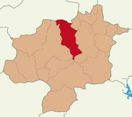
O'Bil Bil은 호주 [2]퀸즐랜드 노스 버넷 지역에 있는 시골 지역입니다.2016년 인구조사에서 [1]오빌 빌의 인구는 29명이었다.
지리
버넷 고속도로는 동쪽과 북쪽 경계를 형성하고 버넷 강은 서쪽 [3]경계를 형성합니다.
역사
그 지역의 이름은 버넷 [4]강의 지류인 오빌 빌 크릭에서 따왔다.
Malmoe 주립 학교는 1914년 8월에 개교했다.1928년에 오빌 빌 주립학교로 개명했다.1964년경에 문을 닫았다.[5]
O'Bill Bill Creek 주립학교는 1916년 1월에 개교했다.1925년에 그것은 카츠크릭 밸리 주립학교로 개명되었다.1971년 [5]3월 12일에 문을 닫았다.
2016년 인구조사에서 [1]오빌 빌의 인구는 29명이었다.
레퍼런스
- ^ a b c Australian Bureau of Statistics (27 June 2017). "O'Bil Bil (SSC)". 2016 Census QuickStats. Retrieved 20 October 2018.
- ^ "O'Bil Bil – locality in North Burnett Region (entry 47621)". Queensland Place Names. Queensland Government. Retrieved 28 December 2020.
- ^ Google (13 August 2019). "O'Bil Bil, Queensland" (Map). Google Maps. Google. Retrieved 13 August 2019.
- ^ "O'Bil Bil Creek – creek in the North Burnett Region (entry 24934)". Queensland Place Names. Queensland Government. Retrieved 25 December 2017.
- ^ a b Queensland Family History Society (2010), Queensland schools past and present (Version 1.01 ed.), Queensland Family History Society, ISBN 978-1-921171-26-0


