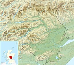
로찬 스른 스머르
Lochan Sròn Smeur| 로찬 스른 스머르 | |
|---|---|
 로찬 스론 스머어 스론 스머어 해변의 보트하우스는 근처에 있는 언덕의 이름이며 블랙베리(스머)의 아웃크롭(sron)을 의미할 수 있다. | |
| 좌표 | 56°42′42″N 4°32′10″w/56.711700°N 4.536100°W좌표: 56°42′42″N 4°32′10″W / 56.711700°N 4.536100°/ |
| 유형 | 민물 로치 |
| 최대 길이 | 0.804km(0.500mi)[1] |
| 최대폭 | 0.40km(0.25mi)[1] |
| 표면적 | 19.5ha(48에이커)[2] |
| 평균 깊이 | 10.3ft(3.1m)[1] |
| 최대 깊이 | 33피트(10m)[1] |
| 쇼어 길이1 | 2.2km(1.4mi) |
| 지표면 표고 | 346m(1,135ft)[2] |
| 1 해안 길이는 정확히 정해진 척도가 아니다. | |
로찬 스른 스머는 스코틀랜드 타이사이드에 있는 상류층 로치다.[1][2]
참조
- ^ a b c d e John, Murray; Lawrence, Pullar (1910). Bathymetrical Survey of the Fresh-Water Lochs of Scotland, 1897-1909 Lochs of the Tay Basin Volume II - Lochan Sròn Smeur. National Library of Scotland: National Challenger Officer. p. 66. Retrieved 26 June 2018.
 이 글은 공개 도메인에 있는 이 출처의 텍스트를 통합한다..
 - ^ a b c d "Lochan Sròn Smeur". Centre for Ecology and Hydrology. Scotland and Northern Ireland Forum for Environmental Research (SNIFFER). Retrieved 26 June 2020.


