버켈란트
Berkelland버켈란트 | |
|---|---|
 보르쿨로의 교회 | |
 깃발  국장 | |
.svg) 겔덜랜드의 위치 | |
| 좌표: 52°7°N 화씨 6°32°E / 52.117°N 6.533°E좌표: 52°7′N 6°32′E / 52.117°N 6.533°E | |
| 나라 | 네덜란드 |
| 주 | 겔덜란드 |
| 확립된 | 2005년[1] 1월 1일 |
| 정부 | |
| • 차체 | 시의회 |
| • 시장 | 주스트 판 우스트럼 (VVD) |
| 면적 | |
| • 합계 | 260.21km2(100.47 sq mi) |
| • 육지 | 258.06km2(99.64 sq mi) |
| • 물 | 2.15km2(0.83 sq mi) |
| 표고 | 16m(52ft) |
| 최고 고도 | 35m(제곱 피트) |
| 인구 (1919년 1월)[6] | |
| • 합계 | 43,904 |
| • 밀도 | 170/km2(400/sq mi) |
| 시간대 | UTC+1(CET) |
| • 여름(DST) | UTC+2(CEST) |
| 우편번호 | 7150–7165, 7260–7261, 7270–7275 |
| 지역번호 | 0544, 0545, 0573 |
| 웹사이트 | gemeenteberkelland |
버켈란드(Dutch 발음: [bbrrkllntnt] (![]() 듣기)는 네덜란드 겔더랜드 지방의 자치단체다. 2005년 1월 1일 보르쿨로, 아이버겐, 니드, 루를로의 구 자치체들의 합병으로 탄생하였다. 새로운 자치시는 작은 강인 베르켈강의 이름을 따서 명명되었다.
듣기)는 네덜란드 겔더랜드 지방의 자치단체다. 2005년 1월 1일 보르쿨로, 아이버겐, 니드, 루를로의 구 자치체들의 합병으로 탄생하였다. 새로운 자치시는 작은 강인 베르켈강의 이름을 따서 명명되었다.
인구중심
- 이전 Borculo의 일부분: 보르쿨로, 게스테렌, 겔셀라르, 하를로.
- 이전에 Eibergen의 일부분: Avest, Beltrum, Eibergen, Holterhoek, Hupeld, Lintvelde, Loe, Mallem, Olden Eibergen, Rekken, Zwolle.
- 이전 니드의 일부: 아흐터벨드, 브로케, 훈테, 로추이젠, 니데, 노오르디크, 노오르디케르벨트, 리에트몰렌.
- 루를로의 이전 부분: 브링크만슈에크, 드 브뤼일, 드 하르, 허르네, 마리앙벨데, 루를로, 벨드후크.
지형

2015년 6월, 버켈란드 시의 네덜란드 지형도.
정부
아이버겐 커뮤니티에는 국립 SIGINT Organizationatie의 인터셉션 스테이션이 있다.[7]
저명인사

- 림부르크의 잡스트 (보르쿨로 1560년 - 1621년) 림부르크와 브롱크호르스트 백작
- 메노 테르 브라크(1902년 아이버겐 ~ 1940년)는 네덜란드의 모더니즘 작가
- 전 스피드스케이팅 선수, 1980년 동계 올림픽 금메달리스트 애니 보크링크(Annie Borckink, 1951년 후셀 출생)
- 네덜란드의 사진작가 버트 테우니센(1959년 루를로 출생)은 2차 세계대전 전에 지어진 유럽의 집들을 문서화한다.
- 아스트리드 버스싱크 (1975년 아이버겐 출생) 네덜란드의 영화 제작자
- 네덜란드의 디자이너, 예술가, 기업가 Joris Laarman (1979년 보르쿨로 출생)은 신흥 기술을 사용한다.
- 2016년 하계 올림픽에 출전한 네덜란드 배구 선수 주디스 피에테르센(1989년 아이버겐 출생)
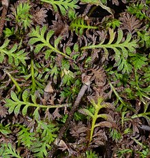
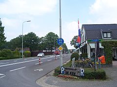
갤러리

루를로, 드 신트 윌리브러더스커크

보르쿨로호프스트라트
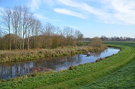
보흐트 인 데베르켈
후플, 데 키에


참조
- ^ "Gemeentelijke indeling op 1 januari 2005" [Municipal divisions on 1 January 2005]. cbs.nl (in Dutch). CBS. Retrieved 19 June 2014.
- ^ "Burgemeester" [Mayor] (in Dutch). Gemeente Berkelland. Archived from the original on 18 July 2014. Retrieved 19 June 2014.
- ^ "Kerncijfers wijken en buurten 2020" [Key figures for neighbourhoods 2020]. StatLine (in Dutch). CBS. 24 July 2020. Retrieved 19 September 2020.
- ^ "Postcodetool for 7271AX". Actueel Hoogtebestand Nederland (in Dutch). Het Waterschapshuis. Retrieved 19 June 2014.
- ^ "Berkelland landschap". Natuurlijk Achterhoek. Retrieved 27 August 2020.
- ^ "Bevolkingsontwikkeling; regio per maand" [Population growth; regions per month]. CBS Statline (in Dutch). CBS. 1 January 2019. Retrieved 1 January 2019.
- ^ "국군 SIGINT Organizationatie." (아카이브) 국방부. 2013년 6월 13일에 검색됨
- ^ IMDb 데이터베이스가 2019년 8월 9일 검색됨
외부 링크
| 위키보야게는 버켈란드를 위한 여행 가이드가 있다. |
겔덜랜드의 행정 구역 | ||
|---|---|---|
 | ||