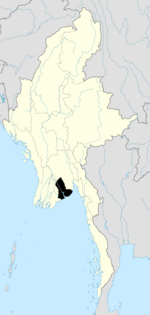
탐웨 타운십
Tamwe Township탐웨 타운십 တာမွေ မြို့နယ် | |
|---|---|
양곤의 도시 | |
| 탐웨 타운십 | |
| 좌표:16°46°16°N 96°10′0″e/16.77111°N 96.16667°E좌표: 16°46°16°N 96°10°0°E/16.77111°N 96.16667°E | |
| 나라 | 미얀마 |
| 나누기 | 양곤 |
| 도시 | 양곤 |
| 타운십 | 탐웨 |
| 지역 | |
| • 합계 | 44.1km2(17.02평방마일) |
| 인구. (2009년)[1] | |
| • 합계 | 140,000 |
| • 밀도 | 3,200/km2 (8,200/140 mi) |
| 시간대 | UTC6:30 (MST) |
| 우편 번호 | 11211, 11212 |
| 지역 번호 | 1 (모바일: 80, 99) |
| YCDC[2] | |
탐웨 타운십(Tamwe Township)은 미얀마 양곤 동부에 위치한 타운십이다.북쪽은 얀킨 진, 동쪽은 싱강윈 진, 서쪽은 반한 진, 남쪽은 [2]민갈라 진과 국경을 접하고 있다.
어원학
"탐웨"는 몬어로 "하나의 토디 야자수"[3][4]를 뜻하는 "타모아"에서 유래했다.
교육
30개의 초등학교, 4개의 중학교,[2] 6개의 고등학교가 있다.
인구.
2014년 3월 현재 탐웨의 인구는 165,313명이고, 남성 거주자는 45.2%,[5] 여성 거주자는 54.8%이다.
랜드마크
다음은 탐웨시가 [6]보호하고 있는 랜드마크 목록입니다.
| 구조. | 유형 | 주소. | 메모들 |
|---|---|---|---|
| 성 프란치스코 가톨릭 교회 | 교회 | 규카산길 131 | 오션슈퍼마켓 슈곤딘로드 |
레퍼런스
- ^ Myo Lwin (16–22 March 2009). "Sputum microscopy centre opens in Tarmwe". The Myanmar Times. Archived from the original on 24 March 2009.
- ^ a b c "Tamwe Township". Yangon City Development Committee. Archived from the original on 2 October 2011. Retrieved 15 March 2009.
- ^ Tun, Than (1988). "Observations on the Translation and Annotation of the Royal Orders Of Burma". Crossroads: An Interdisciplinary Journal of Southeast Asian Studies. 4 (1): 91–99. JSTOR 40860260.
- ^ Banyar, Ko (7 November 2013). "မွန်တို့ဌာနေ ရာမည တိုင်းက မွန် အခေါ်အဝေါ်များ". Phophtaw News Association. Archived from the original on 26 June 2015.
- ^ "Tamwe (Township, Myanmar) - Population Statistics, Charts, Map and Location". www.citypopulation.de. Retrieved 14 March 2020.
- ^ "Special Reports: Heritage List". The Myanmar Times. 29 October 2001. Archived from the original on 15 June 2009.


