퀸즐랜드 주 탈우드
Talwood, Queensland| 탈우드 퀸즐랜드 | |
|---|---|
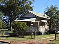
 메인 스트리트 남쪽에 있는 상점들 | |
 탈우드 | |
| 좌표 | 28°29′07″S 149°28′05″E / 28.48528°S 149.46806°E |
| 우편번호 | 4496 |
| 위치 | |
| LGA | 곤디윈디 주 |
| 주 선거인단 | 서던 다운스 |
| 연방 부서 | 마라노아 |
탈우드는 오스트레일리아 퀸즐랜드 곤디윈디 지역에 있는 노스탈우드의 시골 지역에 있는 마을이다.[1]
지리
탈우드는 노스 탈우드 지역의 남쪽 가장자리에 있으며, 사우스 탈우드 경계 바로 북쪽에 있다.[2]
탈우드는 남서부 철도 노선에 있으며 탈우드 철도역(28°29′05″S 149°2)이 운행하고 있다.8′06″E / 28.4846°S 149.4683°E/ )[3][4]
역사
가밀라라이어(Gamilaraay, Kamilaroi, Comilroy)는 남서 퀸즐랜드와 북서 뉴사우스웨일스 출신의 언어다. 가믈라라이어 지역은 디란반디, 탈론, 탈우드, 분군야 등 발론 샤이어 평의회의 지방정부 경계 내에 있는 풍경과 뉴사우스웨일스의 모레, 탐워스, 쿠오나바라브란까지 확장된 문긴디와 부미의 국경도시들을 포함한다.[5]
이 마을의 이름은 1844년부터 사용된 목회자 런 이름인 달우드의 부패로 추정되는데, 이 이름은 원주민 말에서 유래된 것으로 믿어졌다. 1903년 조사 계획서에 1911년 조사 계획서에 나타난 명칭인 탈우드로 변경되었다는 주석을 달고 Tallwood로 표기되었다.[1]
Tallwood 임시 학교는 1911년에 개교했지만 같은 해에 문을 닫았다. 탈우드 주립학교 1918년 11월 4일 개교
교육
탈우드 주립학교(Talwood State School)는 17개 레크리에이션 거리(28°292912″S 149°28′13″E / 28.4866°S 149.4703°E/ )[7][8]에 있는 정부 초등학교(Prep-6)이다. 2018년에는 교사 4명(정규직 3명)과 비교직원 5명(정규직 2명)으로 28명이 등록했다.[9]
탈우드에는 중등학교가 없다. 가장 가까운 중등학교는 건디윈디에 있는 건디윈디 주립 고등학교인데, 거리 때문에 다른 대안으로는 거리 교육과 기숙학교가 있을 것이다.[10]
편의시설
탈우드 우체국은 메인 스트리트 25번지에 있다(28°29′07″S 149°2).8′09″E / 28.4854°S 149.4692°E/ )[11]
갤러리
동부 마을 입구(2021년)

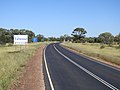
탈우드 타운쉽(2021년)으로 가는 바원고속도로.
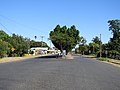
메인 스트리트(2021년) 서쪽을 내려다보고 있다.
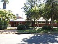
메인 스트리트(2021년)의 탈우드 커뮤니티 센터.
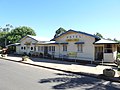
메인 스트리트(2021년)의 탈우드 호텔.

레크리에이션 스트리트(2021년)의 탈우드 주립학교.

탈우드 전쟁 기념관, 공원, 레크리에이션 거리(2021년).
메인 스트리트(2021년)의 탈우드 경찰서.

메인 스트리트(2021년)의 세인트 폴 성공회.

레크리에이션 스트리트(2021년)의 탈우드 커뮤니티 가든.

개종교회, 7번가(2021년)

디란반디 메일은 1987년 탈우드 기차역에 도착한다.


참조
- ^ a b "Talwood – town in Goondiwindi Region (entry 33213)". Queensland Place Names. Queensland Government. Retrieved 4 July 2017.
- ^ "Talwood – population centre in Goondiwindi Regional (entry 33213)". Queensland Place Names. Queensland Government. Retrieved 23 October 2020.
- ^ "Talwood – population centre in Goondiwindi Regional (entry 33213)". Queensland Place Names. Queensland Government. Retrieved 23 October 2020.
- ^ "Railway stations and sidings - Queensland". Queensland Open Data. Queensland Government. 27 August 2020. Archived from the original on 5 October 2020. Retrieved 5 October 2020.
- ^ "Indigenous Language map of Queensland". State Library of Queensland. Archived from the original on 2 September 2020. Retrieved 23 January 2020.
- ^ Queensland Family History Society (2010), Queensland schools past and present (Version 1.01 ed.), Queensland Family History Society, ISBN 978-1-921171-26-0
- ^ "State and non-state school details". Queensland Government. 9 July 2018. Archived from the original on 21 November 2018. Retrieved 21 November 2018.
- ^ "Talwood State School". Archived from the original on 27 December 2020. Retrieved 21 November 2018.
- ^ "ACARA School Profile 2018". Australian Curriculum, Assessment and Reporting Authority. Archived from the original on 27 August 2020. Retrieved 28 January 2020.
- ^ "Queensland Globe". State of Queensland. Retrieved 23 October 2020.
- ^ "Talwood LPO". Australia Post. Archived from the original on 28 November 2020. Retrieved 27 December 2020.
외부 링크
| 위키미디어 커먼즈에는 퀸즐랜드의 탈우드 관련 미디어가 있다. |

