라토웬
Rathowen라토웬 에가인 라트 | |
|---|---|
마을 | |
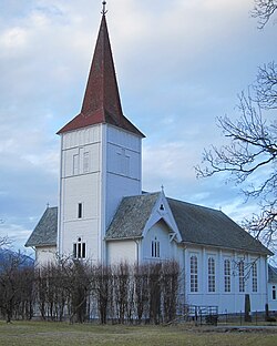
 세인트 토마스 교회 | |
| 좌표:53°39′36″N 7°31′12″w/53.66,000°N 7.52,000°W좌표: 53°39′36″N 7°31′12″W / 53.66000°N 7.52000°W/ | |
| 나라 | 아일랜드 |
| 주 | 레인스터 |
| 카운티 | 웨스트미트 주 |
| 정부 | |
| • 다일 아이레안 | 롱퍼드-웨스트미트 |
| • EU 의회 | 미들랜드-북서부 |
| 인구 (2016)[1] | 150 |
| 시간대 | UTC+0(WET) |
| • 여름(DST) | UTC-1(IST(WEST)) |
| 아일랜드 그리드 참조 | N317678 |
라토웬(Irish: Rarth Eoghain, 'Eohan's ringfort'[2]라는 뜻)은 N4 국민경선 노선에 있는 아일랜드 웨스트미트 카운티의 작은 마을이다.라토웬은 2016년 인구조사에서 처음으로 중앙통계국이 인구조사타운으로 지정했는데 [3]당시 인구는 150명이었다.[1]
운송
스트리트와 라토웬 철도역은 1877년 8월 1일에 개통되었고 마침내 1963년 6월 17일에 폐쇄되었다.[4]
참고 항목
참조
- ^ a b "Rathowen (Census Town) Ireland". citypopulation.de. Retrieved 22 August 2021.
- ^ "Ráth Eoghain / Rathowen". logainm.ie. Placenames Database of Ireland. Retrieved 22 August 2021.
- ^ "Census of Population 2016 - Profile 2 Population Distribution and Movement". cso.ie. Central Statistics Office. Retrieved 26 June 2021.
26 new census towns were created for the 2016 Census [..including..] Rathowen
- ^ "Street and Rathowen station" (PDF). Railscot - Irish Railways. Retrieved 24 November 2007.


