칼미온
Khalmion칼미온 키르기스어: хлми kyrgyz kyrgyz kyrgyz kyrgyz kyrgyz | |
|---|---|
 칼미온 | |
| 좌표:40°12′44§ N 71°37°58°E/40.2122°N 71.63278°E좌표: 40°12°44°N 71°37°58°E/40.2122°N 71.63278°E | |
| 나라 | 키르기스스탄 |
| 지역 | 바트켄 주 |
| 구 | 카담제이 주 |
| 승진 | 762 m (2,500 피트) |
| 인구. (표준) | |
| • 합계 | 6,274 |
| 시간대 | UTC+6 |
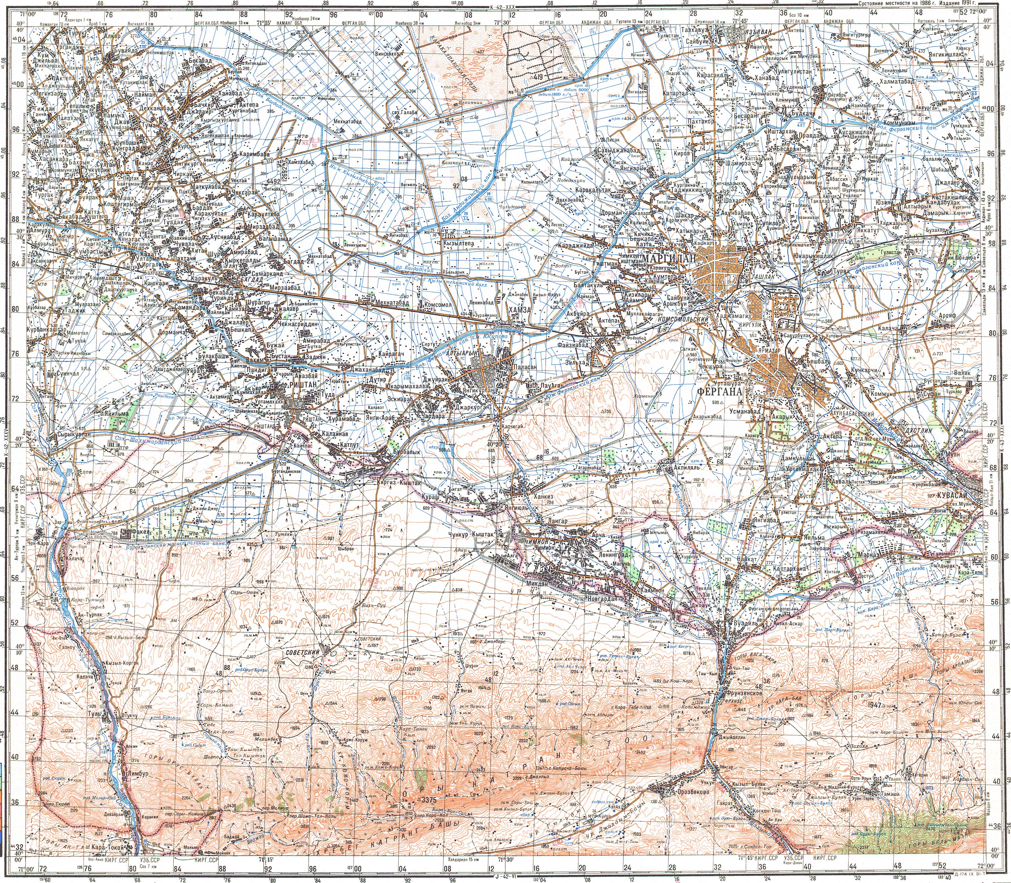
칼미온 (키르기스어:칼미온(Khalmion)[1]은 키르기스스탄 남서부 바트켄 주 카담제이 구에 있는 마을로 우즈베키스탄의 페르가나 주와 실질적으로 국경을 접하고 있다.인구는 [2]2021년에 6,274명이었다.이 마을은 작은장일( [日)의 서쪽(북위 70°12′10°N 71°3우즈베키스탄에 속하는 95050eE/40.20278°N 71.66389°E)로 면적은 1km2 미만이다.이 지역은 또 다른 우즈베키스탄인 거주지역(샤키마르단)의 북서쪽에 위치해 있습니다.키르기스스탄의 칼미온 마을(40°12°44°N 71°37°58°E/40.2122°N 71.63278°E)과 장이-아일 마을(40°10°56°N 71°40°49°E/40.18222°N 71.28°80)이다.
인구.
| 연도 | Pop. | ±% p.a. |
|---|---|---|
| 2009 | 4,602 | — |
| 2021 | 6,274 | +2.62% |
| 주의: 거주 인구; 출처:[6][2] | ||
레퍼런스
- ^ "Classification system of territorial units of the Kyrgyz Republic" (in Kyrgyz). National Statistics Committee of the Kyrgyz Republic. May 2021. pp. 42–46.
- ^ a b "Population of regions, districts, towns, urban-type settlements, rural communities and villages of Kyrgyz Republic" (XLS) (in Russian). National Statistics Committee of the Kyrgyz Republic. 2021. Archived from the original on 10 November 2021.
- ^ "Complete Files of Geographic Names for Geopolitical Areas from GNS". Toponymic information is based on the Geographic Names Database, containing official standard names approved by the United States Board on Geographic Names and maintained by the National Geospatial-Intelligence Agency. More information is available at the Maps and Geodata link at http://www.nga.mil. The National Geospatial-Intelligence Agency name, initials, and seal are protected by 10 United States Code Section 425. Retrieved 2013-02-20.
- ^ National Geospatial-Intelligence Agency. "GeoNames WMS Viewer". Retrieved 2013-02-20.
- ^ 소련 군사지도 K-42-36 (1:200,000)
- ^ "2009 population and housing census of the Kyrgyz Republic: Batken Region" (PDF) (in Russian). National Statistics Committee of the Kyrgyz Republic. 2010. p. 210.

