나고르노카라바흐 주 카르미르규
Karmirgyugh, Nagorno-Karabakh카르미르규 / 기질로바 կրմ q q q / ıı로바 | |
|---|---|
 마을의 경치 | |
 카르미르규 / 기질로바  카르미르규 / 기질로바 | |
| 좌표:39°46-06°N 46°51°02°E/39.76833°N 46.85056°E좌표: 39°46°06°N 46°51°02°E / 39.76833°N 46.85056°E / | |
| 국가(사실상) | |
| • 도도부현 | 아스케란 |
| 국가(de jure) | |
| • 지역 | 코잘리 |
| 승진 | 1,211 m (3,973 피트) |
| 인구. (2015년)[1] | |
| • 합계 | 171 |
| 시간대 | UTC+4(AMT) |
카르미르규(아르메니아어: կրիգ ' ' ' ' ' ', '붉은 마을') 또는 기질로바(아제르바이자니:Qiziloba)는 사실상 독립한 아르차흐 공화국의 아스케란 주에 있는 마을이다.데주레는 아제르바이잔의 코잘리 지구에 있으며, 나고르노카라바흐 분쟁 지역에 있다.
역사
소련 시절, 이 마을은 나고르노카라바흐 자치주의 아스케란 지구의 일부였다.
유적지
Historical heritage sites in and around the village include the 12th/13th-century Church of the Martyr (Armenian: Ըղեն նահատակ եկեղեցի, romanized: Yghen Nahatak Yekeghetsi), a 18th/19th-century cemetery, the church of Surb Astvatsatsin (Armenian: Սուրբ Աստվածածին, lit. 'Holy Mother of God') built in 1841, a spring monument from 1862, and a bridge built in 1864.[1]
경제와 문화
인구는 주로 농업과 축산업에 종사한다.2015년 현재, 마을에는 시립 건물, 문화의 집, 중등학교, 의료 [1]센터가 있다.
인구 통계
그 마을에는 아르메니아계가 다수 거주하고 있다.2005년에는 [2]174명, [1]2015년에는 171명이 거주했다.
갤러리
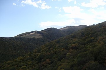
마을 주변 풍경

마을 주변의 자연


레퍼런스
- ^ a b c d Hakob Ghahramanyan. "Directory of socio-economic characteristics of NKR administrative-territorial units (2015)".
- ^ "The Results of the 2005 Census of the Nagorno-Karabakh Republic" (PDF). National Statistic Service of the Republic of Artsakh.
외부 링크
Wikimedia Commons에는 카르미르규, 나고르노카라바흐와 관련된 미디어가 있습니다.
- GEOnet Names Server의 Karmirgh, Nagorno-Karabakh
- 유튜브에 올라온 마을에 대한 짧은 다큐멘터리
자본:아스케란 | ||
| 도시 공동체 |  | |
| 농촌 지역 | ||
| Artsakh의 통제하에 있지 않음 | ||
자본:코잘리 | ||
 | ||


