캥거루 헤드
Kangaroo Head| 캥거루 헤드 사우스오스트레일리아 주 | |
|---|---|
 캥거루 헤드 | |
| 좌표 | 35°43′6″S 137°54′13″E/35.71833°S 137.90361°E좌표: 35°43′6″S 137°54′13″E / 35.71833°S 137.90361°E/ |
| LGA | 캥거루 섬 평의회 |
캥거루 헤드는 캥거루 섬의 더들리 반도의 북서쪽 끝에 위치한 오스트레일리아 남호주에 있는 헤드랜드다.그것은 1802년 3월 23일 영국 탐험가 매튜 플린더스에 의해 이름 지어졌다.
설명
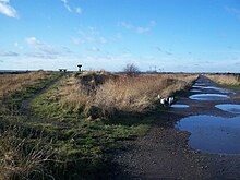
캥거루 헤드는 캥거루 섬의 더들리 반도의 북서쪽 끝이며 서쪽으로는 네판 만, 북쪽으로는 탐정 해협, 동쪽으로는 백스테어스 통로를 내려다보고 있다.그것은 한 쌍의 해안선을 위한 종착역이다. 하나는 동쪽의 케이프 윌러비에서 백스테어스 통로를 통해 연장되고 다른 하나는 남쪽의 스트로브리지 지점에서 네판 만을 통해 연장된다.[1]그것은 '백악관이 뚜렷하게 표시한 엄포, 바위투성이의 지점'으로 묘사된다. 이 지점의 뒤쪽 땅은 91미터(299피트)에서 122미터(400피트)까지 가파르게 높이 올라가 있다.[2]2002년부터는 캥거루 헤드의 관보에 게재된 지역 내에 위치하고 있다.[3]
형성, 지질학, 해양학
캥거루 헤드는 홀로세 호를 시작으로 해수면이 상승하기 시작한 지 7,500년 전 바다가 현재의 수준에 도달했을 때 형성되었다.[4]캥거루 헤드가 포함된 절벽 라인은 타나나파 포메이션으로 알려진 칸만투 그룹 암반에 속하는 회색 메타산드스톤으로 이루어져 있다.[5]캥거루 머리에 인접한 물은 절벽 표면의 밑부분에서 13미터(43피트) 깊이까지 떨어진다.[6]
역사
원주민의 용법
1999년 현재, 이 문헌은 캥거루 헤드의 바로 근처에 있는 원주민의 토지 이용에 관한 어떤 고고학적 발견도 인용하지 않았다.[7]
유럽의 발견
캥거루 헤드는 1802년 3월 23일 매튜 플린더스에 의해 발견되어 이름이 지어졌다.이곳은 플린더스가 고원 산맥에서 가장 높은 봉우리인 고원산을 처음 본 곳이다.[8]
경제활동
2014년 현재, 캥거루 헤드에 인접한 땅은 농사를 짓는데 사용된다.1945년 이전부터 이 지역의 농업 활동은 진행되어 왔으며, 그 당시 대부분의 토지가 자생식물을 제거했다고 보고되었다.[9]
참고 항목
참조
- ^ South Australia. Department of Marine and Harbors (1985), The Waters of South Australia a series of charts, sailing notes and coastal photographs, Dept. of Marine and Harbors, South Australia, pp. Chart 12, ISBN 978-0-7243-7603-2
- ^ Sailing Directions (Enroute), Pub. 175: North, West, and South Coasts of Australia (PDF). Sailing Directions. United States National Geospatial-Intelligence Agency. 2017. p. 215.
- ^ "Search result for "Kangaroo Head (Locality Bounded)" (Record no SA0058060) with the following layers selected - "Suburbs and Localities" and "Place names (gazetteer)"". Department of Planning, Transport and Infrastructure. Archived from the original on 12 October 2016. Retrieved 2 May 2016.
- ^ Robinson, A. C.; Armstrong, D. M. (eds.). A Biological Survey of Kangaroo Island, South Australia, 1989 & 1990 (PDF). Adelaide, SA: Heritage and Biodiversity Section, Department for Environment, Heritage and Aboriginal Affairs, South Australia. p. 26. ISBN 0 7308 5862 6. Retrieved 1 May 2014.
- ^ Fairclough, Martin C (December 2007). "KINGSCOTE Special 1:250 000 geological map" (PDF). MESA Journal. Government of South Australia, DMITRE. 47: 28–31. ISSN 1326-3544. Archived (PDF) from the original on 27 May 2016. Retrieved 18 May 2014.
- ^ South Australia. Department of Marine and Harbors (1985), The Waters of South Australia a series of charts, sailing notes and coastal photographs, Dept. of Marine and Harbors, South Australia, pp. Chart 13, ISBN 978-0-7243-7603-2
- ^ Robinson, A. C.; Armstrong, D. M. (eds.). A Biological Survey of Kangaroo Island, South Australia, 1989 & 1990 (PDF). Adelaide, SA: Heritage and Biodiversity Section, Department for Environment, Heritage and Aboriginal Affairs, South Australia. pp. 34–35. ISBN 0 7308 5862 6. Retrieved 1 May 2014.
- ^ Flinders, Matthew (1966) [1814]. A Voyage to Terra Australis : undertaken for the purpose of completing the discovery of that vast country, and prosecuted in the years 1801, 1802, and 1803 in His Majesty's ship the Investigator, and subsequently in the armed vessel Porpoise and Cumberland Schooner; with an account of the shipwreck of the Porpoise, arrival of the Cumberland at Mauritius, and imprisonment of the commander during six years and a half in that island (Facsimile ed.). Adelaide: Libraries Board of South Australia. pp. 251–252. Retrieved 27 March 2013.
- ^ Robinson, A. C.; Armstrong, D. M. (eds.). A Biological Survey of Kangaroo Island, South Australia, 1989 & 1990 (PDF). Adelaide, SA: Heritage and Biodiversity Section, Department for Environment, Heritage and Aboriginal Affairs, South Australia. p. 52. ISBN 0 7308 5862 6. Retrieved 1 May 2014.
이 사우스 오스트레일리아 지리 기사는 단조롭다.위키피디아를 확장하여 도울 수 있다. |