기야몬 섬
Guillamon Island 기야몬 섬의 북쪽 해안 | |
| 위치 | |
|---|---|
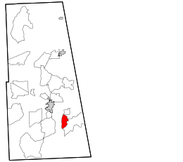
 기야몬 섬 하이랜드 안에 보이는 기야몬 섬 | |
| OS 그리드 참조 | NG63799276 |
| 좌표 | 57°16′30″N 5°55′12″w / 57.274870°N 5.9200086°W |
| 자연 지리학, 지문학 | |
| 섬군 | 이너 헤브리데스 |
| 면적 | 8에이커(3 ha) |
| 최고 고도 | 24m[1][2] |
| 관리 | |
| 소버린 주 | 영국 |
| 나라 | 스코틀랜드 |
| 평의회 | 하이랜드 |
| 인구통계학 | |
| 인구 | 0 |
기야몬 섬은 스코틀랜드 하이랜드의 의회 지역에 있는 스칼페이의 남쪽에 있는 무인도다.[1] 면적은[3] 8에이커(3ha), 남북 방향은 400야드(350m)이다.[4] 그것은 완전히 녹석이다.[5] 그 이름 기원은 불명하다.[6] 길레몬은 트랩 제도의 일원으로 기록되었다.[7] 그것은 1만 1천 파운드에 샀다.[when?][3]
참조
- ^ a b "Guillamon Island". Gazetteer for Scotland. Retrieved 19 January 2019.
- ^ The Scottish Islands: The Bestselling Guide to Every Scottish Island. Hamish Haswell-Smith. 2015. p. 159. ISBN 9781782116783. Retrieved 14 April 2019.
- ^ a b Highlands and Islands: a generation of progress. Alastair Hetherington. 1990. ISBN 9780080379807. Retrieved 19 January 2019.
- ^ "The West coast of Scotland". H.O. Pub. 1948. Retrieved 19 January 2019.
- ^ "A Description of the Western Islands of Scotland, Including the Isle of Man". John Macculloch. 1819. Retrieved 26 February 2019.
- ^ "OS1/16/11/33". ScotlandPlaces. Retrieved 19 January 2019.
- ^ The Geology of Scotland and Its Islands. William Rhind. 1842. p. 131. Retrieved 14 April 2019.
Guillemon Skye.
외부 링크
- "Place Names of Skye" (PDF). Sabhal Mòr Ostaig. Retrieved 26 February 2019.
| 위키미디어 커먼즈에는 기요몬 섬과 관련된 미디어가 있다. |