뒤믈루프샤르, 쿠타하
Dumlupınar, Kütahya덤루프슈나르 | |
|---|---|
| 좌표: 38°51°N 화씨 29도58도 / 38.850°N 29.967°E좌표: 38°51′N 29°58′E / 38.850°N 29.967°E/ | |
| 나라 | 터키 |
| 주 | 쿠타히아 |
| 면적 | |
| • 지구 | 275.82km2 (1955.49 sq mi) |
| 인구 (2012)[2] | |
| • 도시 | 1,296 |
| • 지구 | 3,043 |
| • 지역밀도 | 11/km2(29/sq mi) |
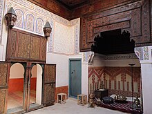
덤루프샤르(Dumlupınar)는 터키의 에게 지역에 있는 쿠타히야 성의 읍·면이다.
이미지 갤러리
참고 항목
참조
- ^ "Area of regions (including lakes), km²". Regional Statistics Database. Turkish Statistical Institute. 2002. Retrieved 2013-03-05.
- ^ "Population of province/district centers and towns/villages by districts - 2012". Address Based Population Registration System (ABPRS) Database. Turkish Statistical Institute. Retrieved 2013-02-27.
외부 링크
| 위키미디어 커먼즈에는 덤루프나르와 관련된 미디어가 있다. |
- 구청장 공식 홈페이지 (터키어로)


