아이오와 주 다우니
Downey, Iowa아이오와 주 다우니 | |
|---|---|
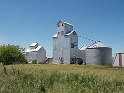
 다우니의 아이오와 주 철로를 따라 곡물 보관함 | |
| 좌표:41°36′58″N 91°20′55″w/41.61611°N 91.34861°W좌표: 41°36′58″N 91°20′55″W / 41.61611°N 91.34861°W/ | |
| 나라 | 미국 |
| 주 | 아이오와 주 |
| 카운티 | 삼나무 |
| 면적 | |
| • 합계 | 0.68 sq mi(1.75 km2) |
| • 육지 | 0.68 sq mi(1.75 km2) |
| • 물 | 0.00 sq mi(0.00km2) |
| 표고 | 689 ft (1968 m) |
| 인구 (2020) | |
| • 합계 | 112 |
| • 밀도 | 165.93/sq mi(64.04/km2) |
| 시간대 | UTC-6(중앙(CST)) |
| • 여름(DST) | UTC-5(CDT) |
| 지역 번호 | 319 |
| GNIS 피쳐 ID | 455974[2] |
다우니는 아이오와 주 시더 카운티에 있는 비법인 공동체다.[2]
인구통계학
| 역사인구 | |||
|---|---|---|---|
| 인구조사 | Pop. | %± | |
| 2020 | 112 | — | |
역사
다우니는 1836년에 처음 정착되었지만, 시카고, 록 아일랜드, 태평양 철도가 건설된 후 봄인 1856년에 설립되었다.[4]다우니는 설립자인 휴 D의 이름을 따서 명명되었다.다우니.[5]다우니의 인구는 1902년에 100명,[6] 1925년에 105명이었다.[7]
참조
- ^ "2020 U.S. Gazetteer Files". United States Census Bureau. Retrieved March 16, 2022.
- ^ a b "Downey". Geographic Names Information System. United States Geological Survey.
- ^ "Census of Population and Housing". Census.gov. Retrieved June 4, 2016.
- ^ The History of Cedar County, Iowa: Containing a History of the County, Its Cities, Towns, etc. Western Historical Company. 1878. p. 512.
- ^ Aurner, Clarence Ray (1910). A Topical History of Cedar County, Iowa, Volume 1. S. J. Clarke. pp. 129.
- ^ Cram's Modern Atlas: The New Unrivaled New Census Edition. J. R. Gray & Company. 1902. pp. 203–207.
- ^ Company, Rand McNally and (1925). Premier Atlas of the World: Containing Maps of All Countries of the World, with the Most Recent Boundary Decisions, and Maps of All the States,territories, and Possessions of the United States with Population Figures from the Latest Official Census Reports, Also Data of Interest Concerning International and Domestic Political Questions. Rand McNally & Company. p. 190.


