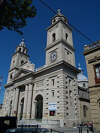
디마탈링
Dimataling디마탈링 | |
|---|---|
| 디마탈링 현 | |
 봉인 | |
 디마탈링이 강조 표시된 잠보앙가 델 수르 지도 | |
오픈스트리트맵  | |
.svg)  디마탈링 필리핀 내 위치 | |
| 좌표: 7°32˚N 동경 123°22°E / 7.53°N 123.37°E좌표: 7°32′N 123°22′E / 7.53°N 123.37°E/ 7 | |
| 나라 | 필리핀 |
| 지역 | 잠보앙가 반도 |
| 주 | 잠보앙가델수르 |
| 구 | 제2구 |
| 설립됨 | 1950년 6월 17일 |
| 바랑게이 | 24(바랑게이 참조) |
| 정부 | |
| • 유형 | 상무니앙바얀 |
| • 시장 | 아벨리노 J. 예루다 |
| • 부시장 | 오마르 T. 불루안 |
| • 대표 | 레오나르도 L. 바바사 주니어 |
| • 시 의회 | 회원들 |
| • 유권자 | 유권자 2만1,192명(2019년) |
| 면적 | |
| • 합계 | 141.80km2(54.75제곱 mi) |
| 표고 | 12m(39ft) |
| 최고 고도 | 146m(479ft) |
| 최저 고도 | 0m(0ft) |
| 인구 (1998년 인구조사) | |
| • 합계 | 31,340 |
| • 밀도 | 220/km2 (190/sq mi) |
| • 가구 | 6,501 |
| 이코노미 | |
| • 소득계층 | 제4기 시립 소득계층 |
| • 빈곤 발생 | 48.92% (2015)[4] |
| • 수익 | ₱123,993,000.00 (2020) |
| • 자산 | ₱322,557,000.00 (2020) |
| • 지출 | ₱115,870,000.00 (2020) |
| • 부채 | ₱114,642,000.00 (2020) |
| 서비스 제공업체 | |
| • 전기 | 잠보앙가델서1전기협동조합(잠보우랑가1) |
| 시간대 | UTC+8(PST) |
| 우편번호 | 7032 |
| PSGC | |
| IDD : 지역번호 | +63 (0)62 |
| 네이티브 언어 | 수바논 세부아노 차바카노 타갈로그어 |
| 웹사이트 | www |
디마탈링, 공식적으로 디마탈링 자치주(세부아노: Lungsod sa Dimataling, Subanen: 벤와 디마탈링; 차바카노: 디마탈링(Dimataling), 타갈로그: 바얀 ng 디마탈링)은 필리핀 잠보앙가 델 수르 지방의 4급 자치구다. 2020년 인구조사에 따르면, 31,340명의 인구를 가지고 있다. [3]
Dimataling was created in 1950 from the barrios of Dinas, Legarda, Mirapao, Migpulao, Kalipapa, Pisaan, Bubway, Tiniguangan, Tabina and Dimataling from Pagadian (not yet as a city at that time) and the barrios of Punta Flecha, Pitogo, Qugbay, Balong-balong, Libertad and Dumanguilas from Margosatubig.[5]
바랑게이
디마틀링은 행정적으로 24개의 바랑게이로 세분된다.
- 바카야완
- 바하
- 발라나간
- 발루노
- 비누에이
- 부부라이
- 그래프
- 요제피나
- 가가와산
- 랄라브
- 리베르타드
- 마가히스
- 마하야그
- 메르세데스
- 포블라시온
- 살로아간
- 산로크
- 스가베이 우노
- 셈바토
- 섬팟
- 팅가불롱
- 티니강간
- 티팡기
- 어퍼 루디옹
기후
| 디마탈링, 잠보앙가 델 수르 기후 데이터 | |||||||||||||
|---|---|---|---|---|---|---|---|---|---|---|---|---|---|
| 월 | 얀 | 2월 | 3월 | 4월 | 5월 | 준 | 줄리 | 8월 | 9월 | 10월 | 11월 | 12월 | 연도 |
| 평균 높은 °C(°F) | 31 (88) | 31 (88) | 32 (90) | 32 (90) | 31 (88) | 30 (86) | 29 (84) | 29 (84) | 29 (84) | 29 (84) | 30 (86) | 31 (88) | 30 (87) |
| 평균 낮은 °C(°F) | 21 (70) | 22 (72) | 22 (72) | 23 (73) | 24 (75) | 24 (75) | 24 (75) | 24 (75) | 24 (75) | 24 (75) | 23 (73) | 22 (72) | 23 (74) |
| 평균 강수량 mm(인치) | 22 (0.9) | 18 (0.7) | 23 (0.9) | 24 (0.9) | 67 (2.6) | 120 (4.7) | 132 (5.2) | 156 (6.1) | 119 (4.7) | 124 (4.9) | 54 (2.1) | 24 (0.9) | 883 (34.6) |
| 평균 비 오는 날 | 9.4 | 9.1 | 11.5 | 11.9 | 20.1 | 22.5 | 22.4 | 23.2 | 21.5 | 22.2 | 15.7 | 11.5 | 201 |
| 출처: 마테오블루 | |||||||||||||
인구통계학
| 연도 | Pop. | ±% p.a. |
|---|---|---|
| 1960 | 30,632 | — |
| 1970 | 28,341 | −0.77% |
| 1975 | 20,883 | −5.94% |
| 1980 | 16,497 | −4.60% |
| 1990 | 20,365 | +2.13% |
| 1995 | 23,116 | +2.40% |
| 2000 | 25,843 | +2.42% |
| 2007 | 26,902 | +0.56% |
| 2010 | 27,715 | +1.09% |
| 2015 | 30,081 | +1.57% |
| 2020 | 31,340 | +0.81% |
| 출처: 필리핀 통계청 | ||
이코노미
| 디마탈링의 빈곤발생현황 | |
| 출처: 필리핀 통계청[11][12][13][14][15][16] | |
참조
- ^ 디마탈링 현 (DILG)
- ^ "2015 Census of Population, Report No. 3 – Population, Land Area, and Population Density" (PDF). Philippine Statistics Authority. Quezon City, Philippines. August 2016. ISSN 0117-1453. Archived (PDF) from the original on May 25, 2021. Retrieved July 16, 2021.
- ^ a b Census of Population (2020). "Region IX (Zamboanga Peninsula)". Total Population by Province, City, Municipality and Barangay. PSA. Retrieved 8 July 2021.
- ^ https://psa.gov.ph/sites/default/files/City%20and%20Municipal-level%20Small%20Area%20Poverty%20Estimates_%202009%2C%202012%20and%202015_0.xlsx; 발행일: 2019년 7월 10일; 출판사: 필리핀 통계청.
- ^ "An act to create the municipality of Dimataling in the province of Zamboanga". LawPH.com. Archived from the original on 2012-07-12. Retrieved 2011-04-09.
- ^ "Dimataling: Average Temperatures and Rainfall". Meteoblue. Retrieved 1 May 2020.
- ^ Census of Population (2015). "Region IX (Zamboanga Peninsula)". Total Population by Province, City, Municipality and Barangay. PSA. Retrieved 20 June 2016.
- ^ Census of Population and Housing (2010). "Region IX (Zamboanga Peninsula)". Total Population by Province, City, Municipality and Barangay. NSO. Retrieved 29 June 2016.
- ^ Censuses of Population (1903–2007). "Region IX (Zamboanga Peninsula)". Table 1. Population Enumerated in Various Censuses by Province/Highly Urbanized City: 1903 to 2007. NSO.
- ^ "Province of Zamboanga del Sur". Municipality Population Data. Local Water Utilities Administration Research Division. Retrieved 17 December 2016.
- ^ "Poverty incidence (PI):". Philippine Statistics Authority. Retrieved 28 December 2020.
- ^ https://psa.gov.ph/sites/default/files/NSCB_LocalPovertyPhilippines_0.pdf; 발행일: 2005년 11월 29일; 출판사: 필리핀 통계청.
- ^ https://psa.gov.ph/sites/default/files/2003%20SAE%20of%20poverty%20%28Full%20Report%29_1.pdf; 발행일: 2009년 3월 23일; 출판사: 필리핀 통계청.
- ^ https://psa.gov.ph/sites/default/files/2006%20and%202009%20City%20and%20Municipal%20Level%20Poverty%20Estimates_0_1.pdf; 발행일: 2012년 8월 3일; 출판사: 필리핀 통계청.
- ^ https://psa.gov.ph/sites/default/files/2012%20Municipal%20and%20City%20Level%20Poverty%20Estima7tes%20Publication%20%281%29.pdf; 발행일: 2016년 5월 31일; 출판사: 필리핀 통계청.
- ^ https://psa.gov.ph/sites/default/files/City%20and%20Municipal-level%20Small%20Area%20Poverty%20Estimates_%202009%2C%202012%20and%202015_0.xlsx; 발행일: 2019년 7월 10일; 출판사: 필리핀 통계청.
외부 링크

 디마탈링
디마탈링