코니에
Cornier코니에 | |
|---|---|
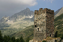
 코니에에 있는 무스시 예배당 | |
 국장 | |
코니어의 위치  | |
 코니에  코니에 | |
| 좌표:46°05′37″N 6°18′02″E/46.0936°N 6.3006°E좌표: 46°05′37″N 6°18′02″E / 46.0936°N 6.3006°E/ 6 | |
| 나라 | 프랑스. |
| 지역 | 아우베르그네르알페스 |
| 부서 | 오뜨사보이 |
| 아르론디스먼트 | 본네빌 |
| 광동 | 라로슈르포론 |
| 인터커뮤니티티 | 코뮌 드 코뮌 드 페이 로초이스 |
| 정부 | |
| • 시장(2020–2026) | 미셸[1] 루 |
| 면적 1 | 6.78km2(2.62평방 미) |
| 인구 (2018년 1월)[2] | 1,328 |
| • 밀도 | 200/km2 (190/sq mi) |
| 시간대 | UTC+01:00(CET) |
| • 여름(DST) | UTC+02:00(CEST) |
| INSEE/우편 번호 | 74090 /74800 |
| 표고 | 453–912m(1,486–2,992ft) |
| 웹사이트 | Mairie-cornier.com |
| 1 1km2(0.386평방미터 또는 247에이커) 이하의 호수, 연못, 빙하 및 하천 유역을 제외한 프랑스 토지 등록부 자료. | |
코르니에르는 프랑스 남동부 아우베르그네-르손-알프스 지역에 있는 오트사보이에 주(州)의 코뮌이다.
참고 항목
참조
- ^ "Répertoire national des élus: les maires". data.gouv.fr, Plateforme ouverte des données publiques françaises (in French). 9 August 2021.
- ^ "Populations légales 2018". The National Institute of Statistics and Economic Studies. 28 December 2020.
| 위키미디어 커먼즈에는 코니에와 관련된 미디어가 있다. |