바라마 강
Barama River| 바라마 강 | |
|---|---|
| 위치 | |
| 나라 | 가이아나 |
| 물리적 특성 | |
| 출처 | |
| • 위치 | 7°40°N 59°15°W/7.667°N 59.250°W |
| 입 | |
• 위치 | 와이니 강 |
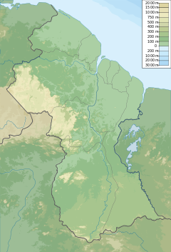
바라마 강은 와이니 강의 지류로, 둘 다 가이아나의 바리마 와이니 행정구역에 있다.[1][2][3]
강의 정착지로는 카리코(카리아코)와 차이나 랜딩이 있다.[4]비행장(야키슈리 비행장)은 2011년 이 지역에 대한 접근을 제공하기 위해 개방되었다.[5][6]
금광은 이 지역에서 흔하며, 바라마의 둑을 준설하여 금을 채취한다.[4]벌목도 그 지역에 존재한다.[7]
참고 항목
참조
- ^ 영국 해외조사국 1966년 가이아나 NW 시트지 1:50만 지도
- ^ 1993년 The New International Atlas, 랜드 맥널리.
- ^ "NGA: GNS Home". nga.mil. Archived from the original on 2020-04-10. Retrieved 2009-07-08.
- ^ a b "Barama River residents complained about dredges". Stabroek News. 2009-09-16. Retrieved 2021-01-04.
- ^ "Closure of northwest aerodrome causing hardship for Barama residents". Stabroek News. 2018-04-16. Retrieved 2021-01-04.
- ^ "Yakishuru aerodrome reopened". Stabroek News. 2018-04-20. Retrieved 2021-01-04.
- ^ "Chinese company seeking to log on former Barama concession". Stabroek News. 2018-04-23. Retrieved 2021-01-04.
좌표: 7°40′N 59°15′W / 7.667°N 59.250°W/ 7


