화구룬초
Huaguruncho| 화구룬초 | |
|---|---|
| 타라타 | |
 | |
| 최고점 | |
| 승진 | 5,723 m (18,776 피트) |
| 좌표 | 10°31′52″s 75°55′54″w/10.53111°S 75.93167°W좌표: 10°31°52°S 75°55°54°W / 10.53111°S 75.93167°W / |
| 지리 | |
 화구룬초 페루 | |
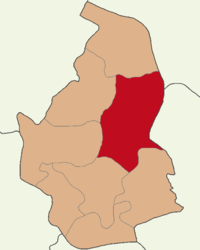
| 위치 | 페루, 파스코 주 |
| 부모 범위 | 안데스 와쿠룬추 |
화구룬초,[1][2][3][4][5] 타라타[6][7] 또는 화구룬초는[4][8] 페루 안데스 산맥의 화구룬초 산맥에 있는 높이 5,723미터의 [3][4][7]산이다.공식적으로 [7]타라타라고 이름 붙여진 가장 높은 봉우리는 후아촌과 티클라카얀의 경계에 있는 파스코 지역에 위치해 있습니다.IGN 지도에서 후아구룬초[7] 치코로 명명된 작은 봉우리가 티클라카얀 구에 [6]있습니다.
연구에 따르면 화구룬초 빙하의 변동은 열대 대서양의 기온 변화로 인해 발생했으며, 마지막 빙하 팽창은 ca.4000~2000년 전.[5]
레퍼런스
- ^ Lezameta, Pablo (2004). Documental de la provincia de Pachitea. Ediciones PASALEAP. pp. 12, 15, 20.
- ^ Box, Ben (1999). The South American Handbook. McGraw-Hill/Contemporary. p. 1380. ISBN 9780844249841.
- ^ a b "Huaguruncho". www.montanasperuanas.com. Archived from the original on 2016-08-20. Retrieved 2016-07-16.
- ^ a b c Biggar, John (2005). The Andes: A Guide for Climbers. Andes. p. 107. ISBN 9780953608720.
Huagaruncho
- ^ a b Stansell, Nathan D.; et al. (2015). "Late Glacial and Holocene glacier fluctuations at Nevado Huaguruncho in the Eastern Cordillera of the Peruvian Andes". Geology. 43 (8): 747–750. doi:10.1130/G36735.1.
- ^ a b escale.minedu.gob.pe - 파스코 주(파스코 지역)의 UGEL 지도
- ^ a b c d Peru 1:100 000, Ulcumayo (22-l). IGN (Instituto Geográfico Nacional - Perú).
- ^ Neate, Jill (1994). "Peru". Mountaineering in the Andes. RGS-IBG Expedition Advisory Centre. ISBN 0-907649-64-5.
Huagaruncho