인디애나 주 마셜 카운티 호두 타운쉽
Walnut Township, Marshall County, Indiana호두 타운쉽 | |
|---|---|
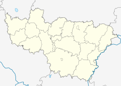
 마셜 카운티의 위치 | |
| 좌표:41°13′31″N 86°12′25″w/41.22528°N 86.20694°W좌표: 41°13′31″N 86°12′25″W / 41.22528°N 86.20694°W | |
| 나라 | |
| 주 | |
| 카운티 | 마셜 |
| 정부 | |
| • 유형 | 인디애나 타운쉽 |
| 면적 | |
| • 합계 | 37.75 sq mi(97.8 km2) |
| • 육지 | 37.71 sq mi(97.7 km2) |
| • 물 | 0.04 sq mi(0.1km2) 0.11% |
| 표고 | 817피트(249m) |
| 인구 (2010) | |
| • 합계 | 2,747 |
| • 밀도 | 72.8/sq mi(28.1/km2) |
| ZIP 코드 | 46501, 46504, 46563, 46570 |
| GNIS 피쳐 ID | 0453970 |
호두 타운쉽은 미국 인디애나 주 마셜 카운티에 있는 10개 타운쉽 중 하나이다.2010년 인구조사 기준 인구는 2,747명이고 주택은 1,124채였다.[1]
역사
호두 타운쉽은 1859년에 조직되었다.[2]
아르고스 이자악 월튼 리그 역사 구역은 2011년 국가 사적지에 등재되었다.[3]
지리
2010년 인구조사에 따르면 읍면적은 총 37.75제곱마일(97.8km22)이며, 이 중 37.71제곱마일(99.89%)은 토지, 0.04제곱마일(0.10km2)은 물이다.[1]
도시, 마을, 마을
- 아르고스(대수)
비법인 도시
묘지
마을에는 메이플 그로브와 맥그루라는 두 개의 묘지가 있다.
주요 고속도로
공항 및 착륙지
- 스콧 비행장
교육
- 아르고스 커뮤니티 스쿨
호두 타운쉽 주민은 아르고스 공공도서관에서 무료 도서관 카드를 발급받을 수 있다.[4]
정치구
- 인디애나 제2의회 선거구
- 주 하원 17구역
- 주상원 5구
참조
- "Walnut Township, Marshall County, Indiana". Geographic Names Information System. United States Geological Survey. Retrieved 2009-09-29.
- 미국 인구조사국 2008 TIGER/라인 형태 파일
- 인디애나맵
- ^ a b "Population, Housing Units, Area, and Density: 2010 - County -- County Subdivision and Place -- 2010 Census Summary File 1". United States Census. Archived from the original on 2020-02-12. Retrieved 2013-05-10.
- ^ McDonald, Daniel (1908). A Twentieth Century History of Marshall County, Indiana, Volume 1. Lewis Publishing Company. p. 89.
- ^ "National Register of Historic Places Listings". National Park Service. December 23, 2011. Retrieved March 9, 2013.
- ^ "About us". Argos Public Library. Retrieved 10 March 2018.
외부 링크
인디애나 주 마셜 카운티 월넛 타운쉽과 인접한 장소 | |
|---|---|