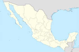
테페살라
Tepezalá테페살라 | |
|---|---|
 아구아스칼리엔테스 시의 자치구 위치 | |
| 좌표:22°13°N 102°10°W/22.217°N 102.167°W좌표: 22°13′N 102°10′W / 22.217°N 102.167°W | |
| 나라 | 멕시코 |
| 주 | 아구아스칼리엔테스 |
| 시 | 테페살라 (시군) |
| 면적 | |
| • 육지 | 232.664km2(89.832 sq mi) |
| 인구 (2015)[2] | |
| • 합계 | 20,926 |
| • 밀도 | 89.9/km2(233/sq mi) |
테페살라는 멕시코 아구아스칼리엔테스 주에 있는 시·군이다.테페살라 마을은 테페살라 주변 자치구의 시가지 역할을 한다.
테페살라는 16세기 옛 은로(Silver Route)에 있던 광물과 초목이 풍부한 주 동부 산맥의 기슭에 위치해 있어 이 지역에 엄청난 부를 가져다 주고 멕시코 북부를 정복하는 데 도움을 주었다.그 도시의 광산은 그것을 유명하게 만들었고 국가에 부를 가져다 주었다.
인구통계학
| 연도 | Pop. | ±% |
|---|---|---|
| 2010 | 19,668 | — |
| 2015 | 20,926 | +6.4% |
| 2020 | 22,485 | +7.5% |
| [3][4][5][6] | ||
2015년 멕시코 인터켄살 조사 기준 테페살라 자치구의 인구는 20,926명이다.[2]2010년 현재, 테페살라 마을은 총 4,511명의 인구를 가지고 있다.[7]테페살라 마을 외에 자치구는 132개 지역으로, 그 중 가장 많은 지역(2010년 인구가 괄호 안에 들어 있음)이 도시형인 샌안토니오(3345명)와 도시형인 엘 차요테(1,817명), 농촌형인 카르보네라스(1,261명) 등이었다.[7]
기후
| Tepezala에 대한 기후 데이터(1951–2010) | |||||||||||||
|---|---|---|---|---|---|---|---|---|---|---|---|---|---|
| 월 | 얀 | 2월 | 3월 | 4월 | 5월 | 준 | 줄리 | 8월 | 9월 | 10월 | 11월 | 12월 | 연도 |
| 높은 °C(°F) 기록 | 31.0 (87.8) | 31.5 (88.7) | 33.0 (91.4) | 37.0 (98.6) | 37.0 (98.6) | 37.0 (98.6) | 35.5 (95.9) | 34.0 (93.2) | 36.0 (96.8) | 32.5 (90.5) | 31.0 (87.8) | 35.0 (95.0) | 37.0 (98.6) |
| 평균 높은 °C(°F) | 21.9 (71.4) | 23.7 (74.7) | 26.4 (79.5) | 29.3 (84.7) | 30.7 (87.3) | 29.8 (85.6) | 27.3 (81.1) | 27.0 (80.6) | 26.0 (78.8) | 25.7 (78.3) | 24.2 (75.6) | 22.2 (72.0) | 26.2 (79.2) |
| 일평균 °C(°F) | 12.9 (55.2) | 14.3 (57.7) | 16.8 (62.2) | 19.6 (67.3) | 21.2 (70.2) | 21.4 (70.5) | 19.8 (67.6) | 19.3 (66.7) | 18.7 (65.7) | 17.6 (63.7) | 15.1 (59.2) | 13.3 (55.9) | 17.5 (63.5) |
| 평균 낮은 °C(°F) | 3.8 (38.8) | 5.0 (41.0) | 7.2 (45.0) | 9.9 (49.8) | 11.8 (53.2) | 12.9 (55.2) | 12.2 (54.0) | 11.6 (52.9) | 11.4 (52.5) | 9.5 (49.1) | 6.0 (42.8) | 4.5 (40.1) | 8.8 (47.8) |
| 낮은 °C(°F) 기록 | −11.0 (12.2) | −2.0 (28.4) | −2.0 (28.4) | 0.0 (32.0) | 1.0 (33.8) | 4.5 (40.1) | 5.0 (41.0) | 4.0 (39.2) | 2.0 (35.6) | 1.0 (33.8) | −2.0 (28.4) | −5.5 (22.1) | −11.0 (12.2) |
| 평균 강수량 mm(인치) | 16.1 (0.63) | 10.3 (0.41) | 5.4 (0.21) | 6.9 (0.27) | 19.4 (0.76) | 59.3 (2.33) | 113.5 (4.47) | 94.6 (3.72) | 74.3 (2.93) | 27.4 (1.08) | 8.1 (0.32) | 11.8 (0.46) | 447.1 (17.60) |
| 평균 강수일(평균 0.1mm) | 2.0 | 1.4 | 1.0 | 1.2 | 2.7 | 7.0 | 10.3 | 9.5 | 7.1 | 3.5 | 1.2 | 1.7 | 48.6 |
| 출처: Servicio Metalologico Nacional[8][9] | |||||||||||||
갤러리
참조
- ^ "Unidad de Microrregiones Cedulas de Informacion Municipal (SCIM)" (in Spanish). Secretara de Desarrollo Social. Archived from the original on December 31, 2017. Retrieved November 18, 2017.
- ^ a b "Tabulados de la Encuesta Intercensal 2015" (xls) (in Spanish). INEGI. Archived from the original on December 31, 2017. Retrieved July 15, 2017.
- ^ "Localidades y su población por municipio según tamaño de localidad" (PDF) (in Spanish). INEGI. Archived from the original (PDF) on August 31, 2018. Retrieved July 15, 2017.
- ^ "Número de habitantes". INEGI (National Institute of Statistics and Geography). Archived from the original on July 2, 2017. Retrieved July 15, 2017.
- ^ "Tabulados de la Encuesta Intercensal 2015" (xls) (in Spanish). INEGI. Archived from the original on December 31, 2017. Retrieved July 15, 2017.
- ^ "INEGI. Censo de Población y Vivienda 2020. Tabulados del Cuestionario Básico – Aguascalientes" [INEGI. 2020 Population and Housing Census. Basic Questionnaire Tabulations – Aguascalientes] (Excel) (in Spanish). INEGI. 2020. pp. 1–4. Archived from the original on January 28, 2021. Retrieved January 27, 2021.
- ^ a b "Tepezalá". Catálogo de Localidades. Secretaría de Desarrollo Social (SEDESOL). Retrieved April 23, 2014.
- ^ "Estado de Aguascalientes-Estacion: Tepezala". Normales Climatologicas 1951–2010 (in Spanish). Servicio Meteorologico Nacional. Retrieved May 8, 2015.
- ^ "Extreme Temperatures and Precipitation for Tepezala 1962–2010" (in Spanish). Servicio Meteorológico Nacional. Retrieved May 8, 2015.


