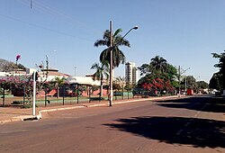
탕가라다세라
Tangará da Serra탕가라 다 세라는 브라질 중서부 마토 그로소 주에 있는 시이다.[1][2][3][4]
탕가라다세라 | |
|---|---|
시 | |
 | |
 | |
| 나라 | |
| 지역 | 남동부 |
| 주 | 마토 그로소 |
| 메소레지온 | 미드웨스트 마토 그로센스 |
| 표고 | 1388ft(423m) |
| 인구 (이스트 에스트)[5] | |
| • 합계 | 105,711 |
| 시간대 | UTC-3(BRT) |
폭포와 급류가 많기로 유명한 세포투바 강은 탕가라 다 세라 인근에 위치해 있다.
참고 항목
참조
- ^ "Divisão Territorial do Brasil" (in Portuguese). Divisão Territorial do Brasil e Limites Territoriais, Instituto Brasileiro de Geografia e Estatística (IBGE). July 1, 2008. Retrieved December 17, 2009.
- ^ "Estimativas da população para 1º de julho de 2009" (PDF) (in Portuguese). Estimativas de População, Instituto Brasileiro de Geografia e Estatística (IBGE). August 14, 2009. Retrieved December 17, 2009.
- ^ "Ranking decrescente do IDH-M dos municípios do Brasil" (in Portuguese). Atlas do Desenvolvimento Humano, Programa das Nações Unidas para o Desenvolvimento (PNUD). 2000. Retrieved December 17, 2009.
- ^ "Produto Interno Bruto dos Municípios 2002-2005" (PDF) (in Portuguese). Instituto Brasileiro de Geografia e Estatística (IBGE). December 19, 2007. Retrieved December 17, 2009.
- ^ IBGE 2020


