아칸소 주 인디펜던스 카운티 사우스사이드
Southside, Independence County, Arkansas아칸소 주, 사우스사이드 | |
|---|---|
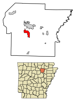
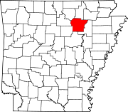
 아칸소 주 인디펜던트 카운티의 사우스사이드 위치. | |
| 나라 | 미국 |
| 주 | 아칸소 주 |
| 카운티 | 독립 |
| Incorporated | 2014 |
| 정부 | |
| 면적 | |
| • 합계 | 9.86 sq mi(25.53km2) |
| • 육지 | 9.86 sq mi(25.53km2) |
| • 물 | 0.00 sq mi(0.01km2) |
| 인구 (2020) | |
| • 합계 | 4,279 |
| • 밀도 | 434.20/sq mi (1934.64/km2) |
| 시간대 | UTC-6(CST) |
| • 여름(DST) | UTC-5(CDT) |
| FIPS 코드 | 05-65630 [2] |
사우스사이드(Southside)는 미국 아칸소 주 인디펜던트 카운티에 위치한 법인 도시다.
남쪽의 고도는 354피트(108m)이다.[3]
아칸소 고속도로 14번 국도의 급발진 경로는 사우스사이드와 살라도를 연결한다.[4]
역사
사우스사이드사는 2014년 10월 29일에 법인화되었다.
인구통계학
| 역사인구 | |||
|---|---|---|---|
| 인구조사 | Pop. | %± | |
| 2020 | 4,279 | — | |
| 미국 십수년 인구 조사 | |||
교육
사우스사이드의 학생들은 아칸소 주 사우스사이드 학군이나 베이츠빌 학군으로 갈 수 있다.
참조
- ^ "2020 U.S. Gazetteer Files". United States Census Bureau. Retrieved October 29, 2021.
- ^ "Feature ID 68757: Township of Barren (Independence County, Arkansas)". Geographic Names Information System. United States Geological Survey. Retrieved May 31, 2014.
- ^ "Southside". Geographic Names Information System. United States Geological Survey. 30 Apr 1980. Retrieved 2009-07-11.
- ^ "Archived copy" (PDF). Archived from the original (PDF) on 2015-09-23. Retrieved 2015-10-14.
{{cite web}}: CS1 maint: 타이틀로 보관된 사본(링크)
외부 링크
좌표:35°41.90˚N 91°37.40˚W/35.69833°N 91.62333°W


