페르세베르언스
Perseverance Harbour| 페르세베르언스 | |
|---|---|
| 위치 | 캠벨 섬 |
| 좌표 | 52°33′07″S 169°11′42″E / 52.552°S 169.195°E좌표: 52°33′07″S 169°11′42″E / 52.552°S 169.195°E/ 552. |
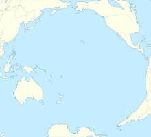
사우스 하버로도 알려진 페르세우스 하버는 뉴질랜드의 아북극성 외딴 섬 중 하나인 캠벨 섬 해안에 있는 큰 움푹 패인 곳이다. 이 항구는 섬의 남동쪽에 있는 바다에 이르는 긴 측면 연립선이며, 섬의 가장 높은 지점인 허니 산이 내려다보고 있다. 캠벨 섬 기상대는 항구의 서쪽 끝에 있다.[1]
On 4 November 1810 the island's discoverer Captain Frederick Hasselborough (or "Hasselburgh" or "Hasselburg"; there are several spellings), who had returned from Sydney, was drowned in Perseverance Harbour, together with Elizabeth Farr, a young woman born at Norfolk Island, and a twelve- or thirteen-year-old Sydney boy George Allwright.[2]
참조
- ^ G.P. Glasby (7 February 1989). Antarctic Sector of the Pacific. Elsevier. pp. 295–. ISBN 978-0-08-087089-2. Retrieved 29 June 2013.
- ^ Peter Entwisle (2005). Taka: A Vignette Life of William Tucker 1784-1817 : Convict, Sealer, Trader in Human Heads, Otago Settler, New Zealand's First Art Dealer. Port Daniel Press. pp. 73–. ISBN 978-0-473-10098-8. Retrieved 29 June 2013.


