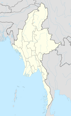
마네루프로
Manerplaw마네루프로 မၤနၢၤပျီ | |
|---|---|
| 좌표:17°43°30°N 97°4466eE/17.72500°N 97.73500°E좌표: 17°43°30°N 97°44µ6µE/17.72500°N 97.73500°E 97 | |
| 나라 | |
| 나누기 | 카인 주 |
| 구 | 하푼 구 |
| 타운십 | 하푼 타운십 |
| 설립. | 1975 |
| 포기. | 1995 |
| 인구. (대피 전) | 3,000[1] |
| 시간대 | UTC+6.30 (MMT) |
Manerplaw (S'gaw Karen: မၤနၢၤပျီ; Burmese: မာနယ်ပလော) was a village in Kayin State, Myanmar (Burma), on the Moei River.[2]그곳은 카렌족이 통치하는 독립 국가의 수도로 제안된 곳이었고, 지역적으로는 카우툴레이로 알려져 있었다.마네르플로는 1975년에[3] 설립되었고 1992년에 약 3,000명의 인구가 있었으나 정부의 [1]군사 공세로 대피하였다.
카렌 국민연합(KNU), 전 버마 학생민주전선(ABSDF), 신사회를 위한 민주당(DPNS), 국민민주전선(NDF)[3] 등 여러 야당 단체들의 본부가 마네르플로에 위치해 있었다.1990년 [4]12월 마네르플로에서 국가 버마 연합 정부(NCGUB)가 수립되었다.
마네르플로는 1995년 1월 27일 타트마도와 민주당 카렌 불교군(DKBA)에 의해 생포되어 점령되었다가 [5]버려졌다.
레퍼런스
- ^ a b "The Ethnic Minority Fighting a Burmese Onslaught". Journeyman Pictures. April 1992. Retrieved 24 April 2016.
- ^ Seekins, Donald M. (2017). "Manerplaw". Historical Dictionary of Burma (Myanmar). Lanham, Maryland: Rowman & Littlefield. p. 340. ISBN 978-1-5381-0183-4.
- ^ a b "The Politics of Pressure: The 1990s and the Fall of Manerplaw". www.ibiblio.org. The Museum of Karen History and Culture. Retrieved 19 April 2018.
- ^ Seekins, Donald M. (2017). "Chonology". Historical Dictionary of Burma (Myanmar). Lanham, Maryland: Rowman & Littlefield. p. xxx. ISBN 978-1-5381-0183-4.
- ^ "The Fall of Manerplaw. KHRG Commentary February 1995". KHRG. Retrieved 20 April 2017.


