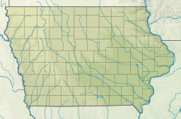
로스트 그로브 호
Lost Grove Lake| 로스트 그로브 호 | |
|---|---|
| 위치 | 스콧 군, 아이오와, 미국 |
| 좌표 | 41°40′53″n 90°28′29″w/41.681494°N 90.474703°WCoordinates:41°40′53″N 90°28′29″W/41.681494°N 90.474703°W/41.681494, -90.474703. |
| 유형 | 저수지 |
| 일차유입 | 로스트 크리크 |
| 일차 유출 | 로스트 크리크 |
| 유역 면적 | 어퍼 미시시피 강 |
| 분지 국가 | 미국 |
| 표면적 | 400에이커의 땅(160ha) |
| 최대 깊이 | 50피트(15m) |
스콧 군, 아이오와 주의 로스트 그로브 레이크 인공 호수라고.[1][2][3]
역사
주요 경사로에 건설 중반에서 후반 6월부터 2014년까지 시작했다.[4]
참조
- ^ "Lost Grove Lake Wildlife Management Area" (PDF). Iowa Department of Natural Resources. April 2013. Retrieved 2 November 2013.
- ^ "Lost Grove Lake" (PDF). Department of Natural Resources. Retrieved 4 February 2022.
- ^ "Lost Grove Wildlife Area is living up to high expectations". Iowa Department of Natural Resources. Retrieved 2022-03-04.
- ^ Iowa Department of Natural Resources (24 May 2013). "Lost Grove Lake filling too fast". Quad-City Times. Retrieved 2 November 2013.


