노스캐롤라이나 주 로렐 스프링스
Laurel Springs, North Carolina노스캐롤라이나 주 로렐 스프링스 | |
|---|---|
 로렐 스프링스 입성 | |
 노스캐롤라이나 주 로렐 스프링스  노스캐롤라이나 주 로렐 스프링스 | |
| 좌표:36°24′41″N 81°15′46″w/36.41139°N 81.26278°W좌표: 36°24′41″N 81°15′46″W / 36.41139°N 81.26278°W/ | |
| 나라 | 미국 |
| 주 | 노스캐롤라이나 |
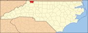
| 카운티. | 알레가니 |
| 표고 | 2,749ft(838m) |
| 시간대 | UTC-5(동부(EST)) |
| • 여름(DST) | UTC-4(EDT) |
| 우편번호 | 28644 |
| 지역 번호 | 336 |
| GNIS 피쳐 ID | 1021119[1] |
로렐 스프링스는 미국 노스캐롤라이나 주 알레한기 카운티에 있는 비법인 공동체다.로렐 스프링스는 스파르타에서 남서쪽으로 10.2마일(16.4km) 떨어진 아셰카운티 선 인근 노스캐롤라이나 18번 고속도로와 노스캐롤라이나 88번 고속도로 분기점에 위치해 있다.[2]블루리지 파크웨이는 또한 지역사회의 중심을 가로지른다.로렐 스프링스는 우편번호 28644를 가진 우체국을 가지고 있다.[3][4]
로버트 L. 도톤 하우스는 1979년에 국가 사적지에 등재되었다.[5]
참조
- ^ "Laurel Springs". Geographic Names Information System. United States Geological Survey.
- ^ Alleghany County, North Carolina (Map). North Carolina Department of Transportation. 2009.
- ^ United States Postal Service (2012). "USPS - Look Up a ZIP Code". Retrieved 2012-02-15.
- ^ "Postmaster Finder - Post Offices by ZIP Code". United States Postal Service. Retrieved March 24, 2013.
- ^ "National Register Information System". National Register of Historic Places. National Park Service. July 9, 2010.