코짐
Kozhim| 코짐 러시아어: ќж russian russian russian | |
|---|---|
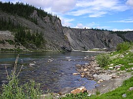
 유구드바 국립공원의 코짐 | |
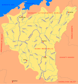
 페초라 유역의 코짐 | |
| 위치 | |
| 나라 | 러시아 |
| 주 | 코미 공화국 |
| 물리적 특성 | |
| 원천 | 우랄 산맥 |
| • 장소 | 러시아 |
| • 좌표 | 64°55°48°N 60°40′07″e/64.93000°N 60.66861°E |
| 입 | 코슈 |
• 좌표 | 65°47°35°N 59°181010eE/65.79306°N 59.30278°E좌표: 65°47°35°N 59°18 †10 †E / 65.79306°N 59.30278°E / / |
| 길이 | 202 km (160 mi) |
| 유역 크기 | 5,180km2(2,000평방마일) |
| 방전 | |
| • 장소 | mouth(표준 평균) |
| 유역 특징 | |
| 진행 | 코슈→Usa→페초라→바렌츠해 |
코짐 강은 러시아 코미 공화국에 있는 강으로 아극성 우랄 [1][2][3][4][5]산맥을 통과합니다.그것은 미국의 지류인 고슈강의 지류이다.길이는 202km, 배수 유역은 5,180km2(2,000평방마일)[6]이다.
「 」를 참조해 주세요.
레퍼런스
- ^ "Paleomagnetism of paleozoic sediments from the Kozhim River section: On the problem of palinspastic reconstructions of the Subpolar Urals and Pai-Khoi". ResearchGate. Retrieved 11 December 2014.
- ^ "Transactions (Doklady) of the Russian Academy of Sciences". 1997. Retrieved 11 December 2014.
- ^ Carbonate Platform Systems. 2000. pp. 159–160. ISBN 9781862390744. Retrieved 11 December 2014.
- ^ Tockner, Klement; Uehlinger, Urs; Robinson, Christopher T. (31 January 2009). Rivers of Europe. ISBN 9780080919089. Retrieved 11 December 2014.
- ^ Sovfoto. "A prospector panning for gold in the kozhim river in the komi region of russia, 1990s". Getty Images. Retrieved 11 December 2014.
- ^ "Река КОЖИМ in the State Water Register of Russia". textual.ru (in Russian).
외부 링크
- 1990년대 러시아 고미의 코짐 강변에 있는 금 시굴촌(이미지).Diomedia.com 를 참조해 주세요.


