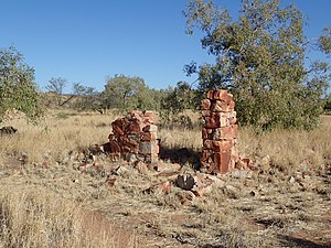
이이트월레펜티 / 데이븐포트 레인지 국립공원
Iytwelepenty / Davenport Range National Park| 이이트월레펜티 / 데이븐포트 레인지 국립공원 북방영토 데이븐포트[1] | |
|---|---|
 Iytwelepenty/Davenport Range 국립공원(녹색으로 표시됨) | |
| 가장 가까운 마을 또는 도시 | 텐넌트 크리크 |
| 확립된 | 1993 |
| 면적 | 1,278.47km2(493.6 sq mi)[2] |
| 관리 권한 | 북부지역 공원 및 야생동물 위원회 |
| 웹사이트 | 이이트월레펜티 / 데이븐포트 레인지 국립공원 |
| 참고 항목 | 북부 영토의 보호 지역 |
Iytwelepenty / Davenport Range, or Davenport Ranges National Park (Iytwellepenty),[3] previously the Davenport Murchison National Park,[4] is a national park in the Northern Territory of Australia about 1,033 kilometres (642 mi) south-east of the territorial capital of Darwin,[5] occupying around 1,120 km2 (430 sq mi)s of the Davenport Range.[3]그것은 5만8,050 km2 (22,410 평방 미)의 면적인 Davenport Murchison Ranges 생물오레지온 안에 있고, 반건조에서 아열대까지 이르는 기후를 가지고 있다.[4]
이 산들은 수억년 전 지질학적 사건에 의해 발생했지만, 최근 우주에서의 이미지들은 약 1억년 전에만 해도 능선과 계곡을 노출시키는 침식이 일어났다는 것을 보여준다.[6]고대 침식된 충격 분화구인 아멜리아 크릭 크레이터가 이 지역의 데이븐포트 레인지 내에 있다.[citation needed]
참고 항목
갤러리
참조
- ^ "Place Names Register Extract for "Iytwelepenty / Davenport Ranges National Park"". NT Place Names Register. Northern Territory Government. Retrieved 5 February 2020.
- ^ a b "CAPAD 2012 Northern Territory Summary (see 'DETAIL' tab)". CAPAD 2012. Australian Government - Department of the Environment. 7 February 2014. Retrieved 7 February 2014.
- ^ a b "Northern Territory For Everyone: Davenport Murchision National Park". Northern Territory for Everyone. Retrieved 9 August 2021.
- ^ a b Davenport Murchison Ranges bioregion (PDF). Department of Agriculture, Water and the Environment. Retrieved 9 August 2021.
- ^ Hema, Maps (2007). Australia Road and 4WD Atlas (Map). Eight Mile Plains Queensland: Hema Maps. p. 101. ISBN 978-1-86500-456-3.
- ^ "Davenport-Murchison Range, Northern Territory, Australia". NASA Earth Observatory. Retrieved 9 August 2021.
외부 링크
좌표:20°51′36″S 134°56′28″E/20.8600°S 134.9410°E


