코타후시 서브바신 조경보호구역
Cotahuasi Subbasin Landscape Reserve| 코타후시 서브바신 조경보호구역 | |
|---|---|
| 쿠엔카 델 코타와시 | |
IUCN 범주 V(보호된 가로/세로) | |
 | |
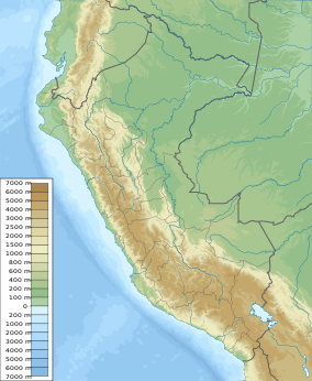
페루의 지도 | |
| 위치 | 페루 라 유니온 주 아레키파 주 |
| 좌표 | 15°03′04″S 72°55′12″w / 15.051°S 72.92°W[1] |
| 면적 | 4,905.5km2(1,894.0 sq mi) |
| 확립된 | 2005년 5월 18일 |
코타후시 서브바신 조경보호구역(스페인어: Supposa Paisajistica Sub Cuenca del Cotahuasi)은 라 우니온 주 아레키파 지역에 위치한 페루의 보호구역이다.[1] 그것은 중앙 안데스 푸나와 세추라 사막 생태계의 일부를 보호한다.[2]
참고 항목
참조
- ^ a b "Subcuenca del Cotahuasi in Peru". Protected Planet.
- ^ Olson, D. M, E. Dinerstein; et al. (2001). "Terrestrial Ecoregions of the World: A New Map of Life on Earth". BioScience. 51 (11): 933–938. doi:10.1641/0006-3568(2001)051[0933:TEOTWA]2.0.CO;2.
{{cite journal}}: CS1 maint : 복수이름 : 작성자 목록(링크)
외부 링크


