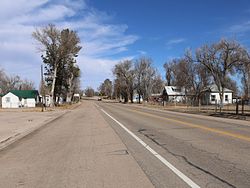
콜로라도 주, 코프
Cope, Colorado콜로라도 주, 코프 | |
|---|---|
 | |
콜로라도 주의 Cope CDP 위치. | |
| 좌표:39°40′09″n 102°51′00″w/39.6692216°N 102.8501063°W좌표: 39°40′09″N 102°51′00″W / 39.6692216°N 102.8501063°W/ [1] | |
| 나라 | |
| 주 | |
| 카운티 | 워싱턴 군 |
| 정부 | |
| • 유형 | 비법인 도시 |
| 면적 | |
| • 합계 | 12.827 sq mi(4.731km) |
| • 육지 | 12.796 sq mi(4.651 km) |
| • 물 | 0.031 sq mi(0.080km2) |
| 표고 | 4,429ft(1,350m) |
| 시간대 | UTC-7(MST) |
| • 여름(DST) | UTC-6(MDT) |
| 우편번호[3] | 80812 |
| 지역 번호 | 970 |
| GNIS 기능[2] | Cope CDP |
Cope는 미국 콜로라도주 워싱턴 카운티에 위치하고 관할하는 비법인 도시, 우체국, 인구조사 지정 장소(CDP)이다.Cope 우체국은 우편번호 80812를 가지고 있다.[3]2010년 미국 인구조사에서 80812 ZIP 코드표 계산 지역의 인구는 인접 지역을 포함하여 275명이었다.[4]
역사
1889년부터 Cope 우체국이 운영되고 있다.[5]그 공동체는 Johnathon C의 이름을 따서 명명되었다.코프, 철도청 공무원.[6]
지리
Cope CDP의 면적은 20에이커(0.080km2)의 물을 포함하여 1,169에이커(4.731km2)[1]이다.
인구통계학
미국 인구조사국은 미국 인구조사 2020을 위한 Cope CDP를 정의했다.
| 연도 | Pop. | ±% |
|---|---|---|
| 2020 | — | |
| 출처: 미국 인구조사국 | ||
참고 항목
참조
- ^ a b c "State of Colorado Census Designated Places - BAS20 - Data as of January 1, 2020". United States Census Bureau. Retrieved December 27, 2020.
- ^ a b c "U.S. Board on Geographic Names: Domestic Names". United States Geological Survey. Retrieved December 27, 2020.
- ^ a b "Look Up a ZIP Code". United States Postal Service. Retrieved December 27, 2020.
- ^ "2010: DEC Summary File 1". United States Census Bureau. Retrieved December 27, 2020.
- ^ "Post offices". Jim Forte Postal History. Archived from the original on 6 March 2016. Retrieved 25 June 2016.
- ^ Dawson, John Frank. Place names in Colorado: why 700 communities were so named, 150 of Spanish or Indian origin. Denver, CO: The J. Frank Dawson Publishing Co. p. 15.


