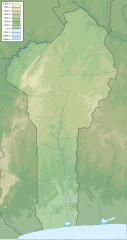
알리보리 강
Alibori River| 알리보리 강 | |
|---|---|
 알리보리를 중심으로 한 북베냉 | |
| 위치 | |
| 나라 | 베냉 |
| 물리적 특성 | |
| 입 | |
• 좌표 | 11°55′59§ N 3°17,28°E/11.933°N 3.291°E좌표: 11°55°59°N 3°17°28°E / 11.933°N 3.291°E / |
| 유역 특징 | |
| 하천계 | 니제르 강 |
알리보리 강은 베냉의 북동쪽에 있는 강이다.이 강은 아타코라 주의 토브레 마을 근처에서 발원하여 북동쪽으로 흐르며 최종적으로 [1][2]비르니-라피아 근처의 니제르 강으로 흐릅니다.알리보리 주에서는 바니코아라 주와 카리마 주(州)의 동쪽 국경과 W 트랜스보더 파크의 동쪽 경계를 형성한다.파코 강은 그 지류 중 하나이다.그곳에는 [3]악어가 서식하고 있다.
레퍼런스
- ^ Sheet 17: Lagos (Map). 1:2,000,000. Series 2201. Defense Mapping Agency Topographic Center. April 1973.
- ^ 랜드 맥널리, 뉴 인터내셔널 아틀라스, 1993년
- ^ International Union for Conservation of Nature and Natural Resources. Crocodile Specialist Group. Working Meeting (1982). Crocodiles: Proceedings of the 5th Working Meeting of the Crocodile Specialist Group of the Species Survival Commission of the International Union for Conservation of Nature and Natural Resources Convened at the Florida State Museum, Gainesville, Florida, U.S.A., 12 to 16 August 1980. IUCN. p. 193. ISBN 978-2-88032-209-0. Retrieved 30 April 2012.


