미제로197번길
U.S. Route 197| 미제로197번길 | |||||||
|---|---|---|---|---|---|---|---|
US 197은 빨간색으로 강조되어 있다. | |||||||
| 경로 정보 | |||||||
| 보조로97번길 | |||||||
| ODOT 및 WSDOT에 의해 유지 관리 | |||||||
| 길이 | 69.93 mi[a] (1965.54km) | ||||||
| 존재했다 | 1952-현재[1] | ||||||
| 주요 접점 | |||||||
| 남쪽 끝 | |||||||
| 노스엔드 | |||||||
| 위치 | |||||||
| 나라 | 미국 | ||||||
| 미국. | 워싱턴 오리건 주 | ||||||
| 카운티 | |||||||
| 고속도로 시스템 | |||||||
| |||||||
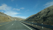
197번 미국 국도(US 197)는 미국 남북 고속도로로, 이 중 69.93마일(112.54km의 4.44마일)의 2.76마일을 제외하고는 모두 오리건 주 내에 있다.이 고속도로는 미국 97번 교차로인 중부 오레곤주 와스코 카운티에서 시작된다. 미국의 197번 고속도로는 4번 달레스칼리포니아 고속도로의 연장선으로서 마우핀, 타이그 밸리, 두퍼르의 도시들을 거쳐 달레스까지 북쪽으로 이동한다.달레스 내에서는 이 고속도로가 미국 30번 고속도로와 동시통행하게 되며 달레스 다리에서 워싱턴으로 가는 콜롬비아 강을 건너기 전에 84번 주간 고속도로(I-844)를 교차한다.이 고속도로는 인접 도시인 클릭키타트 카운티의 달레스포트를 통과하여 주 14번 국도(SR 14)와의 분기점에서 종착한다.
US 197은 1952년에 기존의 Dalles-California Highway를 사용하여 설립되었는데, 그 자체가 1917년에 오레곤 고속도로라는 초기 이름의 일부로 만들어졌다.US 197은 현재 달레스포트의 북쪽 종착역에서 매리힐의 US 97까지 1차 주 고속도로 8(PSH 8)와 830을 따라 이동했으며, 1907년 복도를 따라 지정된 원래의 주 8번 도로로 이동했다.달레스포트-메리힐 구간은 1979년 SR 14로 이전되었지만 2006년까지 미국 고속도로 및 교통 관리 협회(AASHTO)에서 인정을 받지 못했다.
경로 설명
US 197은 오리건과 워싱턴에서 69.93마일(112.54km)을 달리고 있으며 오리건 교통부(ODOT)와 워싱턴 주 교통부(WSDOT)에 의해 유지되고 있다.[2][3]
오리건 주
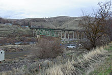
US 197은 중부 오리건 주의 마드라스와 샤니코 사이에 위치한 와스코 카운티의 샤니코 분기점에서 US 97과의 교차로에서 시작된다.달레스칼리포니아 고속도로 4호선의 연장선인 이 고속도로는 3,363피트 높이의 기준 서밋을 넘어 마우핀을 향한 기준 공동체를 통해 스태그 캐년을 따라 북서쪽으로 이동한다.[4]US 197은 워렌 트러스 다리에서 데슈테스 강과 BNSF 철도를 건너 남와스코 [5]카운티 고등학교를 지나 마우핀 시를 통과하면서 데슈테스 애비뉴가 되었다.이 고속도로는 주니퍼 플랫 서쪽으로 계속 이어져 와피티니아 고속도로 44번으로 지정된 오리건 국도 216호선(OR 216)을 교차하며 동시성을 이룬다.[4]US 197과 OR 216은 북북서쪽으로 타이그 계곡으로 이동하며, OR 216은 동시통로를 떠나 Sherars Bridge Highway 290번에서 Grass Valley로 동쪽으로 향한다.[4][6][7]버틀러 캐년 북쪽에서 타이그 리지(Tygh Ridge)까지 2710피트(830m) 높이의 타이그급 서밋을 통과하는 외딴 고속도로가 이어진다.US 197은 듀퍼의 동쪽을 지나 컬럼비아 강 협곡으로 내려가 달링스 도시로 들어간다.이 고속도로는 길이 0.24마일(0.39km)의 US 30과 동시통행을 시작하며, BNSF 동서 철도를 넘어 I-84와 다이아몬드 교환을 한다.[5]US 197은 달레스 다리 위의 인터체인지와 오리건 주를 출발하여 콜롬비아 강을 건너 워싱턴으로 간다.[8][9]연간 평균 일일 교통량(AADT)으로 표현된 연간 평균 교통량을 측정한 ODOT 조사는 2011년 미국 197을 대상으로 실시되었으며, 오레곤에서 가장 혼잡한 구간은 달레스 다리(The Dalles Bridge)로 5,800대의 차량을 운행하는 반면, 가장 덜 혼잡한 구간은 종점 북쪽인 것으로 계산되었다.US 97에 390대의 차량을 서비스하고 [10]있어
워싱턴
US 197은 달레스 댐 하류 콜롬비아 강을 가로지르는 강철 캔틸레버 트러스 교량인 달레스 다리로 워싱턴으로 들어가 클릭키타트 카운티의 달레스포트로 들어간다.이 고속도로는 컬럼비아 협곡 지역 공항을 지나 SR 14와 교차하는 북쪽 종착역까지 2.76마일(4.44km) 동안 북쪽으로 계속된다.[3][9]US 197은 워싱턴 주 입법부에 의해 SR 197으로 정의되며, 워싱턴의 개정 강령의 일부는 §47.17.382로 정의된다.[11]WSDOT는 교통량을 측정하기 위해 매년 주 고속도로에 대한 일련의 조사를 실시하는데, 이는 AADT의 관점에서 표현된다.2012년, WSDOT는 미국 197의 워싱턴 구간에 3,700에서 6,100대의 차량이 운행된다고 계산했는데, 주로 Dalles Bridge에서 운행했다.[12]
역사
1907년 워싱턴에 있는 US 197이 주 고속도로 시스템에 추가되었고, 이후 1937년 PSH 8로 지정되었으며, 밴쿠버에서 메리힐까지 콜롬비아 강을 따라 동쪽으로 이동하였다.[13][14][15]오리건 주 내의 US 197은 1917년 11월 27일 오레건 주 고속도로 위원회가 채택한 초기 명칭의 주 고속도로 시스템의 일부로 만들어진 달레스-캘리포니아 고속도로 4호선의 한 부분으로 지정되어 있다.[1]이 고속도로는 달레스 강에서 중부 오레곤을 거쳐 클라마스 폭포 남쪽에 있는 캘리포니아 주 경계선까지 남쪽으로 이동했다.[16][17]미국 Numbered 도로 시스템에 의하면, 미국 미국 각주 도로 행정관 협회에 의해 승인된 11월 11일 1926,[18]주립 도로 8워싱턴에서 미국-830밴쿠버 Maryhill와 Dalles-California 도로 오레곤에 있는 미국 97로 Shaniko 정션. 미국 플로리다 주 캘리포니아 주 라인씩과씩이었다(AASHO).[19]The Oregon State Highway Department created a numbered state highway system to complement the U.S. route system on May 18, 1937, and The Dalles-California Highway from Shaniko Junction to The Dalles was numbered as OR 50.[1] OR 50 was renumbered to OR 23 on May 26, 1950, and became the Oregon section of US 197 when it was established in 1952.[1]
US 197은 컬럼비아 강 위에 새로 건설된 달레스 다리 북쪽을 달레스포트에서 북동쪽으로 830번과 PSH 8번 고속도로를 타고 동쪽으로 이동하여 메리힐에서 97번 고속도로로 종착했다.[14][20]1968년 미국 노선 시스템에서 US 830과 US 197의 동시성이 제거되었고,[21][22][23] 1964년 주 고속도로 번호 재지정 후 PSH 8, SR 14의 후속 조치와 동시에 US 197이 남게 되었다.[24]SR 14와의 동시성은 1979년에 워싱턴 주 고속도로 시스템에서 제거되었지만,[11][25] 2006년 9월 22일까지 미국 주 고속도로 및 교통 관리 협회(AASHTO)가 정의한 미국 1977의 일부로 남아 있었다.[26]
주요 교차점
| 주 | 카운티 | 위치 | mi[b] | km | 목적지 | 메모들 |
|---|---|---|---|---|---|---|
| 오리건 주 | 와스코 | 0.00 | 0.00 | 남부 종착역 | ||
| 24.74 | 39.82 | OR 216의 남쪽 끝 중첩 | ||||
| 타이그 계곡 | 33.28 | 53.56 | OR 216의 북쪽 끝 중첩 | |||
| 달링스 | 66.24 | 106.60 | US 30 남쪽 끝 겹침 | |||
| 66.48– 66.56 | 106.99– 107.12 | 인터체인지, 미국 북단 30중첩 | ||||
| 컬럼비아 강 | 67.17 0.00 | 108.10 0.00 | 달레스 다리 오레곤-워싱턴 주 노선 | |||
| 워싱턴 | 클릭키타트 | 2.76 | 4.44 | 북부 종착역 | ||
| 1.000 mi = 1.609 km, 1,000 km = 0.621 mi | ||||||
메모들
참조
- ^ a b c d Singh, Ron (January 2007). "History of State Highways in Oregon" (PDF). Oregon Department of Transportation. pp. 89–98. Retrieved March 22, 2013.
- ^ a b c "Straightline Charts: The Dalles-California Highway No. 4" (PDF). Oregon Department of Transportation. May 2012. pp. 1–3. Archived (PDF) from the original on January 2, 2014. Retrieved March 4, 2013.
- ^ a b c d Staff (2012). "State Highway Log: Planning Report 2012, SR 2 to SR 971" (PDF). Washington State Department of Transportation. p. 1212. Archived (PDF) from the original on February 10, 2017. Retrieved March 4, 2013.
- ^ a b c "Cross Reference Table of Highway Route Number to State Highway Number" (PDF). Oregon Department of Transportation. 2011. Archived from the original (PDF) on October 31, 2012. Retrieved March 4, 2013.
- ^ a b State of Oregon: Oregon Railroads (PDF) (Map). Oregon Department of Transportation. July 7, 2010. Archived (PDF) from the original on March 19, 2013. Retrieved March 4, 2013.
- ^ Oregon Transportation Map Showing Federal Functional Classification of Roads: Wasco County (PDF) (Map). Oregon Department of Transportation. 2012. p. 2. Archived (PDF) from the original on January 2, 2014. Retrieved March 4, 2013.
- ^ Oregon Transportation Map Showing Federal Functional Classification of Roads: Wasco County (PDF) (Map). Oregon Department of Transportation. 2012. p. 3. Archived (PDF) from the original on July 16, 2012. Retrieved March 4, 2013.
- ^ Oregon Transportation Map Showing Federal Functional Classification of Roads: Wasco County (PDF) (Map). Oregon Department of Transportation. 2012. p. 1. Archived (PDF) from the original on July 16, 2012. Retrieved March 4, 2013.
- ^ a b Google (July 24, 2008). "U.S. Route 197" (Map). Google Maps. Google. Retrieved July 24, 2008.
- ^ Staff (2011). "Traffic Volumes on State Highways" (PDF). Oregon Department of Transportation. p. 6. Archived from the original on February 3, 2021. Retrieved April 20, 2013.
- ^ a b "47.17.382: State route No. 197". Revised Code of Washington. Washington State Legislature. 1979 [1973]. Archived from the original on October 3, 2006. Retrieved July 24, 2008.
- ^ Staff (2012). "2012 Annual Traffic Report" (PDF). Washington State Department of Transportation. p. 156. Archived (PDF) from the original on December 24, 2013. Retrieved March 23, 2013.
- ^ Washington State Legislature (March 13, 1907). "Chapter 151: Providing for the Establishment, Construction and Maintenance of State Roads and Making Appropriations for Certain State Roads". Session Laws of the State of Washington. Session Laws of the State of Washington (1907 ed.). Olympia, Washington: Washington State Legislature. pp. 310–311. Retrieved March 17, 2013.
State Road No. 8, or the Columbia River road: This road shall begin at the town of Washougal in Clarke county, Washington, and run thence over the line as surveyed for such state road through Clarke and Skamania counties, and thence over the most practicable route to the town of Goldendale, in Klickitat county.
- ^ a b Washington State Legislature (March 17, 1937). "Chapter 190: Establishment of Primary State Highways". Session Laws of the State of Washington. Session Laws of the State of Washington (1937 ed.). Olympia, Washington: Washington State Legislature. pp. 937–938. Archived from the original on October 1, 2013. Retrieved March 17, 2013.
SEC. 8. A primary state highway to be known as Primary State Highway No. 8, or the Evergreen Highway, is hereby established according to description as follows: Beginning at Vancouver on Primary State Highway No. 1, thence in an easterly direction by the most feasible route by way of Stevenson to Goldendale, thence in a northeasterly direction by the most feasible route by way of Satus Pass to a junction with Primary State Highway No. 3, southeast of Yakima.
- ^ Long, Priscilla (June 12, 2006). "The Dalles Bridge spanning the Columbia River is completed on December 18, 1953". HistoryLink. Archived from the original on October 20, 2012. Retrieved March 17, 2013.
- ^ Constitution and statutes of the state of Oregon relating to roads, highways, bridges and ferries. Oregon Secretary of State. 1917. Retrieved March 10, 2013.
- ^ "To Cinder State Highway". The Spokesman-Review. June 19, 1917. p. 13. Retrieved March 17, 2013.
- ^ Weingroff, Richard F. (January 9, 2009). "From Names to Numbers: The Origins of the U.S. Numbered Highway System". Highway History. Federal Highway Administration. Archived from the original on May 21, 2011. Retrieved March 17, 2013.
- ^ Bureau of Public Roads & American Association of State Highway Officials (November 11, 1926). United States System of Highways Adopted for Uniform Marking by the American Association of State Highway Officials (Map). 1:7,000,000. Washington, DC: United States Geological Survey. OCLC 32889555. Retrieved November 7, 2013 – via Wikimedia Commons.
- ^ The Dalles, 1953 (JPG) (Map). 1:250,000. United States Geological Survey. 1953. Archived from the original on October 23, 2012. Retrieved March 17, 2013.
- ^ Northwest, 1967 (Map). Rand McNally. 1967. Archived from the original on August 30, 2012. Retrieved March 17, 2013.
- ^ The Dalles, 1971 (JPG) (Map). 1:250,000. United States Geological Survey. 1971. Archived from the original on October 22, 2012. Retrieved March 17, 2013.
- ^ "State Approves Route Extension". Lewiston Morning Tribune. April 21, 1966. p. 12. Archived from the original on February 3, 2021. Retrieved March 22, 2013.
- ^ Prahl, C. G. (December 1, 1965). "Identification of State Highways" (PDF). Washington State Highway Commission, Department of Highways. Archived (PDF) from the original on February 2, 2020. Retrieved March 17, 2013.
- ^ Staff (1980). "Annual Traffic Report, 1980" (PDF). Washington State Department of Transportation. p. 152. Archived from the original (PDF) on March 18, 2011. Retrieved March 16, 2013.
- ^ Washington State Department of Transportation (September 22, 2006). "An Application from the State Highway or Transportation Department of Washington for the Elimination of U.S. Route 197 (part)" (PDF). American Association of State Highway and Transportation Officials. Archived (PDF) from the original on December 26, 2013. Retrieved March 11, 2013.
외부 링크
경로 지도:
| KML 파일(편집 • 도움말) |


