툴레 사이트 J
Thule Site J| 툴레 사이트 J | |
|---|---|
 툴레 AN/FPS-50 검출 반사체(1959–1987)-콘크리트 기초는 양생 콘크리트의 열이 영구 동토층이 녹는 것을 방지하기 위해 대형 냉동장치를 포함했다.[citation needed] | |
 | |
| 일반 정보 | |
| 유형 | 레이더 구조 |
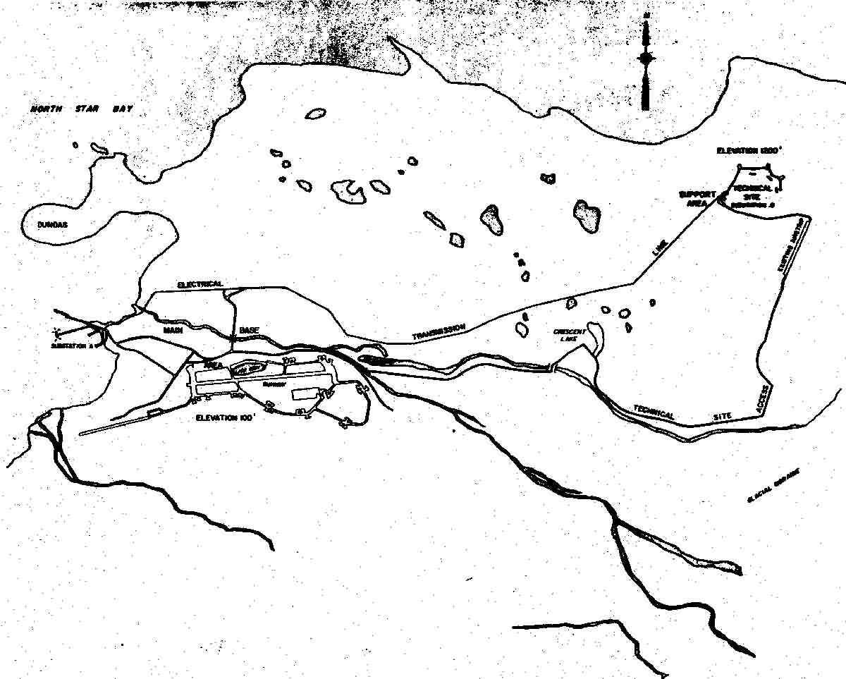
| 위치 | 툴레 AB에서 10마일(13마일) |
| 나라 | 목장 |
| 좌표 | 76°34′13″N 68°17′56″W / 76.570258°N 68.298998°WCoordinates: 76°34′13″N 68°17′56″W / 76.570258°N 68.298998°WEarly Warning Radar76°34′04″N 68°17′03″W / 76.56785°N 68.284214°W AN/FPS-49A bldg[2] |
| 열린 | 1958-60(AN/FPS-50) 1963년(AN/FPS-49A) 1987(AN/FPS-120) |
툴레 사이트 J(J-Site)는 툴레 공군기지 인근 그린랜드에 있는 미사일 경고 및 우주선 추적을 위한 미국 우주군(USSF) 레이더 기지다.솔리드 스테이트 단계별 레이더 시스템의 최북단 기지로, RCA 474L 탄도미사일 조기경보시스템의 제1 부지로 군사설비가 구축되었으며, BMEWS 레이더 12대 중 5대가 탑재되었다.스테이션의 구조는 다음과 같다.
- "EWR 설비":[3] SSPARS(Solid State Phase Array Radar System) 단계 배열 레이더가[4] 설치된 구조물
- BMEWS 레이더 건물: 이전 AN/FPS-50 건물 4개 중 3개 건물, AN/FPS-49A 건물[2] 1개
- 지원 구조: 예를 들어, 스테이션의 "지원 현장"(cf)에 통신 장비가 있는 건물."레이더 장착 기술 사이트"—[5]1961년에[6] 15개의 주요 구조물이 완성되었다(즉, 원래의 BRCS용 Bldg 98).[7]

역사

BMEWS General Operational Requirement 156 was issued on November 7, 1957 (BMEWS had originally been "designed to go with the active portion of the WIZARD system") and on February 4, 1958; the USAF informed Air Defense Command (ADC) that BMEWS was an "all-out program" and was "...being placed on the Department of Defense master urgency list."[8]1958년 1월 14일, 미국은 툴레와 함께 1959년에 운용될 "탄도 미사일 조기경보 시스템 구축 결정"[9]을 발표했다. 1958년 5월 추정치의 툴레와 클리어 공군 기지 총 비용은 8억 달러였다. (1958년 10월 13일, 1960년 9월 완공 예정)[10]
번스앤로 사가[11] 운영한 제2차 세계대전 선박(화물선)은 원래 수년 후 발전소가 건설될 때까지 J사이트 전기와 난방용품을 공급했고,[12] 물은 툴레 AB에서 지점을 거쳐 현장으로 흘러갔다.[13]
건설
Kiewit은 중공(예: AN/FPS-50 반사기 기초와[14] 송신기 건물 사이의 터널)[15]을 위해 계약되었고, 1958년[16] 5월에 공사가 시작되었다(크롬강 1.5% 대신 일반 탄소강 볼트로 인해 시험 반사기 설치가 실패함).[15]전기 열로 된 유지관리 건물은 최초의 준공 건물이었으며, 25톤 기초가 있는 AN/FPS-50 반사기 4대는 1959년[15] 8월 8일까지 완공되었다("추적기용 받침대 2개"는 이연 레이더용으로 건설되었다).[17]1959년 7월 13일, 중간 부지에 관한 캐나다와의 조약 5045호 [1] 서부 전기 BMEWS 후방 통신 시스템 (BRCS)이 "Thule의 교환대와[where?] 뉴욕시의 BMEWS 프로젝트 사무소" 사이에 설립되었다. 즉, 툴레와 매사추세츠 사이의 유사한 선로는 1959년 여름 "잠수함 케이블"을 사용했다.툴레와 케이프 다이어 사이에."("[18]BMEWS 후방 롱 라인 시스템"[19] 스테이션은 CFS 해상도[20] & CFS Saglek에 있었다.)[21]드와이트 D 대통령아이젠 하워는 4월 23일 1960년"4레이더 안테나가 툴레에 예정대로 공사[며]모든 기술적 건물들이 용인되었다 그리고는 전자 구성 부품의 포상은 진행 중[그리고]가설 완성되었다"[22]및 레이더 시험에 통보 받은 5월 16일 IBM709년은 protot로 사용 1960[23]—a 단신식 진공관에 시작되었다.소금물 ypeSile Impact Predictor(MIP)는 2개 층[2]을 점유했다(AN/FSQ-28 미사일 영향 예측기 세트의 이중 IBM-709-TX 솔리드 스테이트 컴퓨터는 나중에 건물 2에 설치되었다).[24]부품 "고장"[25]을 예측하기 위해, 계약자는 또한 32k "고속 메모리"가 장착된 "Checkout Data Processor"[3]--RCA 501 컴퓨터[4], 5-76KC 556 bpi 3/4" 테이프 드라이브 및 200 트랙 랜덤 액세스 LFE 드럼을 설치했다.[citation needed]스캐너 건물 중 한 곳에서 레이더가 처음 전송된 것은 1960년 8월이었다.[5]
RCA 운영
미국 대륙의 BMEWS Central Computer and Display Facility와 같은 날짜에, "1960년 9월 30일 자정["BMEWS Site I"]에서 초기 운용 능력을 달성했으며, 이후 콜로라도 스프링스의 CC&DF로 데이터의 단순 MIP와 음성 전송을 사용한 "shaked" 기간이 이어졌다.[26]
- 허위경보
- 1960년 10월 5일, 소련 수상 니키타 흐루쇼프가 뉴욕에 있을 때 [27]툴레 월출 중 레이더[28] 반송으로 거짓 경보가 발생하였다(1961년 1월 20일, CNCNORAD는 인공위성 궤도를 넘어 메아리 수신을 없애기를 희망하여 2초 FPS-50 주파수를 승인했다).[29]1961년 11월 24일 콜로라도 스프링스의[30] 북동쪽에 있는 그들의 블랙 포레스트 마이크로파 스테이션에서 AT&T 운영자 오류가 발생하여, Ent AFB CC&DF로의 BMEWS 통신 중단과 전략 항공 사령부로의 출력(B-52의 상공비행 확인 사이트 J는 공격받지 않았다)을 초래했다.[31]
The BRCS undersea cable from Greenland had been cut "presumably by fishing trawlers" in September, October, and November 1961 (the BMEWS teletype and backup SSB substituted)[32]--Hard Head[6] missions for continual monitoring commenced in 1961 [7] (the Bomb Alarm System had been installed at the Thule and Clear BMEWS sites by 10 February 1961.[10]국지적 간섭(예: "크레인 및 바닥 왁서")과 장비 문제가 완화되고 72시간 테스트가 "자동 후방 데이터 전송"(BRCS)을 검증한 후, 1961년 "완전 자동 운전 시작 허가; 1월 31일 유효 2400시간 GMT 31시간"[26]이 발행되었다.해리 윌스는[33] 1961년 1월 3일 툴레 프로젝트에서 공군 최고책임자였다("BMEWS 프로그램 부책임자"). 그는 1964년 2월 14일 BMEWS SPO에서 "우주 트랙 SPO"[8]로 재배치되었다.)[34]
방공 사령부
1962년 1월 5일 민간 계약자(RCA 정부 서비스)[35]에서 방공 사령부로 이관된 [36]툴레 작전과 1962년 "스캐너 6"의 배수구에 형성된 싱크홀.[9] 1962년 중반까지 ECCM에 대한 BMEWS "퀵 픽스"가 툴레에 설치되었다."[32]
툴레 기후에[37] 특화된 라돔을 탑재한 RCA AN/FPS-49A 레이더 세트가 1963년 12월까지 설치되었고 [38]툴레 다중 경로 테스트는 1964년 5월까지 완료되었다.[39]시스템 비용이 총 12억5900만 달러에 달했던 1967년, BMEWS 개조 시험은 5월 15일("BMEWS 완성")[34]에 종료되었고, 1968년 툴레 공군기지 B-52 충돌[10] 동안 폭탄 경보 시스템이 거짓 경보를 발생시켰다(시스템은 1970년에 비활성화되었다).[10]1980년 6월, 굿이어에[11] 의한 툴레의 FPS-49A 라돔이 "땅에 태워졌다"고 다시 세워졌고, [12]와 1983년 툴레 P-산맥 사이트에서 사이트 J로 1960년대 후반 위성 통신 단말기가 옮겨졌다.[40]AN/FSQ-28 예측 변수를 대체하기 위해 1970년대 후반 MIRV로부터의[41] 반환 처리 계획이 새 미사일 영향 예측기 컴퓨터를 설치했고 1984년 9월에 완료되었다.[34][42]1983년 7월 29일 툴레에 계약된 후 1984년 11월 7일 AN/FPS-120 조기경보레이더 건설이 시작되었고, 1985년 6월 26일에 "어레이 플레이트"가 완성되었고, 1986년 6월 8일에 1차 위성 트랙이 완성되었다.[34]
솔리드 스테이트 단계별 어레이 레이더
| 외부 매체 | |
|---|---|
| 이미지들 | |
| 비디오 | |
툴레의 BMEWS 레이더는 1987년 6월에 비활성화되었다.[43][44]툴레의 BMEWS 시스템은 SSPARS AN/FPS-120에 의해 "2QFY87년에 완성" (1~3월) "2면-파형 배열 레이더[완료]"로 "대체"[45]되었다.[46]240도 감지 호와[47] 함께 AN/FPS-49A는 1996년에 온전하고 파손되었으며,[16] 2014년까지 안테나와 라돔이 제거되었다.[13] 덴마크 의회가 승인한 후 [14] 레이시온은 2005년에 더 큰 지상 기반 미드코스 방어 프로그램의 일환으로 툴레의 "조기 경고 레이더"를 개량하기로 계약되었다.[3]2008년 준비를 목표로, 실제로 설치는 2009년 6월 24일에 완료되었다.[15] 툴레의 AN/FPS-132 UEWR(Upgrated Early Warning Radar)은 지구 궤도를 도는 위성에 대한 미국 관측의 약 10%를 완료한다.[48]
참조
- ^ "Missile Sites". ed-thelen.org. Retrieved 2015-05-18.
- ^ a b "Google Maps". Google Maps.
- ^ a b Upgrade to the Thule Air Base Early Warning Radar Site (FBO webpage) (Report). FedBizOpps.gov. October 8, 2005. Retrieved 2014-03-19.
- ^ "The Center for Land Use Interpretation". clui.org. Retrieved 2015-05-18.
- ^ "Thule J Site". radomes.org.
- ^ "The Milwaukee Journal - Google News Archive Search". Retrieved 2015-05-18.
- ^ "Broken Arrow -- The B-52 Accident.................. - Thuleforum". thuleforum.com. Archived from the original on 2015-05-19. Retrieved 2015-05-18.
- ^ 1958년 NORAD/CONAD History Summary, Jan-Jun에 인용된 USAF 메모.
- ^ "NORAD Selected Chronology". Federation of American Scientists. Retrieved 2014-03-05.
14 Jan 58 -- United States announced decision to establish a Ballistic Missile Early Warning System
(또한 NORAD.mil의 목록, 웨이백 머신에 2012-09-15 보관 & 2008년 책) - ^ a b c Wainstein, L. (June 1975). The Evolution of U.S. Strategic Command and Control and Warning: Part One (1945-1953) (PDF) (Report). Vol. Study S-467. Institute for Defense Analyses. pp. 1–138. Retrieved 2014-03-09.
- ^ a b "news article title tbd". January 5, 1961. Retrieved 2014-03-17.
Sylvania Electric Products for the data take-off unit and the missile impact predictor, and Goodyear Aircraft for the tracking radar antenna, pedestal and domes. Thule power ship was "Hull No. 2150, Froeming Bros Inc., Milwaukee, 1945…built as a 5,000 ton freighter, 338 feet long, 50 broad and 21 deep. … 34,500 kilowatt steam generating plant. The floating power plant performed emergency service after hurricanes in Florida and Puerto Rico before its sides were sprayed with four inches of insulation and it was towed to Thule [for] most of the electricity [and it] feeds three miles of steam heating lines as well. …earth embankment [for] its private lagoon … roller brackets…welded to the side…run on steel pilings driven into the bottom of the bay. … A private contractor, Burns & Roe, Inc., of New York, runs the ship for RCA.
- ^ "Yahoo! Groups". groups.yahoo.com. Retrieved 2015-05-18.
- ^ Desktop Corrosion Control Study for Thule Afr Base, Greenland (Report). Retrieved 2014-03-17.
Chlorinated water is piped 10 miles to the distribution storage tanks the [Thule Tracking Station] base. … The water distribution branch that goes to the J-Site (BMEWS)
- ^ "Kiewit :: Cold War Construction". kiewit.com. Retrieved 2015-05-18.
- ^ a b c "BMEWS Site 1, Under Construction - 1958-1960". radomes.org. Retrieved 2015-05-18.
- ^ a b Hoffecker, Whorton, & Buechler. Cold War Historic Properties of the 21st Space Wing (Report). Retrieved 2014-03-20.
ADC assumed control ofThule [AB] in 1960 ... The original radar screens were dismantled in 1987 when the site was upgraded to phased-array radar. The scanner buildings and tracking radar remain intact but are not used and have fallen into disrepair. ... Cavalier AS...approximately 67 miles north of Grand Forks, and 15 miles south of the Canada–US border, near the community of Concrete. The 278-acre installation... In 1977, the operation of the PAR Site was transferred to the Air Force ADC... After the elimination of ADC in 1979, PARCS was transferred to SAC. In 1983, the site became a part of AFSPC (and was officially redesignated Cavalier AS). The land at Cavalier is leased from the Army. ...Missile Site Radar (MSR) at Grand Forks
{{cite report}}: CS1 maint : 복수이름 : 작성자 목록(링크) - ^ Rogers, Warren Jr. (June 2, 1960). "Summit Failure Speeds Up Development of BMEWS". Herald Tribune News Service. Retrieved 2014-03-09.
- ^ "ABMWSP Summary - 23 April 1960". alternatewars.com. Retrieved 2015-05-18.
- ^ "Telecommunications (Domestic Satellite) (2 of 3 folders)" (PDF). claytwhitehead.com. October–December 1969. Retrieved 2015-05-18.
- ^ 미첼, 월트."Troposcatter의 리솔루션 섬에서 추억".그 2014-03-11에 원래에서 Archived.. 탄도 미사일 조기 경계망 Rearward 링크 툴레 다이어에 ResX1까지 ResX에 결의하고 구스 베이:NewYork에 왔다 2014-03-09 Retrieved.나는 그것에 링크 캐나다 마르코니에 의해 1961년까지 1974년 기간에 계약에 따라 유지된다고 의심하고 있다.(또한 보"DEWDROP Tropospheric는 스캐터 AM통신 링크 툴레 탄도 미사일 조기 경계망과 케이프 다이어 사이에").
- ^ "BMEWS". Archived from the original on 2010-10-05. Retrieved 2015-05-18.
- ^ Report No. 8, Progress of Anti-Ballistic Missile Weapon System Program (Summary) (Summary with Deputy Secretary of Defense cover letter) (Report). available at Eisenhower Presidential Library. Retrieved 2014-03-21.
{{cite report}}:외부 링크 위치location= - ^ "The Spokesman-Review - Google News Archive Search". Retrieved 2015-05-18.
- ^ "Yahoo! Groups". groups.yahoo.com. Retrieved 2015-05-18.
- ^ "Watchful eye of BMEWS turns toward Soviets" (Google news archive). Ellensburg Daily Record. June 18, 1961. Retrieved 2014-03-09.
- ^ a b North American Air Defense Command Historical Summary (Report).[specify]
- ^ Pearson, Drew (May 16, 1961). "A Day In The War Room At NORAD" (Google news archive). The Palm Beach Post. Retrieved 2014-03-09.
- ^ Sampson, Curt (2010-01-25). "The Moon as a Soviet Missile Attack". Retrieved 2014-03-05.
- ^ Stone & Banner. Radars for the Detection and Tracking of Ballistic Missiles, Satellites, and Planets (PDF) (Report). Retrieved 2020-06-11.
The Millstone radar served as a development model for RCA's AN/FPS-49, AN/FPS-49A, and AN/FPS-92 radars, all of which were used in the BMEWS. … Millstone was used to develop a fundamental understanding of several important environmental challenges facing the BMEWS. These challenges included the measurement of UHF propagation effects in the ionosphere, the impact of refraction close to the horizon, the effect of Faraday rotation on polarization, and the impact of backscatter from meteors and the aurora on the detection performance of the radar and its false-alarm rate [15–17]. … In the early 1960s, the Millstone radar was converted from a UHF to an L-band system. …the Air Force in the 1960s sponsored the development of Haystack, a versatile facility in Tyngsboro, Massachusetts, that supports radar- and radio-astronomy research and the national need for deep-space surveillance.
- ^ "AT&T caused NORAD blackout…" (web post of newspaper column). EVER WONDER?. Colorado Springs Gazette. 2011-08-26. Retrieved 2014-03-10.
an engineer we'll call "Q" didn't follow instructions "for routining a TD2 transmitter and receiver." He enclosed diagrams showing what went wrong. There was no "500A termination on the Channel Dropping Network when he was running the Radio Frequency (RF) Sweep Generator to adjust the equipment." That generator leaked RF into the Channel Separating Filter "interfering with all the other transmitters in the Black Forest Microwave Station, causing a complete failure of all channels going to Ent. SAC scrambled all aircraft. Later SAC billed AT&T for all the fuel used."
- ^ Philips, Alan F. "20 Mishaps That Might Have Started Accidental Nuclear War". NuclearFiles.org. Retrieved 2014-03-05.
- ^ a b North American Air Defense Command Historical Summary (Report).[specify] "CONAD 관제센터(Thule AB, Greenland)... 데스크 탑 V에서는 전투 작전 센터에 대한 운영 평가가 실시되었다. 쿠바의 위기가 시작되었을 때, 소련의 트롤러가 [BMEWS 해저] 케이블 바로 위에서 목격되었다. ... BMEWS 후방 통신은 모든 케이블의 동시 절단에 의해서만 실질적으로 영향을 받을 수 있다."
- ^ "The Milwaukee Journal - Google News Archive Search". Retrieved 2015-05-18.
- ^ a b c d Del Papa, Dr. E. Michael; Warner, Mary P (October 1987). A Historical Chronology of the Electronic Systems Division 1947-1986 (PDF) (Report). Retrieved 2014-03-08.
7 November [1984] Installation of [SSPARS] radar hardware at Site I, Thule, Greenland, for the Ballistic Missile Early Warning System (BMEWS) was begun.
- ^ Shore, Bruce (Spring 1963). "the fourth state of matter". Electronics Age. RCA: 29.
- ^ "Ballistic Warning Is Aim of BMEWS" (Google news archive). The Evening News. Newburgh, New York. June 19, 1964. Retrieved 2014-03-09.
high-speed scanning switches and a massive array of feedhorns… Federal Electric Corp., Paramus, N.J., is the prime contractor for manning and maintaining the Thule BMEWS site.
- ^ "AN/FPS-49, 49A". Retrieved 2014-03-05.
The prototype unit operated at Moorestown, New Jersey
- ^ "Annual Report of the Secretary of Defense, The Armed Forces, pp. 14-15 ("Continental Air Defense" section)" (MDA.mil excerpt). Department of Defense Annual Report, FY 1960 (Report). Retrieved 2014-03-06.
- ^ 벽, R. B.TM-4001, MITRE Corporation 496 시스템 프로젝트 오피스를 위한 툴레 공군기지 그린란드에서의 BMEWS 다중경로 시험 계획
- ^ "Newcomer's Welcome Package: Thule Air Base, Greenland: Home of the 821st Air Base Group" (PDF). militaryonesource.mil. Retrieved 2015-05-18.
- ^ Robert C. Aldridge (1983). First Strike!: The Pentagon's Strategy for Nuclear War. South End Press. p. 197. ISBN 9780896081543.
- ^ "Document Detail for IRISNUM= 01073102". airforcehistoryindex.org. Retrieved 2015-05-18.
- ^ Trip Report[s]… (abstract regarding a collection of trip reports) (Report). Vol. I OF II. 1987. IRIS 01098592. Retrieved 2014-03-19.
- ^ "12th Space Warning Squadron". Retrieved 2014-03-19.
The radar beam is electronically steered to a programmed location. This process, accomplished in milliseconds, increases capabilities and decreases response time. Each radar face provides 120 degrees azimuth coverage, for a total of 240 degrees coverage. The antenna is inclined +20 degrees for scan coverage of +3.5 to +85 degrees elevation. Each array face contains 3,589 antenna elements; 2,560 are active and 1,029 are inactive.
- ^ Duke, S.; Stockholm International Peace Research Institute (1989). United States Military Forces and Installations in Europe. Oxford University Press. p. 47. ISBN 9780198291329. Retrieved 2015-05-18.
- ^ "Clear Upgrade (U)". fas.org. Archived from the original on 2008-10-11. Retrieved 2015-05-18.
- ^ Hanley, Charles J--Associated Press (August 17, 1987). "Soviets, Eskimos protest Thule radar" (Google news archive). Star-News. Retrieved 2014-03-09.
The radar, a Phased Array Warning System…can "see" 3,200 miles, 200 miles farther than the old system, and has a 240-degree arc…40 degrees more than the old.
- ^ "Shelton Reaffirms Commitment to Critical but Costly Thule Base Spac…". Archived from the original on 22 March 2014.

