미국령 버진아일랜드 사바나 섬
Savana Island, U.S. Virgin Islands | |
| 위치 | 사바나 섬, 미국령 버진아일랜드, 미국령 버진아일랜드 |
|---|---|
| 좌표 | 18°20′15″n 65°04′59″W / 18.3375°N 65.083194°W |
| 탑 | |
| 표시 | 백색의 |
| 동력원 | 태양열 발전 |
| 빛 | |
| 초점 높이 | 91m(제곱 피트) |
| 범위 | 7nmi(13km; 8.1mi) |
| 특성 | FL W 4s |

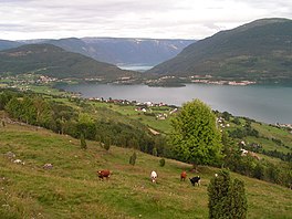
사바나 섬은 미국령 버진아일랜드의 섬이다. 그것은 세인트 웨스트 엔드 근처에 위치해 있다. 토머스는 18°20'N 65°05'W, 시릴 E. 킹 공항에서 서쪽으로 약 7마일 떨어져 있다(미국령 버진아일랜드의 마이너 아일랜드 참조).
참고 항목
참조
- ^ Rowlett, Russ. "Lighthouses of the U.S. Virgin Islands". The Lighthouse Directory. University of North Carolina at Chapel Hill. Retrieved 2017-01-11.
- ^ List of Lights, Pub. 110: Greenland, The East Coasts of North and South America (Excluding Continental U.S.A. Except the East Coast of Florida) and the West Indies (PDF). List of Lights. United States National Geospatial-Intelligence Agency. 2016.
좌표: 18°20′22″N 65°04′45″W / 18.33944°N 65.07917°W
이 미국령 버진아일랜드의 위치 기사는 단조롭다. 위키피디아를 확장하여 도울 수 있다. |