푸에르토리코 마야구에즈 사바네타스
Sabanetas, Mayagüez, Puerto Rico사바네타스 | |
|---|---|
바리오 | |
 해질녘의 엘마니 비치 | |
 마야구에즈 시내의 사바네타스 위치(빨간색으로 표시됨 | |
 사바네타스 푸에르토리코의 위치 | |
| 좌표:18°15′38″N 67°10′57″w/18.260656°N 67.182623°W좌표: 18°15′38″N 67°10′57″W / 18.260656°N 67.182623°W/ [1] | |
| 영연방 | |
| 시 | |
| 면적 | |
| • 합계 | 8.30 sq mi(21.5 km2) |
| • 육지 | 6.46 sq mi(16.7km2) |
| • 물 | 1.84 sq mi(4.8km2) |
| 표고 | 3피트(0.9m) |
| 인구 (2010) | |
| • 합계 | 4,005 |
| • 밀도 | 620/sq mi(240/km2) |
| 출처: 2010년 인구조사 | |
| 시간대 | UTC-4(AST) |
사바네타스는 푸에르토리코 마야구에즈 시의 바리오이다.2010년의 인구는 4,005명이다.[3][4][5]
역사
푸에르토리코는 1898년 파리 조약의 조항에 따라 스페인-미국 전쟁의 여파로 스페인에 양도되어 미국의 비법인 영토가 되었다.1899년 미국 전쟁부가 푸에르토리코 인구조사를 실시한 결과 사바네타스 바리오의 인구는 1,401명이었다.[6]
| 역사인구 | |||
|---|---|---|---|
| 인구조사 | Pop. | %± | |
| 1900 | 1,401 | — | |
| 1980 | 3,418 | — | |
| 1990 | 3,794 | 11.0% | |
| 2000 | 4,161 | 9.7% | |
| 2010 | 4,005 | −3.7% | |
| 미국 십수년 인구[7] 조사 1899년 (1990년 ~[8] 1900년) 1910년[9] 1930-1950[10] 1980-2000[11] 2010[12] | |||
이름
사바네타스 바리오(Sabanetas Barrio)는 북쪽으로는 아냐스코 시와 국경을 맞대고 있는 해안 시골 및 강변 바리오이다.그것은 마야귀에스의 북쪽 해변, 모나 해협 앞, 그리고 현재 리오 그란데 드 아냐스코라고 불리는 강 하구 부근에 있는 평야나 사바나에서 그 이름을 유래했다.[13]마야구에즈에서 관할권이 본섬에서 확장되는 두 개의 바리오 중 하나로, '야산 땅'[13]을 뜻하는 타이노 이름인 데세체오 섬이 관할 구역에 포함되기 때문이다.'사바나' 명사 접미사 속의 '에타'는 서인도 제도, 고아라보 강, 수녀원의 늪, 라 보퀼라의 카뇨, 알가로보스와 미라데로의 언덕 사이에 위치하기 때문에, 이러한 사바나들의 범위를 나타내는 것을 의미하며, 실제로 그렇듯이 자연에 한계가 있다.[13]
주목할 만한 랜드마크
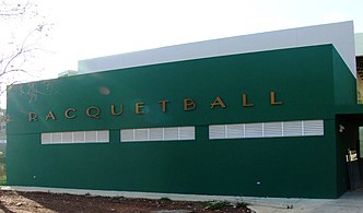
사바네타스는 엘마니 공동체의 고향이다.[14]사바네타스 바리오 더 엘 마니 파빌리온 내부에는 2010년 중미, 카리브해 올림픽 핸드볼 경기가 열린 엘 마니 파빌리온이 있다.[15]보킬라 크리크 야생동물 보호구역(레세바 자연 델 카뇨 데 라 보킬라)도 사바네타스에 위치해 있다.[16]유제니오 마리아 데 호스토스 공항 지역 공항은 바리오의 경계 안에 위치해 있다.
갤러리

사바네타스의 외제니오 마리아 데 호스토스 공항 타워
엘마니 정


참고 항목
참조
- ^ a b "US Gazetteer 2019". US Census. US Government.
- ^ 미국 지질조사국 지리적 이름 정보 시스템:사바네타스바리오
- ^ Picó, Rafael; Buitrago de Santiago, Zayda; Berrios, Hector H. Nueva geografía de Puerto Rico: física, económica, y social, por Rafael Picó. Con la colaboración de Zayda Buitrago de Santiago y Héctor H. Berrios. San Juan Editorial Universitaria, Universidad de Puerto Rico,1969.
- ^ Gwillim Law (20 May 2015). Administrative Subdivisions of Countries: A Comprehensive World Reference, 1900 through 1998. McFarland. p. 300. ISBN 978-1-4766-0447-3. Retrieved 25 December 2018.
- ^ Puerto Rico:2010:population and housing unit counts.pdf (PDF). U.S. Dept. of Commerce, Economics and Statistics Administration, U.S. Census Bureau. 2010.
- ^ Joseph Prentiss Sanger; Henry Gannett; Walter Francis Willcox (1900). Informe sobre el censo de Puerto Rico, 1899, United States. War Dept. Porto Rico Census Office (in Spanish). Imprenta del gobierno. p. 164.
- ^ "U.S. Decennial Census". United States Census Bureau. Archived from the original on February 13, 2020. Retrieved September 21, 2017.
- ^ "Report of the Census of Porto Rico 1899". War Department Office Director Census of Porto Rico. Archived from the original on July 16, 2017. Retrieved September 21, 2017.
- ^ "Table 3-Population of Municipalities: 1930 1920 and 1910" (PDF). United States Census Bureau. Archived (PDF) from the original on August 17, 2017. Retrieved September 21, 2017.
- ^ "Table 4-Area and Population of Municipalities Urban and Rural: 1930 to 1950" (PDF). United States Census Bureau. Archived (PDF) from the original on August 30, 2015. Retrieved September 21, 2014.
- ^ "Table 2 Population and Housing Units: 1960 to 2000" (PDF). United States Census Bureau. Archived (PDF) from the original on July 24, 2017. Retrieved September 21, 2017.
- ^ Puerto Rico:2010:population and housing unit counts.pdf (PDF). U.S. Dept. of Commerce Economics and Statistics Administration U.S. Census Bureau. 2010. Archived (PDF) from the original on 2017-02-20. Retrieved 2019-08-02.
- ^ a b c Cedó Alzamora, Federico (2010). MAYAGÜEZ,SU NOMBRE, SOBRENOMBRES Y LOS DE SUS BARRIOS (PDF). Mayagüez: Gobierno Municipal de Mayagüez. pp. 1–28.
- ^ 일반 목적 인구 데이터, 인구 조사 2000. 우니다드 데 시스테마스 데 Informacion Geografica, Area de Tecnologiaa de Informacion Gubernamental, Oficina de Gerencia y Presupuesto. 고비에르노 데 푸에르토리코.2010년 9월 21일 회수된 웨이백 머신에 보관된 2010-08-12.
- ^ 기사 제목[무서워!]
- ^ "Archived copy" (PDF). Archived from the original (PDF) on 2011-07-18. Retrieved 2010-08-20.
{{cite web}}: CS1 maint: 제목 (링크) Boquilla Creek 야생동물 보호구역에 대한 브로셔 (스페인어)
