판공 산맥
Pangong Range
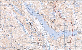
판공 범위를 포함한 지도 (AMS, 1954)
판공 산맥은 인도 북부 라다크 지역의 산맥으로, 판공호 남쪽 해안을 따라 추술에서 북서쪽으로 약 100km 떨어진 라다크 산맥과 평행하게 뻗어 있다.최고 사거리는 6700m(2만2000ft)로 북쪽 경사면은 빙하가 많이 낀다.[1]
참조
- ^ 도르트 외, 파국적 부분 배수 (2011), 페이지 111.
참고 문헌 목록
- Dortch, Jason M.; Owen, Lewis A.; Caffee, Marc W.; Kamp, Ulrich (2011). "Catastrophic partial drainage of Pangong Tso, northern India and Tibet". Geomorphology. 125 (1): 109–121. doi:10.1016/j.geomorph.2010.08.017. ISSN 0169-555X.
- Godwin-Austen, H. H. (1867), "Notes on the Pangong Lake District of Ladakh, from a Journal made during a Survey in 1863", The Journal of the Royal Geographic Society of London, London: J. Murray: 343–363, JSTOR 1798534
- Strachey, Henry (1854), Physical Geography of Western Tibet, London: William Clows and Sons – via archive.org


