무르가툴
Murgathaul무르가툴 | |
|---|---|
인구조사타운 | |
 무르가툴 인도 웨스트벵골의 위치  무르가툴 무르가툴 (인도) | |
| 좌표:23°37′33″N 87°04′10″E/23.625819°N 87.069575°E좌표: 23°37′33″N 87°04′10″E / 23.625819°N 87.069575°E/ | |
| 나라 | |
| 주 | 웨스트벵골 |
| 구 | 파심 바르다만 |
| 면적 | |
| • 합계 | 2.12km2(0.82 sq mi) |
| 인구 (2011) | |
| • 합계 | 7,371 |
| • 밀도 | 3,500/km2(9,000/sq mi) |
| 언어들 | |
| • 공식 | 벵골어, 힌디어, 영어 |
| 시간대 | UTC+5:30(IST) |
| 핀 | 713323 |
| 전화 번호 | 0341 |
| 차량등록 | WB |
| 웹사이트 | paschimbardhaman |
무르가툴은 인도 서벵골 주에 있는 파심 바르다만 지구의 아산솔 사다르 소분류에 있는 라니간지 CD 블록의 인구조사 마을이다.
지리
MC: 시공사, CT: 인구조사 마을, N: 이웃, R: 농촌 중심지
작은 지도에서의 공간 제약 때문에, 더 큰 지도에서의 실제 위치는 약간 다를 수 있다.
위치
Murgathaul은 23°37′33″N 87°04′10″E / 23.625819°N 87.069575°E/ 에 위치한다.
제마리(J.K. 나가르 타운쉽), 벨바탄, 무르가툴라, 암쿨라, 에가라, 사헤브간지, 라후나작, 발라브푸르 등이 라니간지 서부와 남쪽에 인구조사 마을 군집을 이루고 있다.반스라와 바카르나가르는 동쪽의 라니건즈와 인접해 있다.[1]
도시화
2011년 인구조사에 따르면 아산솔 사다르 구획 인구의 83.33%가 도시였고 16.67%가 농촌이었다.[2]2015년에는 아산솔시공사 관할 구역 내에 쿨티, 라니건지, 자무리아 시군이 포함되었다.[3]Asansol Sadar subdivision에는 26개의 (+1 부분) 인구 조사 타운스가 있다. (부분적으로 지도에 표시됨; 지도에 표시된 모든 장소는 전체 화면 지도에 연결됨).
인구통계학
2011년 인도 인구조사에 따르면 무르가툴은 총인구가 7,371명으로 이 중 3920명(53%), 3451명(47%)이 여성이었다.0~6세의 인구는 1,031명이다.무르가툴의 전체 문맹자는 4682명(6년 이상 인구의 73.85%)이었다.[4]
*언어에 대한 자세한 내용은 Raniganj(지역사회 개발 블록)를 참조하십시오.#언어와 종교
2001년[update] 인도 인구조사를 기준으로 무르가툴의 인구는 7872명이다.[5]남성은 인구의 55%를 차지하고 여성은 45%를 차지한다.무르가툴은 평균 문해율이 53%로 전국 평균 59.5%보다 낮다. 남성 문해율은 64%, 여성 문해율은 39%이다.무르가툴에서는 인구의 15%가 6세 미만이다.
2011년 인구조사에 따르면, 아산솔을 중심으로 한 도시 집중(UA)의 인구는 124만3414명이었다.In addition to the erstwhile municipalities of Kulti, Jamuria, and Raniganj subsequently incorporated into the Asansol Municipal Corporation, the agglomeration included the census towns of Amkula, Baktarnagar, Ballavpur, Bhanowara, Domohani, Egara, Jemari (J.K. Nagar Township), Majiara, Murgathaul, Raghunathchak, Sahebganj and Topsi, and also Char자무리아의 산물인 [6][3]앙푸르
사회 기반 시설
2011년 지구 인구 조사 핸드북에 따르면, 바르다만, 무르가툴의 면적은 2.12km이다2.시민 편의시설 중 1.5km의 도로와 배수구가 개방되어 있고, 보호용수 공급에는 상수 탱크, 처리원 수돗물이 포함되어 있었다.105개의 국내 전기 연결부와 21개의 도로 조명(점수)을 갖추고 있었다.가장 가까운 약국/보건소 또는 다른 의료 시설은 4km 떨어져 있었다.그곳의 교육 시설 중에는 초등학교 4곳, 중학교 1곳, 6km 떨어진 라니건즈에서 가장 가까운 상급 중등학교가 있었다.6개의 비형식 교육 센터(Sarva Siksha Abhiyan)가 있었다.[7]
이코노미
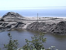
그것은 탄광 구역의 중심부에 있다.[8]
Collieries in the Satgram Area of Eastern Coalfields are: Kalidaspur, J.K.Nagar, Satgram, Ratibati, Chapui Khas, Mithapur, Nimcha, Jemehari, Pure Searsole, Tirath, Kuardih, Ardragram OCP and Seetaldasji OCP.[9]
교육
하라반가 비베카난다 중학교(Harabhanga Vivekananda Junior High School)는 2009년 설립된 벵골-중견 남녀공학 기관이다.5반부터 8반까지 가르칠 수 있는 시설을 갖추고 있다.[10]
참조
- ^ "Census of India 2011, West Bengal: District Census Handbook, Barddhaman" (PDF). Map of Raniganj CD Block, page 215. Directorate of Census Operations, West Bengal. Retrieved 31 August 2018.
- ^ "District Statistical Handbook 2014 Burdwan". Table 2.2, 2.4(a). Department of Statistics and Programme Implementation, Government of West Bengal. Archived from the original on 21 January 2019. Retrieved 4 September 2018.
- ^ a b "The Kolkata Gazette" (PDF). Notification No. 335/MA/O/C-4/1M-36/2014 dated 3 June 2015. Department of Municipal Affairs, Government of West Bengal. Archived from the original (PDF) on 12 March 2017. Retrieved 4 September 2018.
- ^ "2011 Census – Primary Census Abstract Data Tables". West Bengal – District-wise. Registrar General and Census Commissioner, India. Retrieved 18 February 2017.
- ^ "Census of India 2001: Data from the 2001 Census, including cities, villages and towns (Provisional)". Census Commission of India. Archived from the original on 16 June 2004. Retrieved 1 November 2008.
- ^ "Constituents of Urban Agglomerations having population 1 lakh and above" (PDF). Provisional Population Total, Census of India 2011. Government of India. Retrieved 27 August 2018.
- ^ "District Census Handbook Barddhaman, Census of India 2011, Series 20, Part XII A" (PDF). Section II Town Directory, Pages 1179-1210; Statement I: Status and Growth History, Page 1179; Statement II: Physical Aspects and Location of Towns, Page 1188; Statement III: Civic and other Amenities, Page 1191; Statement IV: Medical Facilities, Page 1196; Statement V: Educational, Recreational and Cultural Facilities, Page 1200; Statement VI:Industry and Banking, Page 1209. Directorate of census Operations V, West Bengal. Retrieved 14 May 2020.
- ^ 챗토파다이, 악코리, p 666
- ^ "Coalmining impact on the Environment" (PDF). Chapter V: Table 5.2. shodganga.infibnet. Retrieved 21 February 2017.
- ^ "Harabhanga Vivekananda Jr High Sch". Schools.org.in. Retrieved 6 June 2020.