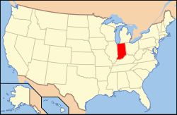
인디애나 주 워런 카운티 마운드 타운쉽
Mound Township, Warren County, Indiana마운드 타운쉽 | |
|---|---|
 워런 카운티의 마운드 타운쉽 위치 | |
 미국 인디애나 주의 위치 | |
| 좌표:40°08′52″N 87°28′12″w/40.14778°N 87.47000°W좌표: 40°08′52″N 87°28′12″W / 40.14778°N 87.47000°W/ | |
| 나라 | 미국 |
| 주 | 인디애나 주 |
| 카운티 | 워런 |
| 정부 | |
| • 유형 | 인디애나 타운쉽 |
| 면적 | |
| • 합계 | 16.79 sq mi(43.5km2) |
| • 육지 | 16.57 sq mi(42.9km2) |
| • 물 | 0.22sqmi(0.6km2) 1.31% |
| 표고 | 640 ft (104 m) |
| 인구 (2010) | |
| • 합계 | 418 |
| • 밀도 | 25.2/sq mi(9.7/km2) |
| 시간대 | UTC-5(동부(EST)) |
| • 여름(DST) | UTC-4(EDT) |
| 지역 번호 | 765 |
| GNIS 피쳐 ID | 453656 |
마운드 타운쉽은 미국 인디애나주 워렌 카운티에 있는 12개 타운쉽 중 하나이다.2010년 인구조사에 따르면, 인구는 418명이고 183채의 주택을 포함하고 있다.[2]
역사
마운드 타운쉽은 1827년 군을 조직할 때 만들어진 원래 4개 군 중 하나이다.[3]
지리
2010년 인구조사에 따르면 읍면적은 총 16.79제곱마일(43.5km2)이며, 이 중 16.57제곱마일(42.9km2)은 토지, 0.22제곱마일(0.57km2)은 물이다.[2]포스터 마을은 미국 136번 국도 바로 북쪽에 위치해 있으며, 읍면동 남서쪽 국경에서 동쪽으로 약 1.6km 떨어져 있다.마을 내 멸종된 공동체로는 19세기 초 와바시 강둑에서 번성했던 볼티모어와 로민 코너가 있다.키친 크릭과 주머니쥐 룬의 시냇물은 마을을 가로질러 흐른다.
묘지
이 마을에는 볼티모어,[4] 로저스[5], 그리고 윗마운드의 세 묘지가 있다.[6]
교통
미국 136번 국도는 읍면 남부를 가로질러 일리노이 주 댄빌과 코빙턴을 서쪽으로 연결하는 노선이다.[7]Indiana State Road 63은 읍면동쪽에서 북쪽으로 운행하며,[8] Indiana State Road 263의 어린이 노선은 미국 136번 국도와 교차하는 바로 북쪽에 있는 State Road 63과 합류한다.[9]10km(6마일)짜리 베르밀리온밸리 철도는 코빙턴 인근의 플렉스-N-게이트 공장을 운행하며, 공장에서 서쪽으로 포스터 마을을 지나 댄빌에서 CSX 노선을 만난다.[10][11]
교육
마운드 타운쉽은 워런 카운티의 메트로폴리탄 학군에 속해 있다.[12]
정부
마운드 타운쉽에는 농촌 화재 보호 및 구급 서비스를 관리하고, 빈곤층 구호 및 묘지 관리, 농장 평가 등을 담당하는 수탁자가 있다.수탁자는 3인 마을 이사회의 도움을 받는다.이사회와 이사회는 4년 임기로 선출된다.[13]
마운드 타운쉽은 인디애나 제8대 의회 선거구, 인디애나 하원 42구역,[14] 인디애나 주 상원 38구역의 일부다.[15]
참조
- ^ "US Board on Geographic Names". United States Geological Survey. October 25, 2007. Retrieved 2017-05-09.
- ^ a b "Population, Housing Units, Area, and Density: 2010 - County -- County Subdivision and Place -- 2010 Census Summary File 1". United States Census. Archived from the original on 2020-02-12. Retrieved 2013-05-10.
- ^ 워렌 카운티 역사 학회 1966 페이지 56.
- ^ "Baltimore Cemetery". Geographic Names Information System. United States Geological Survey. Retrieved 2011-02-05.
- ^ "Roger Cemetery". Geographic Names Information System. United States Geological Survey. Retrieved 2011-02-05.
- ^ "Upper Mound Cemetery". Geographic Names Information System. United States Geological Survey. Retrieved 2011-02-05.
- ^ "U.S. Route 136". Highway Explorer. Archived from the original on 2011-07-11. Retrieved 2010-09-21.
- ^ "State Road 63". Highway Explorer. Archived from the original on 2012-03-09. Retrieved 2010-09-21.
- ^ "State Road 263". Highway Explorer. Archived from the original on 2012-04-06. Retrieved 2010-09-21.
- ^ "State of Indiana 2012 Rail System Map" (PDF). Indiana Department of Transportation. 2011. Retrieved 2011-06-19.
- ^ "Employer Status Determination: Vermilion Valley Railroad Company, Inc". Railroad Retirement Board. 2003-06-30. Archived from the original on 2010-06-10. Retrieved 2010-08-28.
- ^ "Corporation Snapshot, M S D Warren County #8115". Indiana Department of Education. Archived from the original on 2002-07-06. Retrieved 2011-01-27.
- ^ "Government". United Township Association of Indiana. Retrieved 2011-01-06.
- ^ "Indiana Senate" (PDF). State of Indiana. Retrieved 2013-12-02.
- ^ "Indiana House Districts" (PDF). State of Indiana. Retrieved 2013-12-02.
- "Mound Township, Warren County, Indiana". Geographic Names Information System. United States Geological Survey. Retrieved 2009-09-24.
- 미국 인구조사국 TIGER/라인 형태 파일
참고 문헌 목록
- Goodspeed, Weston A. (1883). "Part II. History of Warren County". Counties of Warren, Benton, Jasper and Newton, Indiana. Chicago: F. A. Battey and Company. pp. 31–156. Retrieved 2010-09-19.
- Clifton, Thomas, ed. (1913). Past and Present of Fountain and Warren Counties Indiana. Indianapolis: B. F. Bowen and Company. pp. 201–335. Retrieved 2010-09-19.
- Warren County Historical Society (1966). A History of Warren County, Indiana. Williamsport, Indiana.
- Warren County Historical Society (2002). A History of Warren County, Indiana (175th Anniversary Edition). Williamsport, Indiana.
| 위키미디어 커먼즈에는 인디애나주 워렌 카운티의 마운드 타운쉽과 관련된 미디어가 있다. |


