플로리다 주의 군 목록
List of counties in Florida| 플로리다 주의 주 | |
|---|---|
| 위치 | 플로리다 주 |
| 번호 | 67 |
| 인구 | 7,900 (자유)– 2,662,777 (Miami-Dade) |
| 지역들 | 240 평방 마일 (6202 km) (유니온)– 2,034평방마일(5,270km2) (팜비치) |
| 정부 | |
| 소분할 |
|
미국 플로리다주에는 67개의 카운티가 있습니다.이곳은 1821년에 두 개의 주가 스페인 영토로 유지되는 두 개의 지방 구역을 보완하면서 미국의 영토가 되었다: 서쪽의 에스캄비아와 세인트. 동쪽의 존스, 스와니 강으로 나누어져 있습니다.다른 모든 카운티들은 원래 이 두 카운티에서 분배되었다.플로리다는 1845년에 미국의 27번째 주가 되었고, 그 마지막 주는 1925년에 알라추아 [1]카운티의 일부에서 길크리스트 카운티가 형성되면서 만들어졌다.플로리다의 카운티들은 주 정부의 하위 부서이다.1968년, 카운티들은 그들만의 [2]헌장을 개발할 수 있는 힘을 얻었습니다.플로리다 주의 2개 군구를 제외한 모든 자치단체는 통합 자치단체입니다. 예외적으로 시골 와쿨라 [3]카운티의 카운티 소재지인 크로포드빌과 콜리에 카운티의 나폴리 시 경계 밖에 위치한 동 나폴리입니다.
플로리다 주의 이름은 플로리다의 다양한 문화 유산을 반영한다.일부는 남부연합의 정치 지도자들과 스페인 탐험가들의 이름을 따서 스페인 주권의 영향을 받은 반면, 다른 것들은 기독교 성인들, 아메리카 원주민 유적지, 미국의 정치 지도자들의 이름을 따서 명명되었다.강, 호수, 식물 등 이 지역의 자연적 특징도 카운티 이름에 흔히 사용된다.플로리다에는 제2차 세미놀 전쟁 참가자들의 이름을 딴 카운티가 있다: 마이애미 데이드 카운티는 부분적으로 당시 미군 소령이었던 프랜시스 L. 데이드에서 이름을 따왔다.오세올라 카운티는 전쟁의 원주민인 무스코기-세미놀 저항군 지도자 오세올라에서 이름을 따왔다.[4]
인구 수치는 2021년 빈티지 인구 조사 추정치에 기초한다.플로리다의 인구는 21,781,128명으로 2020년보다 1.1% 증가했다.플로리다 카운티의 평균 인구는 325,091명이고 마이애미 데이드 카운티는 가장 인구가 많고 (2,662,777명), 리버티 카운티가 가장 적다 (7,900명).평균 국토 면적은 805평방미터(2,085km2)이다.가장 큰 카운티는 팜 비치 카운티(2,034 평방 미, 5,268 km2)이고 가장 작은 카운티는 유니언 카운티(240 평방 미, 6222 km)입니다.주의 총 면적은 65,795 평방 마일이며, 그 중 육지 면적은 53,927 평방 마일(139,6702 km)이고, 수역은 11,868 평방 [5]마일입니다.
FIPS(Federal Information Processing Standard)는 미국 정부가 카운티를 고유하게 식별하기 위해 사용하며 각 항목에 대해 제공됩니다.이러한 코드는 미국 인구조사국의 각 카운티별 "빠른 사실"과 연결되어 있습니다.플로리다의 FIPS 코드 12는 다른 주의 카운티와 구별하기 위해 사용됩니다.예를 들어 Alachua County의 고유한 전국 식별자는 12001입니다.[6]
군
| 자치주 | FIPS 코드[6] | 군청[7] 소재지 | Est.[4] | 로부터[8] 형성원 | 어원학[4] | 밀도 | 인구[9] | 영역[10][7] | 지도 |
|---|---|---|---|---|---|---|---|---|---|
| 알라추아 주 | 001 | 게인즈빌 | 1824 | 듀발과 세인트루이스 존스 | "저그"라는 뜻의 세미놀-크리크 단어에서 나온 것으로 보아 이 지역에서[11] 흔히 볼 수 있는 싱크홀을 지칭하는 것으로 보인다. | 319.49 | 279,238 | 874 평방 밀리 (2,264km2) |  |
| 베이커 군 | 003 | 마쿠레니 | 1861 | 뉴리버 | 제임스 맥네어 베이커(1821년–1892년), 남부 연방 상원의원이자 나중에 제4사법구 판사 | 49.09 | 28,715 | 585평방미 (1,515km2) | 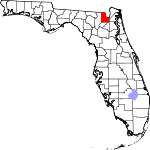 |
| 베이 군 | 005 | 파나마시티 | 1913 | 칼훈과 워싱턴 | 세인트 앤드류 만(St. Andrew's Bay), 카운티의 중심 지형 | 234.51 | 179,168 | 764평방미 (1,979km2) |  |
| 브래드퍼드 군 | 007 | 스타크 | 1858 | 컬럼비아 1861년까지 뉴리버로 명명되었다. | 리처드 브래드포드, 남북전쟁에서 사망한 최초의 플로리다 출신 장교; 그는 산타로사 섬 전투 중에 사망했다. | 97.41 | 28,540 | 293평방미 (759km2) | 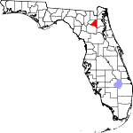 |
| 브레바르 주 | 009 | 티투스빌 | 1844 | 힐즈버러와 모기 성(聖)이라 이름 붙여졌다. 1855년까지[12] 루시 | 시어도어 워싱턴 브레바드, 1853년부터 1861년까지[12] 초기 정착민, 후에 주 감사관 | 605.72 | 616,628 | 1,018 평방 밀리 (2,637km2) |  |
| 브라우어드 주 | 011 | 포트 로더데일 | 1915 | 마이애미 데이드 팜 비치 | 나폴레옹 보나파르트 브라우어드(1857년-1910년), 1905년부터 1909년까지 플로리다의 19대 주지사 | 1597.17 | 1,930,983 | 1,190 평방 미 (3,153km2) |  |
| 칼훈 주 | 013 | 블런트스타운 | 1838 | 프랭클린, 잭슨, 워싱턴 | 사우스캐롤라이나 출신의 남부 정치인을 이끄는 존 C. 칼훈(1782년–1850년) | 24.06 | 13,641 | 567평방미 (1,469km2) | 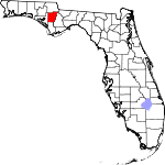 |
| 샬럿 군 | 015 | 푼타 고다 | 1921 | 데소토 | 아마 칼루사라는 이름의 부패일 겁니다. 이 지역에서 온 아메리카 원주민 집단이죠. | 280.75 | 194,843 | 694평방미 (1,797km2) |  |
| 시트러스 군 | 017 | 인버네스 | 1887 | 에르난도 | 그 나라의 감귤나무 | 270.69 | 158,083 | 584 평방 밀리 (1,513km2) | 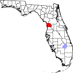 |
| 클레이 군 | 019 | 그린 코브 스프링스 | 1858 | 듀발 | 헨리 클레이(1777년-1852년), 존 퀸시 애덤스 치하의 1825년부터 1829년까지 국무장관 | 369.99 | 222,361 | 601평방미 (1,557km2) |  |
| 콜리어 군 | 021 | 동나폴리 | 1923 | 이씨 | 배런 콜리어(1873년–1939년)는 남부 플로리다의 토지 대부분을 개발한 광고 기업가이다. | 190.51 | 385,980 | 2,026 평방 밀리 (5,247km2) |  |
| 컬럼비아 군 | 023 | 레이크 시티 | 1832 | 알라추아 | 크리스토퍼 콜럼버스(1451년 경-1506년), 아메리카 탐험가 | 88.31 | 70,385 | 797평방미 (2,064km2) | 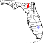 |
| 더소토 현 | 027 | 아카디아 | 1887 | 매너티 | 에르난도 데 소토(1496년/1497년–1542년), 스페인의 탐험가이자 정복자 | 54.02 | 34,408 | 637평방미 (1,650km2) |  |
| 딕시 군 | 029 | 크로스 시티 | 1921 | 라파예트 | 미국 남부의 일반적인 별명인 딕시 | 24.29 | 17,102 | 704 평방 밀리 (1,823km2) | 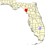 |
| 더발 현 | 031 | 잭슨빌 | 1822 | 세인트 존스 | 윌리엄 포프 듀발(1784년-1854년), 플로리다 준주의 초대 주지사 | 1291.91 | 999,935 | 774평방미 (2,005km2) |  |
| 에스캄비아 주 | 033 | 펜사콜라 | 1821 | 두 개의 원래 카운티 중 하나 | 분쟁의 원인; 아마도 "맑은 물"을 의미하는 아메리카 원주민 단어 샴비아 또는 물물교환을 의미하는 스페인어 단어 "캄비아"에서 유래했을 수 있다. | 485.53 | 322,390 | 664평방미 (1,620km2) |  |
| 플래글러 군 | 035 | 부넬 | 1917 | 세인트존스 볼루시아 | 헨리 모리슨 플래글러(1830년-1913년), 플로리다 이스트 코스트 철도 설립자 | 249.34 | 120,932 | 485 평방 밀리 (1,256km2) |  |
| 프랭클린 군 | 037 | 아팔라치콜라 | 1832 | 개즈든과 워싱턴 | 벤자민 프랭클린(1706년-1790년), 미국 건국의 아버지 중 한 명 | 23.54 | 12,572 | 534평방미 (1,383km2) |  |
| 가즈든 군 | 039 | 퀸시 | 1823 | 잭슨 | 제임스 가즈든(1788년-1858년), 미국 외교관이자 가즈든 매입의 거명 | 84.72 | 43,714 | 516 평방 밀리 (1,336km2) | 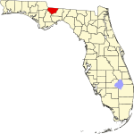 |
| 길크리스트 군 | 041 | 트렌턴 | 1925 | 알라추아 | 앨버트 길크리스트(1858년-1926년), 제20대 플로리다 주지사 | 52.61 | 18,360 | 349평방미 (904km2) |  |
| 글레이즈 군 | 043 | 무어 헤이븐 | 1921 | 데소토 | 플로리다 에버글레이즈 | 15.81 | 12,234 | 774평방미 (2,005km2) |  |
| 걸프 군 | 045 | 포트 포트조. | 1925 | 칼훈 | 멕시코 만 | 25.42 | 14,363 | 565 평방 밀리 (1,463km2) |  |
| 해밀턴 군 | 047 | 재스퍼 | 1827 | 제퍼슨 | 알렉산더 해밀턴(1757년–1804년), 초대 미국 재무장관이자 건국의 아버지 | 27.17 | 13,993 | 515 평방 밀리 (1,334km2) | 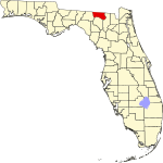 |
| 하디 군 | 049 | 우슐라 | 1921 | 데소토 | 캐리 A. 하디(1876년-1957년), 하디 카운티 창설 당시 플로리다 주지사 | 39.91 | 25,425 | 637평방미 (1,650km2) |  |
| 헨드리 군 | 051 | 라벨레 | 1923 | 이씨 | 프란시스 A. 헨드리(1833년-1917년), 초기 플로리디언 개척자이자 정치인 | 34.96 | 40,313 | 1,190 평방 미 (2,986km2) |  |
| 에르난도 현 | 053 | 브룩스빌 | 1843 | 알라추아 힐즈버러 1844년부터 1850년까지 벤튼이라는 이름을 붙였다. | 에르난도 데 소토 (1496년/1497년–1542년), 스페인의 탐험가이자 정복자 | 419.74 | 200,638 | 478평방미 (1,238km2) |  |
| 하이랜드 군 | 055 | 세브링 | 1921 | 데소토 | 군의 구릉지대에서 따온 이름 | 100.48 | 103,296 | 1,028 평방 밀리 (2,663km2) | 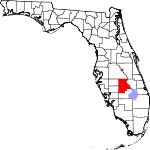 |
| 힐스버러 카운티 | 057 | 탬파 | 1834 | 알라추아 | 윌스 힐, 힐스버러 백작(1718~1793) 전 식민지 국무장관 | 1406.46 | 1,478,194 | 1,051 평방 밀리 (2,722km2) |  |
| 홈스 군 | 059 | 보니페이 | 1848 | 잭슨 앤 월튼 | 주의 동쪽 경계를 이루는 홈즈 크리크 | 41.05 | 19,784 | 482 평방 밀리 (1,248km2) |  |
| 인디안리버 주 | 061 | 베로비치 | 1925 | 세인트루시 | 카운티를 흐르는 인도 라군 강 | 325.37 | 163,662 | 503 평방 밀리 (1,620km2) |  |
| 잭슨 군 | 063 | 마리안나 | 1822 | 에스캄비아 | 앤드류 잭슨(1767년–1845년), 미국의 7대 대통령 | 52.07 | 47,694 | 916평방미 (2,372km2) |  |
| 제퍼슨 군 | 065 | 몬티첼로 | 1827 | 레온 | 토머스 제퍼슨(1743년–1826년)으로 미국의 제3대 대통령이자 독립선언문의 주요 저자 | 24.34 | 14,555 | 598평방미 (1,549km2) |  |
| 라파예트 군 | 067 | 마요 | 1856 | 매디슨 | 길버트 뒤 모티에, 드 라 파예트 후작(1757년–1834년), 미국 독립전쟁의 프랑스 귀족이자 장군 | 15.44 | 8,382 | 543평방미 (1,406km2) |  |
| 레이크 군 | 069 | 타바레스 | 1887 | 오렌지와 섬터 | 그 지역에 많은 호수의 이름을 따서 명명되었다. | 415.32 | 395,804 | 953 평방 밀리 (2,468km2) | 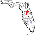 |
| 리 현 | 071 | 포트마이어스 | 1887 | 먼로 | 로버트 E. 리(1807년–1870년)로 남북전쟁 당시 북버지니아 남부연합군 사령관 | 980.07 | 787,976 | 804 평방 밀리 (2,082km2) | 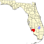 |
| 리온 현 | 073 | 탈라하시 | 1824 | 가즈덴 | 후안 폰세 데 레온(1474년-1521년), 플로리다라는 이름을 가진 스페인 탐험가 | 439.01 | 292,817 | 667평방미 (1,728km2) | 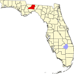 |
| 레비 군 | 075 | 브론슨 | 1845 | 알라추아 | 데이비드 레비 율리(1810년–1886년)로, 주 최초의 미국 상원의원 중 한 명 | 39.50 | 44,158 | 1,190 평방 미 (2,896km2) |  |
| 리버티 군 | 077 | 브리스톨 | 1855 | 가즈덴 | 자유의 애국적 이상 | 9.45 | 7,900 | 836 평방 밀리 (2,190km2) |  |
| 매디슨 군 | 079 | 매디슨 | 1827 | 제퍼슨 | 제임스 매디슨(1751년–1836년), 미국의 제4대 대통령 | 26.43 | 18,288 | 692평방미 (1,792km2) | 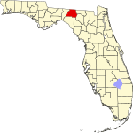 |
| 매너티 주 | 081 | 브라덴톤 | 1855 | 힐스버러 | 해우 또는 바다 소는 플로리다 해역에서 자생한다. | 556.95 | 412,703 | 741평방미 (1,919km2) |  |
| 마리온 군 | 083 | 오칼라 | 1844 | 알라추아, 힐즈버러, 모기 | 프란시스 마리온(1732년 경-1795년), 미국 독립전쟁 당시 군 장교 | 244.40 | 385,915 | 1,579 평방 밀리 (4,090km2) |  |
| 마틴 군 | 085 | 스튜어트 | 1925 | 팜비치 | 존 W. 마틴(1884년-1958년), 카운티 창설 당시 플로리다 주지사 | 287.67 | 159,942 | 556 평방 밀리 (1,620km2) |  |
| 마이애미데이드 군 | 086 | 마이애미 | 1836 | 먼로 1997년까지 데이드라고 이름 붙여졌다. | 마이애미와 프랜시스 L. 데이드(1793년 경-1835년), 제2차 세미놀 전쟁 당시 미국 육군 소령 | 1368.33 | 2,662,777 | 1,946 평방 밀리 (5,040km2) |  |
| 먼로 군 | 087 | 키웨스트 | 1823 | 세인트 존스 | 제임스 먼로(1758년–1831년), 미국의 제5대 대통령 | 82.42 | 82,170 | 997평방미 (2,582km2) |  |
| 나소 현 | 089 | 페르난디나 해변 | 1824 | 듀발 | 독일 나사우 공국 | 144.46 | 94,189 | 652 평방 밀리 (1,689km2) |  |
| 오칼루사 군 | 091 | 크레스트뷰 | 1915 | 산타로사와 월튼 | 쾌적한 곳, 검은 물, 아름다운 곳이라는 뜻의 고유어 | 227.84 | 213,255 | 936 평방 밀리 (2,424 km2) |  |
| 오키초비 카운티 | 093 | 너비 48km. | 1917 | Osceola와 성루시 | 오키초 비호, 차례로 이것" 큰 물"의 Hitchiti 말에서 있었다 | 52.02 | 40,266 | 774년 sqmi (2,005 km2) | 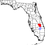 |
| 오렌지 카운티 | 095 | 올랜도 | 1824 | 세인트 존스 명명된 모기 1845년까지 | 그 과일 있던 카운티의 주요 제품. | 1566.90 | 1,422,746 | 908sqmi (2,352 km2) |  |
| 오 세올라 카운티 | 097 | 키 | 1887 | 브레바드 및 오렌지 | 오스콜라 (1804년–1838년), 제2차 세미놀 전쟁 중의 세미놀라 | 305.05 | 403,282 | 1,322 평방 밀리 (3,424km2) |  |
| 팜비치 군 | 099 | 웨스트팜비치 | 1909 | 마이애미 데이드 군 | 카운티의 많은 야자수 | 736.47 | 1,497,987 | 2,034 평방 밀리 (5,268km2) | 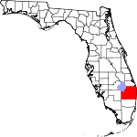 |
| 파스코 군 | 101 | 데이드시티 | 1887 | 에르난도 | 새뮤얼 파스코(1834년-1917년), 카운티 창설 당시 미국 상원의원 | 783.98 | 584,067 | 745평방미 (1,930km2) | 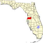 |
| 피넬라스 주 | 103 | 클리어워터 | 1912 | 힐스버러 | 스페인어 Punta Piynal 또는 "Point of Pines"에서 인용했습니다. | 3416.48 | 956,615 | 280평방미 (725km2) |  |
| 포크 군 | 105 | 바토우 | 1861 | 브레바드 힐스버러 | 제임스 K. 포크(1795년–1849년), 미국의 제11대 대통령 | 401.88 | 753,520 | 1,875 평방 밀리 (4,856km2) |  |
| 푸트남 군 | 107 | 팔라트카 | 1849 | 알라추아와 세인트 존스 | 벤자민 A.푸트남(1801년-1869년), 제2차 세미놀 전쟁 당시 군인이자 플로리디언 입법자 | 102.72 | 74,167 | 722평방미 (1,870km2) |  |
| 세인트존스 군 | 109 | 성 아우구스티누스 | 1821 | 두 개의 원래 카운티 중 하나 | 세인트루이스에서 파생된 이름입니다. 존스강은 산후안델푸에르토에서 이름을 따왔다. | 480.24 | 292,466 | 609평방미 (1,577km2) |  |
| 세인트루시 군 | 111 | 포트 피어스 | 1905 | 브레바르 | 기독교 순교자 세인트루시 (283년–304년) | 600.66 | 343,579 | 572평방미 (1,481km2) | 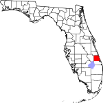 |
| 산타로사 군 | 113 | 밀턴 | 1842 | 에스캄비아 | 산타로사섬으로 이탈리아 비테르보에서 태어난 성 로사 데 비테르보(1235–1252)의 이름을 딴 | 190.94 | 193,998 | 1,016 평방 밀리 (2,631km2) |  |
| 사라소타 현 | 115 | 사라소타 | 1921 | 매너티 | 그 지역을 가리키는 뜻이 불분명한 미국 원주민 단어 | 781.57 | 447,057 | 572평방미 (1,481km2) |  |
| 세미놀 군 | 117 | 샌포드 | 1913 | 오렌지 | 세미놀 인디언 부족 | 1526.28 | 470,093 | 308평방미 (798km2) |  |
| 섬터 군 | 119 | 부시넬 | 1853 | 마리온 | 토머스 섬터(1734년–1832년), 미국 독립전쟁의 장군 | 248.42 | 135,638 | 546평방미 (1,414km2) |  |
| 쑤완니 주 | 121 | 라이브 오크 | 1858 | 컬럼비아 | 북부 플로리다에 있는 266마일 길이의 강인 수워니 강 | 64.66 | 44,485 | 688 평방 밀리 (1,782km2) |  |
| 테일러 군 | 123 | 페리 | 1856 | 매디슨 | 재커리 테일러(1784년–1850년), 미국의 제12대 대통령 | 20.94 | 21,815 | 1,042 평방 밀리 (2,699km2) | 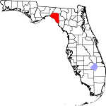 |
| 유니언 군 | 125 | 버틀러 호 | 1921 | 브래드포드 | 이 지역의 주민들이 하나의 자치주로 분할하고자 단결하여 붙여진 이름이다. | 68.06 | 16,335 | 240평방미 (622km2) |  |
| 볼루시아 주 | 127 | 델랜드 | 1854 | 오렌지 | 어원이 불분명한 볼루시아 항구.아마도 이 지역 원주민을 뜻하는 'Euchees의 땅'이라는 미국 원주민 단어에서 유래했을 것이다. | 510.32 | 564,412 | 1,190 평방 미 (2,865km2) |  |
| 와쿨라 주 | 129 | 크로포드빌 | 1843 | 레온 | 와쿨라강은 스페인어로 티무칸어족의 부패로 이름 붙여진 것으로 물의 수역을 묘사하는 데 쓰였지만 그 의미는 불확실하다. | 57.15 | 34,690 | 607평방미 (1,572km2) | 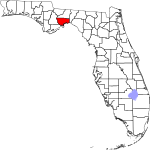 |
| 월튼 군 | 131 | 드푸니악 스프링스 | 1824 | 에스캄비아와 잭슨 | 플로리다 준주 제1장관 조지 월튼 | 75.68 | 80,069 | 1,058 평방 밀리 (2,740km2) | 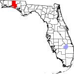 |
| 워싱턴 군 | 133 | 치플리 | 1825 | 잭슨 앤 월튼 | 조지 워싱턴(1732년-1799년), 미국 초대 대통령 | 43.86 | 25,436 | 580 평방 밀리 (1,502 km2) |  |
플로리다 카운티의 연대기
에스캄 비아와 성존스 줐다 플로리다의 2원형의 군 7월 21일 1821년에 생겼다.그들은 현대 국가 테두리 안에서 지역 전체를 덮었다.them,[6]사이의 주 북부 국경에서 멕시코 만까지 구불구불한 경로에 따른 스와니 강 국경선.기본적으로, 이 에스캄 비아 카운티 정부, 그리고 세인트는"비럭질하다."과" 큰 굴곡"지역에 대한 지배권을 가졌다그 주 전체에 그림자를 Johns.
에스캄 비아 카운티의 잭슨(1822년), 개즈던(1823년), 레온과 월턴(1824년), 워싱턴(1825년), 재퍼슨, 해밀턴, 매디슨(1827년), 프랭클린(1832년), 칼훈(1838년)산타 로사는(1842년), 와쿨라(1843), 홈즈(1848년), 자유,(1855년), 라파예트와 테일러(1856년), 베이(1913년), 오칼루 사(1915년), 디 등 20 다른 카운티는 원래 일부이다.위험(1921년)및 멕시코(1925년).
Forty-Five 다른 카운티는 원래 성에서 형성되었다듀발(1822년), 먼로(1823년), 앨라추아, Nassau, 오렌지(원래 모기 1824년), 컬럼비아(1832년), 있는 Hillsboro에 가난(1834년), 마이애미 데이드(원래 데이드는 1836년), 에르난도(원래 벤턴 1843), 브레바드와 매리언(1844년), 레비(1845년), Putnam(1845년), 섬터(1853년), 볼루(1854년), 매너티(1855년)브래드 포드(원래 뉴 강의), C을 포함한 존스 카운티그리고를 스와니 강.(1858년), 베이커 씨와 포크(1861년), 감귤류, Desoto, Lake, 리, 오 세올라, 그리고 파스코(1887년), 세인트 루시에(1905년), 팜 비치(1909년), 피넬 러스(1912년), 세미 놀 족(1913년), 브로워드(1915년), 플래 글러, 오키초비(1917년), 샬롯, 글레이즈, 하디, 하이랜드, 사라 소타, 연합(1921년), 콜리어 헨드리(1923년), Gilcrest, 인디언 강, 마르티.n(1925년).
구군
파예트 카운티는 1832년 치폴라 강 동쪽 잭슨 카운티의 일부에서 만들어졌으며, 카운티 소재지는 오체시(현재의 알타 [13][14]동쪽 칼훈 카운티)이다.1834년에 잭슨 [15]카운티에 다시 합병되었다.
개명된 카운티
플로리다의 5개 카운티 이름이 바뀌었다.대부분의 개명은 플로리다 주의 첫 16년 동안인 1845년과 1861년 사이에 이루어졌다.1997년 데이드 카운티가 마이애미 데이드 카운티로 이름을 바꿨을 때 그 중 하나가 발생했다.
| 군[4] | 날짜[4] | 어원학[4] | 운명[4] |
|---|---|---|---|
| 벤튼 군 | 1844–1850 | 토마스 벤튼(1782년-1858년) 미주리주 상원의원으로 많은 플로리다인들이 아메리카 원주민을 추방하기 위해 원했던 1842년 무장 점령법을 지지했다. | 원래 이름은 에르난도(Hernando)였고, 1850년에 다시 헤르난도(Hernando)로 바뀌었다 |
| 마이애미데이드 군 | 1836–1997 | 프랜시스 L. 데이드(1793년 경-1835년), 제2차 세미놀 전쟁 당시 미국 육군 소령 | 1997년 마이애미 데이드 카운티로 변경, 마이애미 시의 국제적 지명도 향상 |
| 모스키토 군 | 1824–1845 | 스페인인들이 해안 전체에 붙인 이름에서 따온 "로스 모스키토스" | 모기는 이미 1845년 오렌지 카운티로 개명될 때까지 반복적으로 다른 군에 땅을 양도했다. |
| 뉴리버 군 | 1858–1861 | 뉴 강 | 1861년 브래드포드 카운티로 개명 |
| 세인트루시 군 | 1844–1855 | 기독교 순교자 세인트루시 (283년–304년) | 1855년 브레바르 카운티로 개명 |
제안된 카운티
| 군[4] | 제안일자[4] | 어원학[4] | 메모들 |
|---|---|---|---|
| 블록샴 주 | 1915년[16] | 윌리엄 D. 블록섬(1835년-1911년), 제13대 및 제17대 플로리다 주지사 | 윌리스톤의 군청 소재지 |
| 리리드 주 | 1842 | Leigh Read, 입법자 | 모스키토 카운티 개칭 제안 |
| 마이애미[17] 군 | 1947 | 마이애미 시 | 통합 시영 |
| 오션 군 | 1991 | 대서양 | 잭슨빌 비치스 |
「 」를 참조해 주세요.
추가 정보
- Utley, Geo. B. (1908). "Origin of the County Names in Florida". Florida Historical Society Quarterly. 1 (3): 29–35. Retrieved May 25, 2018.
레퍼런스
- 특정한
- ^ "A Guide to Alachua County's History". Alachua County Florida. Archived from the original on October 6, 2006. Retrieved March 24, 2010.
- ^ "About Florida's Counties". Florida Association of Counties. Archived from the original on October 4, 2012. Retrieved January 20, 2010.
- ^ "Demographics". Wakulla County Chamber of Commerce. Retrieved 2012-01-30.
- ^ a b c d e f g h i j "Florida County Maps". Florida Center for Instructional Technology – University of South Florida. Retrieved January 16, 2010.
- ^ "Florida QuickFacts". U.S. Census Bureau. Retrieved September 2, 2021. (2020년 인구조사)
- ^ a b "United States Environmental Protection Agency (EPA) County FIPS Code Listing". United States Environmental Protection Agency. Archived from the original on October 8, 2012. Retrieved April 24, 2008.
- ^ a b "NACo – Find a county". National Association of Counties. Archived from the original on October 25, 2007. Retrieved April 24, 2008.
- ^ Newberry Library, Atlas of Historical County Boundaries: 플로리다, 2014년 5월 액세스
- ^ "U.S. Census Bureau QuickFacts: Florida". United States Census Bureau. Retrieved March 29, 2022.
- ^ "Florida QuickFacts". U.S. Census Bureau. Archived from the original on July 2, 2013. Retrieved April 23, 2008. (2008년 인구조사 추정치)
- ^ Morris, Allen, Florida의 지명
- ^ a b 플로리다 주 브레버드 카운티의 에릭슨, 존 M.1955년의 짧은 역사
- ^ "An Act to organise a county to be called the County of Fayette". Act No. 53 of 1832.
- ^ "An Act, more accurately to define the boundaries of Fayette County, and for other purposes". Act No. 31 (Chapter 688) of 1833.
- ^ "An Act to repeal certain acts organizing the County of Fayette". Act No. 26 (Chapter 765) of 1834.
- ^ "An Act Providing for the Creation of Bloxham County in the State of Florida, and for the Organization and the Government Thereof". Act No. 130 (Chapter 6936) of 1915.
- ^ "An Act Providing the Manner, Method and Means of the Election and Creation of a Charter Board in the Territory now Comprising Dade County; Providing for the Drafting and Adopting of the Charter Prepared by Said Board for Said Territory; Providing for the Election of Commissioners of a New Political Subdivision in the Territory now Comprising Dade County to be Known as the County of Miami; Providing the Effective Date of Said Charter and the Time the Board of Commissioners Shall Take Office; and Providing that This Act Shall not Become Effective Until the Joint Resolution No. 407 has Been Approved by the Qualified Electors of Dade County and of the State of Florida as a Whole". Act No. 853 (Chapter 24467) of 1947.
- 일반
- 플로리다의 지도책 개정판입니다에드워드 A.Fernald & Elizabeth D.Purdum, 편집자(University Press of Florida, 1996)."군의 진화", 98-99페이지.


