남부 연맹의 고수위 표식
High-water mark of the Confederacy| 남부동맹의 고수위표기 | |
|---|---|
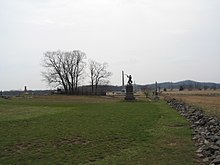 | |
| 위치 | 게티스버그 국립 군사공원 묘지 능선 |
| 좌표 | 39°48.747˚N 77°14.143′w / 39.812450°N 77.235717°W좌표: 39°48.747′N 77°14.143′W / 39.812450°N 77.235717°W/ |
| 설립 사건 | 피켓의 책임, 1863년 7월 3일 |
남부연합의 고수위 표시 또는 남부동맹의 고조(高祖)는 1863년 7월 3일 피켓의 충전 중 남부연합군이 도달한 가장 먼 지점을 나타내는 펜실베이니아주 게티스버그 인근 묘지 능선의 지역을 말한다.[1] 높은 물의 흔적과 유사하게, 이 용어는 거의 틀림없이 남부 연합군이 전쟁에서 승리를 거둘 수 있는 가장 좋은 기회를 가리키는 말이다. 진격선은 「각도」 석벽의 동쪽에 있었다.[2]
역사
이 섹션은 검증을 위해 추가 인용구가 필요하다. (2011년 5월)(이과 시기 |
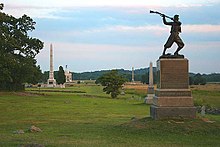
이 명칭은 정부 역사학자 존 B에 의해 발명되었다. 게티스버그 전장의 기념비가 세워지고 있을 때 전후의 바첼더.[3] 일부 역사학자들은 이 전투가 전쟁의 전환점이었고, 이 곳이 동부극장에서 남군의 마지막 주요 공격작전을 대표하는 장소라고 주장해 왔다.
전투 셋째 날(1863년 7월 3일), 남부 연합의 로버트 E. 이 대통령은 묘지 능선에 위치한 유니온 센터에 대한 공격을 명령했다. 이 공격 작전은 거의 12,500명의 군인들이 위험할 정도로 개방된 지형의 1,000야드 이상을 행진할 것을 요구했다.
대규모지만 대부분 실효성이 없는 남부 연합군의 포격으로 인해, 연합군 전선을 향한 개방된 들판을 가로지르는 행진은 피켓의 책임, 조지 E 소령으로 알려지게 되었다. 피켓은 제임스 롱스트리트 중장이 지휘하는 3개 사단 지휘관 중 한 명이었으나, 그의 이름은 이번 폭행사건과 널리 연관되어 왔다. 묘지 능선에 있는 연합군 총과 보병들이 전진하는 대원들에게 사격을 개시하여, 남부 연합군에 50%의 사상자를 냈다. 피켓의 여단 지휘관 중 한 명은 루이스 애디슨 아미스테드 장군이었다. 그의 부하들은 "각"이라고 알려진 벽의 굴곡인 단 한 곳에서 유니온 라인을 뚫을 수 있었다. 연합군의 이 격차는 급히 닫혔고, 이를 뚫은 남부 연합군은 아르미스테드를 포함해 신속히 포로로 잡히거나 사살되었다.
리의 북부 버지니아 군대는 다음날 퇴각하여 게티스버그를 떠나 버지니아로 향했다. 전쟁이 거의 2년 더 지속되었음에도 불구하고, 이 대통령은 그 기간 동안 거의 공격 작전을 펼치지 않았고, 그들 중 어느 누구도 게티스버그 캠페인의 규모에 근접하지 않았다.
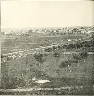 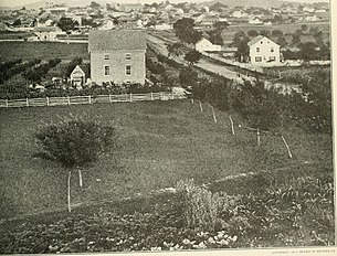 |
| 남북전쟁 사진사 고물표지 파노라마=파노라마의 중앙에는 힐과 이웰의 우월한 세력에 의해 마을을 뚫고 후퇴한 뒤 7월 1일 밤 패배한 1·11연방군단이 팔짱을 끼고 잠든 묘지 능선이 우뚝 솟아 있다. 그 오른쪽의 낮은 지명은 컬프 언덕이다. 사진의 맨 오른쪽에는 라운드 탑이 서 있다. |
기념물
고수도의 기념물 중에는 다음과 같은 것들이 있다.
- 반란 기념비의 높은 워터마크는 피켓의 차지 전환점을 알리는 청동 타블렛이다.
- 제72회 펜실베이니아 보병 기념비(1891년)는 연합군(제72회 펜실베이니아 보병 포함)이 피켓의 차지(Charge of Pickett's Charge)에 종사하는 남부 연합군을 격퇴한 것을 나타내는 기념비다.
- 1887년 루이스 A. 아미스테드 마커는[6] 루이스 아미스테드 남부연합 장군이 치명상을 입고 쓰러지기 전 유니온 포탄에 손을 얹은 지점을 표시한다.[7] 아르미스테드는 더 앵글에서 유니온 라인을 돌파한 1500명의 남부 연합 버진아인 중 한 명이었다.[8]
참고 항목
참조
- ^ a b Bachelder, John B (1892), High Water Mark of the Rebellion Monument, Gettysburg Battlefield Memorial Association, archived from the original (NPS.gov webpage about monument) on 2011-07-21, retrieved 2011-02-11,
rear tablet added 1895 (MN389) listing directors of Gettysburg Battlefield Memorial Association. All 9'H.
- ^ "List of Classified Structures: The Angle Stone Wall, Structure Number WA03". Archived from the original on September 24, 2015. Retrieved July 6, 2020.
Stone wall consists of dry-laid field granite stones and measures 4'0"H x 3'9"H x 1030'. Originally separated the Leister and Small Farm properties from Biggs Farm property.
- ^ 데자르딘, 토마스 A. 이 명예로운 죽음: 게티스버그의 이야기는 어떻게 미국의 기억을 형성했는가. ISBN 0-30681-382-3
- ^ "List of Classified Structures: Alonzo Cushing Marker: MN394". 1887. Archived from the original on September 15, 2012. Retrieved July 7, 2020.
1 of 16 Civil War Monuments of the GBMA Era (1863 - 1895) commerating [sic?] killed or wounded officers. Indicates spot where Lt. Alonzo H. Cushing was mortally wounded July 3, 1863. Located in the Angle near the Battery marker.
- ^ Butler, John M. (1885). The Battle of Gettysburg: An Historical Account.
Armistead answers the challenge: "Give them the cold steel, boys!" and lays his hand upon a gun. But, at that moment, by the side of Cushing, his young and gallant adversary, intrepid Armistead falls, pierced with balls. They both lie at the foot of the clump of trees, which marks the extreme point reached by the Confederates in this, their supremest effort. Where Cushing and Armistead lie is where the tide of invasion stops. The Confederate cause is buried there: there, beneath the blood of as brave soldiers as ever carried sword or faced the march of death. The men who came forward here, when defeated, did not fall back: there was no one left to return.
- ^ "NPGallery Asset Detail: Lewis A. Armistead Marker". npgallery.nps.gov.
First marker erected to commemorate fallen Confederate commander. Denotes site where Brig. Gen. Lewis A. Armistead was mortally wounded. Located in the Angle area, W of Cushing's Battery. Mn base 2'x2' smooth cut. Shaft designed to simulate opening scroll w/incised inscription in face. Badly eroded. All 4'6"H. Inscription: Brigadier General LEWIS A. ARMISTEAD C.S.A. Fell Here July 3, 1863.
- ^ "It's Again A Tented Field: Sickles And Longstreet At Gettysburg" (PDF). New York Times. July 1, 1888. Retrieved 2011-06-15.
The stone marked the spot where Armistead put his hand on a Union cannon and said, "Gentlemen, this gun is ours." In another moment he was [wounded].
- ^ "A Gettysburg Reunion" (Google News Archive). The Canaseraga Times. July 8, 1887. Retrieved 2011-02-11.
One of the dramatic incidents of the day took place at the bloody angle where 1,500 Virginians broke through the lines held by their hosts, and where the three monuments were dedicated on the 3d [of July, 1887].
- ^ "Monument to the 1st New York Independent Battery at Gettysburg".
- ^ "1st NY Independent Battery Regiment during the Civil War - NY Military Museum and Veterans Research Center". dmna.ny.gov.


