구르스코위야
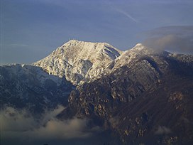
Gurskøya 섬의 동해안에 있는 레이콩 지역의 풍경. | |
 | |
 구르스코위야 섬의 위치  구르스코위야 구르스코위야 (노르웨이) | |
| 지리 | |
|---|---|
| 위치 | 노르웨이의 뫼레 오그 롬스달 |
| 좌표 | 62°12′31″N 5°38′17″E/62.2086°N 5.6381°E좌표: 62°12′31″N 5°38′17″E / 62.2086°N 5.6381°E/ 5 |
| 면적 | 137km2(53제곱 mi) |
| 길이 | 11km(6.8mi) |
| 폭 | 16.5km(10.25mi) |
| 최고 고도 | 660m(2170ft) |
| 최고점 | 솔리아 |
| 관리 | |
노르웨이 | |
| 카운티 | 뫼레 오그 롬스달 |
| 시 | 헤로이 시 산데 시 |
| 인구통계학 | |
| 인구 | 4647 (2015) |
구르스코예야[1] 섬은 노르웨이 뫼레오그 롬스달 군에 있는 섬이다.137 평방 킬로미터(53 평방 미)의 이 섬은 산데와 에뢰이의 자치 단체들이 공유하고 있다.구르스켄, 라르네스, 몰드투스트란다의 마을들이 이 섬에 위치해 있다.섬의 남부는 역사적으로 로브데 시의 일부였다.2015년에는 4,647명의 주민이 이 섬에 살고 있었다.[2]
The island lies north of the Rovdestranda area on the mainland; southwest of the islands of Hareidlandet and Dimnøya, west of the island of Eika; east of the islands of Kvamsøya, Voksa, and Sandsøya; and south of the Norwegian Sea and the islands of Nerlandsøya, Bergsøya, Leinøya, and Flåvær.
이 섬은 어업과 어업 가공과 같은 많은 어업 관련 산업의 본거지다.[2]
주목할 만한 거주자
참고 항목
참조
- ^ "Stadnamn og skrivemåten for stadnamn" (in Norwegian). Kartverket. Retrieved 2019-09-08.
- ^ a b Thorsnæs, Geir, ed. (2015-09-10). "Gurskøya". Store norske leksikon (in Norwegian). Kunnskapsforlaget. Retrieved 2019-09-08.