귈랴르
Gülyalı귈랴르 | |
|---|---|
구 | |
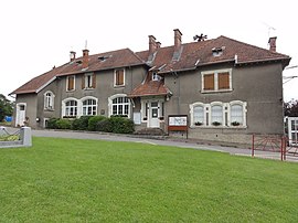
 귈랴르 현의 마을 케스타네 | |
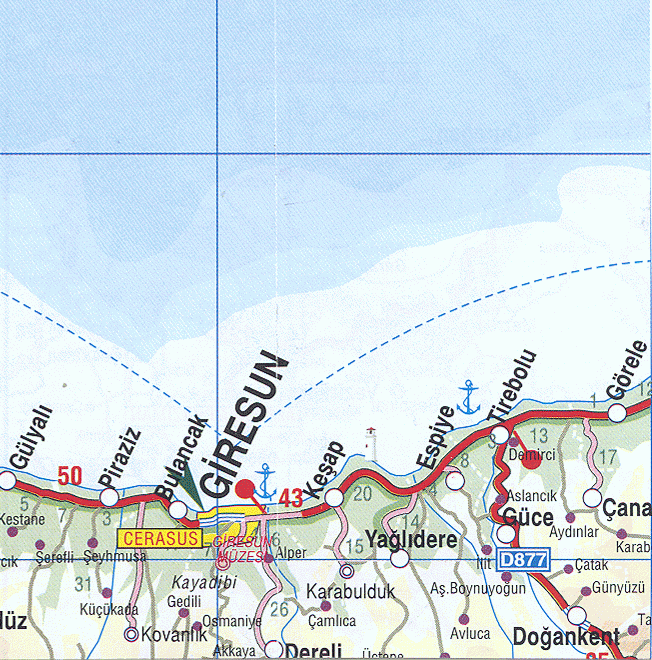
 터키 내 Gülyal location의 위치. | |
 귈랴르 귈랄로의 위치 | |
| 좌표: 40°58˚N 화씨 38°04° / 40.967°N 38.067°E | |
| 나라 | |
| 지역 | 흑해 |
| 주 | 오르두 |
| 정부 | |
| • 시장 | 울라슈 테페(CHP) |
| 면적 | |
| • 지구 | 73.36km2(28.32 sq mi) |
| 표고 | 0m(0ft) |
| 인구 (2012)[2] | |
| • 도시 | 3,383 |
| • 지구 | 7,957 |
| • 지역밀도 | 110/km2 (190/sq mi) |
| 시간대 | UTC+2(EET) |
| • 여름(DST) | UTC+3(EEST) |
| 우편번호 | 52xxxx |
| 지역 번호 | 0452 |
| 번호판 | 52 |
| 기후 | Cfa |
| 웹사이트 | www.gulyali-bld.gov.tr |
귈랴예르(Gülialı, 이전 Abulhayır)는 터키 흑해 지역에 있는 오르두 성의 읍·구로, 오르두 시에서 동쪽으로 15km 떨어진 기레순 시로 향한다. 2000년 인구조사에 따르면 이 지역의 인구는 10,566명이고 이 중 5,245명이 귈랄레 마을에 살고 있다.[3][4] 이 지역은 73km2(28평방미터)의 면적을 차지하고 있으며,[5] 마을은 0m(0피트)의 고도에 있다.
2019년 지방선거에서 공화인민당의 울라 테페 후보가 시장으로 선출됐다.[6]
귈리알레주 지구의 마을로는 예니코이, 암바르첼레, 아이릴레크, 케스타네, 무스타팔레, 타를레사이, 투나스유 등이 있다.
메모들
- ^ "Area of regions (including lakes), km²". Regional Statistics Database. Turkish Statistical Institute. 2002. Retrieved 2013-03-05.
- ^ "Population of province/district centers and towns/villages by districts - 2012". Address Based Population Registration System (ABPRS) Database. Turkish Statistical Institute. Retrieved 2013-02-27.
- ^ Turkish Statistical Institute. "Census 2000, Key statistics for urban areas of Turkey" (XLS) (in Turkish). Retrieved 2009-04-29.
- ^ GeoHive. "Statistical information on Turkey's administrative units". Retrieved 2009-04-29.
- ^ Statoids. "Statistical information on districts of Turkey". Retrieved 2009-04-29.
- ^ "Ordu Gülyalı Seçim Sonuçları - 31 Mart Ordu Gülyalı Yerel Seçim Sonuçları". www.haberler.com (in tr-TR). Retrieved 2021-08-15.
{{cite web}}: CS1 maint: 인식되지 않는 언어(링크)
참조
- Falling Rain Genomics, Inc. "Geographical information on Gülyalı, Turkey". Retrieved 2009-04-28.
외부 링크
좌표: 40°58′00″N 38°04′00″E / 40.96667°N 38.06667°E