페리브리지 서비스
Ferrybridge services| 페리브리지 서비스 | |
|---|---|
 페리브리지 서비스 구역 | |
잉글랜드 웨스트요크셔 소재지 | |
| 정보 | |
| 자치주 | 웨스트요크셔 |
| 도로 | M62 A1(M) |
| 좌표: | 53°41~49°N 1°15′58″w/53.697°N 1.266°W좌표: 53°41°49°N 1°15°58°W / 53.697°N 1.266°W / |
| 교환입니다. | 모토 |
| 이전 연산자 | 그라나다 |
| 오픈일 | 1985년 4월 2일 |
| 웹 사이트 | 공식 웹 페이지 |
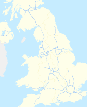
페리브리지 서비스(Perrybridge services)는 Moto가 운영하는 고속도로 서비스 지역(MSA)으로, 영국 웨스트요크셔에 있는 페리브리지의 이름을 따서 명명되었습니다.M62 고속도로와 A1(M) 고속도로에서 쉽게 접근할 수 있습니다.1985년 그라나다 브랜드로 오픈한 페리브리지의 MSA는 2001년부터 Moto 브랜드로 운영되고 있다.
역사
1985년 4월에 그라나다에 의해 개업해,[1][2] 13번째의 서비스 스테이션이 되었다.MSA는 1985년 [3]교통부 장관으로부터 50년 임대를 허가받았다.MSA가 되기 전에는 현장에서 [4][5]뼈 비료 공장이 운영되었다.2000년, 그 서비스는 소비자 잡지 Which?에 의해 영국에서 최악으로 낙인 찍혔고, 1년 후인 2001년에 [6][7]Moto라는 브랜드로 사이트를 다시 시작했다.
M62와 A1 도로의 교차로에서 개통되었지만, 당시에는 A1이 고속도로가 아니었기 때문에 M62가 우선되었고, M62만의 [8]MSA로 등록되었다.그러나 2006년에 페리브리지에서 후크 무어까지의 도로 구간이 고속도로 상태(A1에서 A1(M)[9]로 업그레이드되었다.이 서비스에 인접한 오래된 A1 도로는 현재 A162로 [10]지정되어 있습니다.M62는 33번 교차로에서, A1(M)은 [11]40번 교차로에서 모두 접근할 수 있습니다.
시설.
Ferrybridge의 서비스는 다음과 [12]같이 제공됩니다.
현장에는 주유소와 호텔/모텔도 있습니다.
레퍼런스
- ^ "M62 (Service Stations)". hansard.parliament.uk. Retrieved 22 March 2022.
- ^ Wilson, Charles, ed. (19 February 1986). "Merger will father a leisure megagiant". The Times. No. 62384. p. 32. ISSN 0140-0460.
- ^ "Motorway Service Stations". hansard.parliament.uk. Retrieved 22 March 2022.
- ^ Cooper, Chris (2013). The Great North Road; then and now. Old Harlow: Battle of Britain International. p. 117. ISBN 978-1-870067-79-9.
- ^ "Ferrybridge". maps.nls.uk. Retrieved 14 April 2022.
Use the slider to toggle between old mapping and modern day satellite imagery
- ^ Burkeman, Oliver (4 August 2000). "Motorway madness: Why does service station food have to be quite so awful? And so ridiculously expensive?". The Guardian. p. 26. ISSN 0261-3077.
- ^ Walsh, Dominic (23 May 2001). "Compass puts Moto on the map". The Times. No. 67146. p. 28. ISSN 0140-0460.
- ^ Walton, William; Dixon, Peter (July 2000). "The Deregulation of the Provision of Motorway Service Areas in the United Kingdom and the Consequent Dilemmas for Planning". TPR: Town Planning Review. Liverpool: University of Liverpool. 71 (3): 358. doi:10.3828/tpr.71.3.2g2587138373260g. ISSN 0041-0020.
- ^ Sims, Frank Alexander (2009). "4: England - North Eastern". In McCoubrey, William James (ed.). The motorway achievement. London: Thomas Telford. p. 242. ISBN 978-0-7277-3198-2.
- ^ Cooper, Chris (2013). The Great North Road; then and now. Old Harlow: Battle of Britain International. p. 115. ISBN 978-1-870067-79-9.
- ^ "290" (Map). York. 1:25,000. Explorer. Ordnance Survey. 2019. ISBN 978-0-319-24487-6.
- ^ "Ferrybridge Services". moto-way.com. Retrieved 22 March 2022.


