대샤라트찬드
Dasharathchand대샤라트찬드 दशरथचन्द | |
|---|---|
 대쉬랏찬다 힐 역 | |
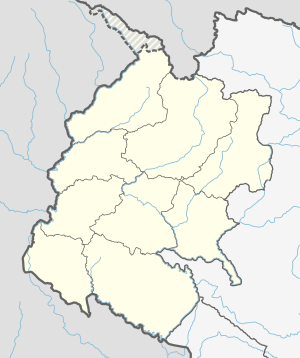
 대시랏찬다 시의 구획도 | |
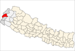
수두르파시킴의 다샤라트찬다 위치 | |
| 좌표: 29°33′17″N 80°25′36″E / 29.55472°N 80.42667°E | |
| 나라 | 네팔 |
| 주 | 수두르파슈힘 프라데시 |
| 구 | 비타디 구 |
| 워즈 | 11 |
| 확립된 | 1997 |
| 정부 | |
| • 유형 | 시장협의회 |
| • 시장 | 나렌드라 싱 타파(NC) |
| • 부시장 | 미나 찬드(NC) |
| 면적 | |
| • 합계 | 135.15km2(52.18제곱 mi) |
| 인구 (2011) | |
| • 합계 | 34,575 |
| • 밀도 | 260/km2 (190/sq mi) |
| • 종교 | 힌두교 |
| 시간대 | UTC+5:45(NST) |
| 우편번호 | 10200 |
| 지역 번호 | 095 |
| 웹사이트 | dasharathchandmun |
다샤라트찬드는 네팔 수두르파슈힘프라데시 주 비타디 지구의 자치구 및 지구본사다. 인도 국경에 가까운 마하칼리 강 위 언덕역이다. 2011년 네팔 인구조사 당시 7,257가구에 34,575명의 인구가 살고 있었다.[1]
배경
다샤라치안 시군은 네팔 정부가 총 22개 시군을 설립하면서 1997년 설립됐다.[2] 6개의 VDC가 이 시군을 설립하는 동안 합병되었다. 이러한 VDC는 다음과 같다. 대쉬랏찬다, 칼랑가, 트리푸라스둔다리, 탈레가다, 조가낫, 바라코트.[3] 2011년 네팔 인구 조사에 따르면, 총 인구는 17,427명, 총 면적은 55.01 평방 킬로미터(21.24 평방 미)이었다. 13개의 병동으로 나뉘었다.[4]
2017년 3월 네팔 정부는 네팔의 모든 지방 단위의 조직을 753개의 새로운 지방 단위의 구조로 개편했다.[5][6] 이전의 구룩홀라, 데히만다우, 두르가 바바니, 두르가산다, 그왈렉, 나가르준 VDC의 일부가 구 다슈랏찬다 시로 합병되어 11개 구단으로 재배열되었다. 현재 Dashrathchanda 시의 총 인구는 34,575명이고 총 면적은 135.15 평방 킬로미터(52.18 평방 미터)이다.[7]
미디어
지역 문화를 알리기 위해 Dasharathchanda에는 Saugat F.M. (103.6 MHz)과 Radio Sunsher (106.6 MHz)라는 두 개의 FM 라디오 방송국이 있다. 또한 지역 라디오 [clarification needed]방송국인 라디오 은웨데우도 있다.[citation needed]
교통
마하칼리 고속도로는 남쪽의 단가디 시와 북쪽의 아피 시와 연결된다.[8]
참조
- ^ "National Population and Housing Census 2011" (PDF). Central Bureau of Statistics. November 2017. Archived from the original (PDF) on 27 January 2018. Retrieved 1 May 2018.
- ^ "Population Monograph of Nepal Vol-3" (PDF). Central Bureau of Statistics. 2014. Retrieved 3 February 2021.
- ^ "Official website of Dashrathchanda Municipality". Dashrathchanda Municipality. Retrieved 3 February 2021.
- ^ "National Population and Housing Census 2011 (National Report)" (PDF). Central bureau of statistics. Retrieved 3 February 2021.
- ^ "New local level structure comes into effect from today". www.thehimalayantimes.com. The Himalayan Times. 10 March 2017. Retrieved 17 July 2018.
- ^ "New local level units come into existence". www.kathmandupost.ekantipur.com. 11 March 2017. Retrieved 18 July 2018.
- ^ "District Corrected Last for RAJAPATRA" (PDF). www.mofald.gov.np. Retrieved 17 July 2018.
- ^ Nepal Country Study Guide – Strategic Information and Developments. IBP USA. 2012. pp. 197–200.
좌표: (16791)_출처:콜로수스-데위키 29°33′17″N 80°25′36″E / 29.55472°N 80.42667°E/


