퀸즐랜드 주 커티스 섬
Curtis Island, Queensland| 커티스 섬 퀸즐랜드 | |||||||||||||||
|---|---|---|---|---|---|---|---|---|---|---|---|---|---|---|---|
 2011년 커티스 섬의 씨힐 등대 | |||||||||||||||
 커티스 섬 | |||||||||||||||
| 좌표 | 23°37′01″S 151°09′11″E / 23.6169°S 151.1530°E | ||||||||||||||
| 인구 | 323(2016년 인구조사)[1] | ||||||||||||||
| • 밀도 | 0.4779/km2(1.2377/sq mi) | ||||||||||||||
| 우편번호 | 4680 | ||||||||||||||
| 면적 | 675.9km2(261.0 sq mi) | ||||||||||||||
| LGA | 글래드스톤 주 | ||||||||||||||
| 주 선거인단 | 글래드스톤 | ||||||||||||||
| 연방 부서 | 플린 | ||||||||||||||
| |||||||||||||||
커티스 섬은 오스트레일리아 퀸즐랜드 주 글래드스톤 지역에 있는 지역이다.[2] 2016년 인구조사에서 커티스섬의 인구는 323명이었다.[1] 비치톤과 사우스엔드의 도시들은 그 지역 안에 있다.[3][4]
지리

커티스 섬은 글래드스톤 하버의 지역에 포함되는 섬 남쪽에 있는 아주 작은 지역을 제외하고 그 이름을 딴 섬의 거의 모든 곳을 차지하고 있다. 섬의 대부분은 개발로부터 보호받고 있다. 바다를 마주보는 섬의 동쪽 대부분은 커티스 섬 국립공원이나 커티스 섬 보존공원 안에 있다. 섬의 본토와 마주보고 있는 서쪽 면의 대부분은 커티스 섬 주립 숲 안에 있다.[5]
비치턴 마을은 섬의 북서부 해안(23°29′20″S 150°58′44″E / 23.489°S 150.979°E/ 비치턴[3] ))에 있다. 비치튼은 해변가를 따라 주택이 몇 채 있지만 많은 땅덩어리가 개발되지 않았다.[5]
남해안에는 3개의 액체 천연가스 시설(23°45 liquid54″S 151°11′53″E / 23.7650°S 151.1980°E/ 섬 으로 구성된 공업지역이 있으며, 수출용 항만시설이 있다.[5][6][7]
남동쪽 해안에는 사우스엔드(Southend)의 작은 마을(23°45 town24″S 151°1)이 있다.8′38″E / 23.7566°S 151.3105°E/ (는 글래드스톤 항구와 산호해의 합류지점에 있는 반도 위에 있다.[4] 사우스엔드에 있는 대부분의 마을 부지가 개발되었다.[5]
본토와 커티스 섬 사이의 수로는 더 협곡으로 알려져 있다.[8] 그것은 27킬로미터(17미)의 긴 좁은 해협이다. 글래드스톤 하버와 케펠 만(피츠로이 강의 하구)을 연결한다. 하지만, 그것은 매우 얕고 어떤 곳에서는 썰물 때 건널 수 있다. 주로 낚시를 포함한 레크리에이션 활동에 사용된다.[9][10]
섬에는 두 개의 등대가 있다.
- 염소자리 곶의 염소자리 빛(23°29′11″S 151°14′12″E / 23.48651°S 151.23654°E/ 의 빛
- 케펠베이가 글래드스톤 항구로 연결되는 협곡의 바다 언덕 조명(23°29′28″S 150°5)8′49″E / 23.49121°S 150.9802°E/
헤드랜드
커티스 섬에는 다음과 같은 헤드가 있다(북쪽에서 남쪽으로).
- 케이프 케펠(23°26′51″S 151°0)3′21″E / 23.4475°S 151.0557°E/ [11][12]
- 스테이션 포인트(23°27′12″S 151°01′02″E / 23.4533°S 151.0173°E/ [11][13]
- 워너 포인트(23°28′43″S 150°5)9′25″E / 23.4787°S 150.9902°E/ [11][14]
- 카프리콘 곶(23°290000sS 151°14′01″E / 23.4832°S 151.2335°E/ [11][15]
- Sea Hill Point(23°29′30″S 150°5)8′40″E / 23.4916°S 150.9778°E/ [11][16]
- 딩키스 포인트(23°29′37″S 150°5)8′50″E / 23.4937°S 150.9805°E/ [11][17]
- 블랙 헤드(23°39′43″S 151°16′03″E / 23.6620°S 151.2676°E/ [11][18]
- Laird Point(23°44″39 151S 151°10″22 /E / 23.7442°S 151.1728 / 151.[11][19]
- 보트시드 포인트(23°47′40″S 151°13′57″E / 23.7945°S 151.2325°E/ [11][20]
- 해밀턴 포인트(23°47′56″S 151°13′22″E / 23.7989°S 151.22228°E/ [11][21]
산들
커티스 섬에는 다음과 같은 산들이 있다(북쪽에서 남쪽으로).
- 볼드 힐(23°27′27″S 151°0)3′37″E / 23.4575°S 151.0602°E/ ( 힐 99m(325ft)[11][22]
- 그래시 힐(23°27′55″S 151°01′34″E / 23.4653°S 151.0261°E/ [11][23]
- 원마일 힐(23°28 (1128S 151°00′53″E / 23.4698°S 151.0146°E/ [11][24]
- Sea Hill(23°29″14 150S 150°5)9′45″E / 23.4873°S 150.9957°E/ ( 84m (276ft)[11][25]
- 코스트 힐(23°30′12″S 151°06′01″E / 23.5033°S 151.1003°E/ ( 힐 124m (407ft)[11][26]
- 바커 마운트(23°31′40″S 151°04′18″E / 23.5279°S 151.0718°E/ ( 161m(528ft)[11][27]
- 바니 산(23°33′13″S 151°0)8′59″E / 23.5536°S 151.1498°E/ ( 85m (279ft)[11][28]
- 샌드힐(23°373710″S 151°13′47″E / 23.6194°S 151.2296°E/ ( 69m(226ft)[11][29]
- 센트럴 힐(23°38′46″S 151°06′41″E / 23.646°S 151.114°E/ ( 86m(282ft)[11][30]
- 블랙 헤드(23°40′08″S 151°16′29″E / 23.6690°S 151.2746°E/ 57m(187ft)[11][31]
- 선박 힐(23°46′06″S 151°13′06″E / 23.7683°S 151.2183°E/ 힐 173m(568ft)[11][32]
역사
카프리콘 곶은 쿡 선장이 1770년 5월 25일, 카프리콘의 트로피크 (1770년 23°28′15″)에 있는 것을 발견했기 때문에 그가 세상을 떠날 때 붙인 이름이다.[33] 그것의 끝점의 현대적인 조사 위치는 현재의 열대지방의 약간 남쪽에 있다.
그 지역성은 섬에서 그 이름을 따온 것인데, 1802년 8월 1일 매튜 플린더스에 의해 명명된 포트 커티스(글래드스톤 지역의 원래 이름)의 이름을 따 1801년 10월 HMS 조사관의 수리를 도운 케이프타운의 영국군 사령관 로저 커티스 경의 이름을 따왔다.[34]
1858년 카누나 골드러시는 많은 사람들을 록햄튼 지역으로 끌어들였다. 그러나 많은 배들이 피츠로이 강 입구에서 많은 모래톱을 협상하는 데 어려움을 겪었기 때문에 1862년에 시범 기지를 요청받았다. 최초의 파일럿 스테이션은 카프리콘 곶에 세워졌으나, 이후 1864년에 그라시 힐(23°27′56″S 151°01′34″E / 23.4656°S 151.0261°E/ ([35][36]로 옮겨졌다.
In 1865 Sea Hill (23°29′13″S 150°59′43″E / 23.48694°S 150.99528°E) was chosen as the site for a quarantine station for ships entering the Fitzroy River, but no quarantine station was constructed there until July 1873 when the ship Countess Russell arrived with 15 cases of typhoid fever on board, 그 결과 임시 병원이 설립되었다.[37] 죽은 사람들은 케펠만 묘지(현 등대 북서쪽)에 묻혔다. 500명 이상의 중국인들이 1877년 천연두 발생으로 씨힐에 격리되었다.[38] 1878년 모기와 잠자리 등의 문제로 인해 검역소가 매켄지 섬(23°30′39″S 150°51′51″E / 23.51083°S 150.86417°E/ 섬)으로 이전되었다.[35][39][40]
1864년 피츠로이 강으로 배를 안내하는 등대가 요청되었으나,[41] 1870년대 초가 되어서야 최초의 씨힐 등대가 건설되었다.[42] 최초의 카프리콘 등대는 1874년에 세워졌다.[43]
몬테 크리스토 목회 역은 1860년대에 존 보나르 피터 해밀턴 램지(기독교 이름 수 때문에 '알파벳' 램지)와 두 파트너에 의해 설립되었다. 그들은 소를 기르고 말을 길렀다. 그들은 협곡의 얕은 곳을 이용하여 람세이의 건널목이라고 알려진 지점에서 썰물 때 그들의 동물들을 본토로 건너갔다.[10] 이런 관행은 목회소가 가스공장으로 개발되기 위해 매각된 2014년까지 계속됐다.[44]
그 연안 기선은 또한 더 협곡을 통해 글래드스톤과 록햄튼 사이를 여행했지만 이것은 만조 때에만 할 수 있었다.[10]
작가 로사 캠벨 프레이드는 커티스 섬에 살았다. 1872년 10월 29일 그녀는 시인 윈드롭 맥워스 프레이드의 조카인 [45]아서 캠벨 프레이드와 결혼했다. 그녀는 커티스 섬에 있는 그의 소유지에서 그와 함께 사는 것을 "끔찍한 고난과 외로움의 존재"라고 묘사했다.[46] Sender는 "커티스 섬에서 보낸 세월과 그녀의 가치와 목소리를 결정하는데 결정적인 역할을 한 세월은 중산층, 관대함, 특권층이라고 표현하기 어렵다"고 말한다.[47] 그녀는 자신의 소설 '호주 여주인공'(1880년)에서 이 시기에 자신의 삶을 재현한다. 그녀가 영성주의로 돌아선 것도 커티스 섬에서의 시간 동안이었다.[48]
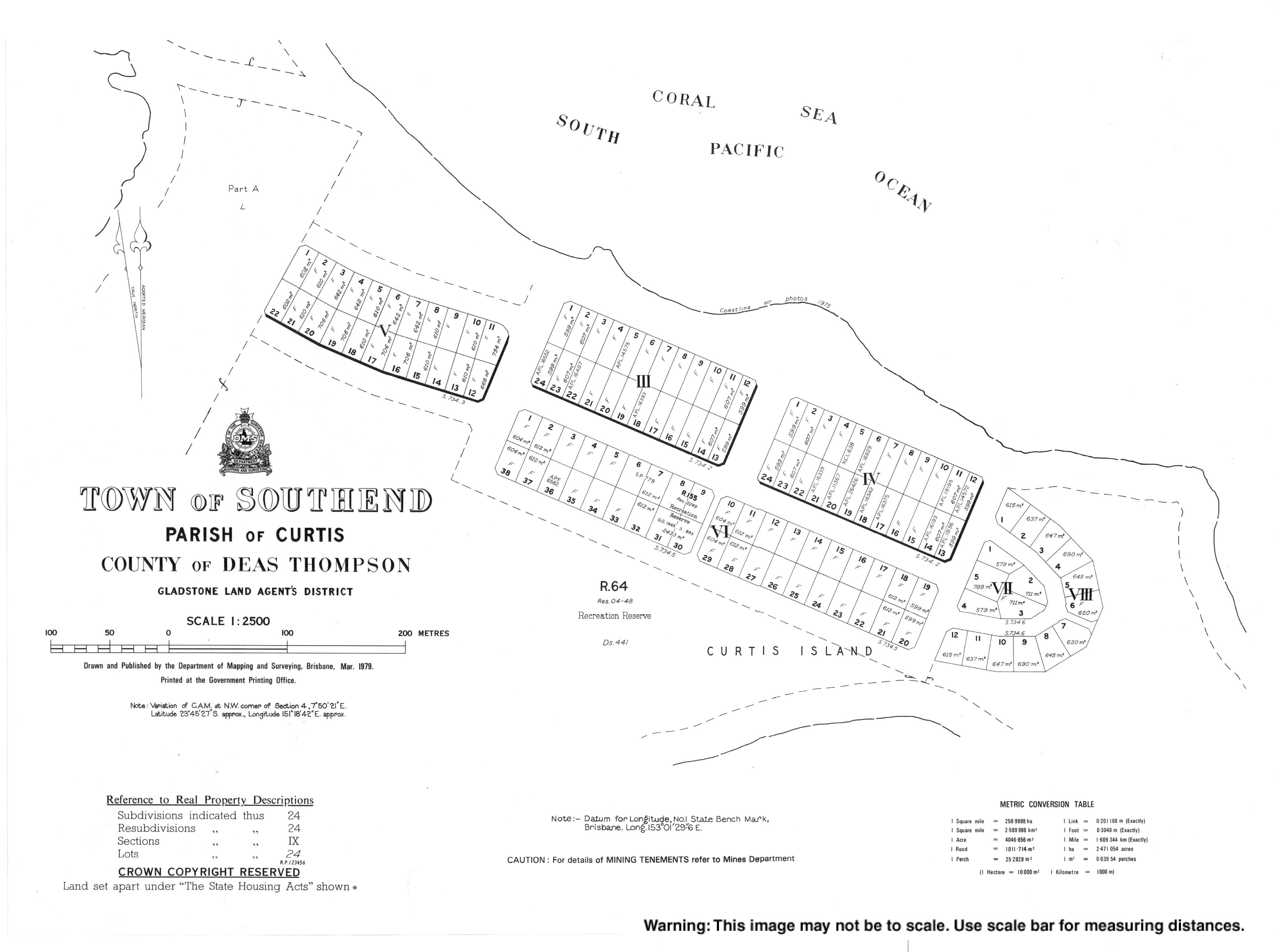
사우스엔드 타운은 1922년 조사 계획 S7341에 처음 등장한다.[4] 1923년 2월, 처음 20블록의 토지를 15년 임대로 제공하였다.[49]
1964년 나우루 섬의 인구를 커티스 섬으로 이전하자는 제안이 나왔다. 그 무렵 나우루는 호주, 영국, 뉴질랜드의 회사들로부터 인산염 채굴을 위해 널리 채굴되어 1990년대에는 이 섬이 사람이 살 수 없을 것이라고 생각될 정도로 경관을 손상시켰다. 그 섬을 재건하는 것은 재정적으로 불가능하다고 여겨졌다. 1962년, 오스트레일리아 수상 밥 멘지스는 광업과 관련된 3국은 나우루아족을 위한 해결책을 제공할 의무가 있다고 말하고, 나우루아족을 위한 새로운 섬을 찾자고 제안했다. 1963년 오스트레일리아 정부는 커티스 섬의 모든 토지(나우루보다 상당히 큰 규모)를 취득한 다음 나우루안에게 그 섬 위에 자유보유권을 부여하고 나우루안이 호주 시민이 될 것을 제안했다.[50][51] 커티스 섬의 나우루아인 정착에 드는 비용은 1000만 파운드로 추정되었는데, 여기에는 주택과 인프라, 목회, 농업, 어업 등의 설립 등이 포함되어 있었다.[52] 그러나 나우루안 사람들은 호주 시민이 되기를 바라지 않았고, 호주인들이 동의하지 않을 독립국가로 자리매김하기 위해 커티스 섬에 대한 주권을 부여받기를 원했다.[53] 나우루는 커티스 섬으로 옮기자는 제안을 거절하고 [54]대신 나우루에서 자체 광산을 운영하는 독립국(1968년 완공된 과정)을 택했다(67년 획득). 1989년 나우루는 인산염 채굴로 인한 환경 피해를 구제하지 못해 나우루의 채굴된 지역을 복구하기 위한 법정 밖 정산을 초래한 호주에 대해 국제사법재판소에서 법적 조치를 취했다.[55][56]
유산 목록
커티스 섬에는 다음과 같은 여러 유산 목록이 있다.
- 커티스 섬의 북동쪽 끝: 곶 염소자리[43] 빛
- Sea Hill Point : Sea Hill Light[42]
운송
커티스 섬에는 다리가 없다.[5] 2019년 4월, 차량 및 여객선이 주 5일 동안 글래드스톤에서 페이스 아일랜드의 Farmers Point를 통해 사우스엔드까지 운행한다.[57]
멸종위기 조류
커티스 섬은 1999년 환경보호 및 생물다양성보전법에 따라 멸종위기에 처한 작은 새인 카프리콘 황색채팅(Epthianura crocea macregori)이 서식하고 있다.[58] 2020년[update] 현재, 이 새는 커티스 섬의 해수면 상승에 의해 위협받고 있다. 퀸즐랜드 중부 해안의 3개 평야에서만 볼 수 있으며, 2002년 이후 이 해안을 따라 해수면이 80밀리미터(3.1인치) 상승하였다. 인구는 20년 전에는 단지 두어 쌍으로 줄었지만, 지금은 커티스 섬에 거의 40명이 살고 있다. 이 같은 증가세는 2006년부터 진행된 야생돼지 도살 프로그램과 2016년경 소떼 제거에 따른 것으로 풀이된다. 잡담은 내륙으로 옮겨오고 있지만 나무에 가까우면 참새매와 같은 새의 먹이가 될 가능성이 높다. 센트럴 퀸즐랜드 대학의 연구원인 밥 블랙은 20년 동안 이 새를 연구해왔다.[59]
참조
- ^ a b Australian Bureau of Statistics (27 June 2017). "Curtis Island (SSC)". 2016 Census QuickStats. Retrieved 20 October 2018.

- ^ "Curtis Island – locality in Gladstone Region (entry 47384)". Queensland Place Names. Queensland Government. Retrieved 1 January 2019.
- ^ a b "Beachton – town in Gladstone Region (entry 48141)". Queensland Place Names. Queensland Government. Retrieved 26 October 2019.
- ^ a b c "Southend – town in the Gladstone Region (entry 31557)". Queensland Place Names. Queensland Government. Retrieved 1 April 2019.
- ^ a b c d e "Queensland Globe". State of Queensland. Retrieved 27 March 2019.
- ^ "The Queensland Curtis LNG Project". QGC. Archived from the original on 5 November 2011. Retrieved 7 November 2011.
- ^ "GLNG". 1 November 2011. Archived from the original on 7 June 2008. Retrieved 7 November 2011.
- ^ "The Narrows – a channel in the Gladstone Region (entry 34032)". Queensland Place Names. Queensland Government. Retrieved 5 April 2019.
- ^ "The Narrows". Gladstone Healthy Harbour Partnership. Archived from the original on 5 April 2019. Retrieved 5 April 2019.
- ^ a b c "Ramsay Crossing" (PDF). Gladstone Regional Council. Archived from the original (PDF) on 5 April 2019. Retrieved 5 April 2019.
- ^ a b c d e f g h i j k l m n o p q r s t u "Mountain peaks and capes - Queensland". Queensland Open Data. Queensland Government. 12 November 2020. Archived from the original on 25 November 2020. Retrieved 25 November 2020.
- ^ "Cape Keppel – cape in Gladstone Region (entry 18005)". Queensland Place Names. Queensland Government. Retrieved 25 November 2020.
- ^ "Station Point – point in Gladstone Region (entry 32297)". Queensland Place Names. Queensland Government. Retrieved 25 November 2020.
- ^ "Warners Point – point in Gladstone Region (entry 48140)". Queensland Place Names. Queensland Government. Retrieved 25 November 2020.
- ^ "Cape Capricorn – cape in Gladstone Region (entry 6160)". Queensland Place Names. Queensland Government. Retrieved 25 November 2020.
- ^ "Sea Hill Point – point in Gladstone Region (entry 30313)". Queensland Place Names. Queensland Government. Retrieved 25 November 2020.
- ^ "Dinkys Point – point in Gladstone Region (entry 10096)". Queensland Place Names. Queensland Government. Retrieved 25 November 2020.
- ^ "Black Head – cape in Gladstone Region (entry 2856)". Queensland Place Names. Queensland Government. Retrieved 25 November 2020.
- ^ "Laird Point – mountain in Gladstone Region (entry 18807)". Queensland Place Names. Queensland Government. Retrieved 25 November 2020.
- ^ "Boatshed Point – mountain in Gladstone Region (entry 3389)". Queensland Place Names. Queensland Government. Retrieved 25 November 2020.
- ^ "Hamilton Point – mountain in Gladstone Region (entry 15281)". Queensland Place Names. Queensland Government. Retrieved 25 November 2020.
- ^ "Bald Hill – mountain in Gladstone Region (entry 1307)". Queensland Place Names. Queensland Government. Retrieved 25 November 2020.
- ^ "Grassy Hill – mountain in Gladstone Region (entry 14662)". Queensland Place Names. Queensland Government. Retrieved 25 November 2020.
- ^ "One Mile Hill – mountain in Gladstone Region (entry 25408)". Queensland Place Names. Queensland Government. Retrieved 25 November 2020.
- ^ "Sea Hill – mountain in Gladstone Region (entry 30312)". Queensland Place Names. Queensland Government. Retrieved 25 November 2020.
- ^ "Coast Hill – mountain in Gladstone Region (entry 7549)". Queensland Place Names. Queensland Government. Retrieved 25 November 2020.
- ^ "Mount Barker – mountain in Gladstone Region (entry 1643)". Queensland Place Names. Queensland Government. Retrieved 25 November 2020.
- ^ "Mount Barney – mountain in Gladstone Region (entry 1689)". Queensland Place Names. Queensland Government. Retrieved 25 November 2020.
- ^ "Sandhill – mountain in Gladstone Region (entry 29602)". Queensland Place Names. Queensland Government. Retrieved 25 November 2020.
- ^ "Central Hill – mountain in Gladstone Region (entry 6786)". Queensland Place Names. Queensland Government. Retrieved 25 November 2020.
- ^ "Black Head – mountain in Gladstone Region (entry 2855)". Queensland Place Names. Queensland Government. Retrieved 25 November 2020.
- ^ "Ship Hill – mountain in Gladstone Region (entry 30747)". Queensland Place Names. Queensland Government. Retrieved 25 November 2020.
- ^ 구텐베르크 프로젝트 첫 항해 중 쿡 선장의 일기
- ^ "Curtis island – island in the Gladstone Region (entry 9101)". Queensland Place Names. Queensland Government. Retrieved 1 April 2019.
- ^ a b Bevis, Mary (24 March 2014). "Keeping island's history alive". Gladstone Observer. Archived from the original on 1 April 2019. Retrieved 1 April 2019.
- ^ "Grassy Hill – hill in Gladstone Region (entry 14662)". Queensland Place Names. Queensland Government. Retrieved 1 April 2019.
- ^ "Sea Hill – hill in the Gladstone Region (entry 30312)". Queensland Place Names. Queensland Government. Retrieved 1 April 2019.
- ^ "Current News". The Queenslander. Vol. XII, no. 85. Queensland, Australia. 31 March 1877. p. 8. Archived from the original on 4 February 2021. Retrieved 1 April 2019 – via National Library of Australia.
- ^ "Mackenzie Island – island in the Shire of Livingstone (entry 20452)". Queensland Place Names. Queensland Government. Retrieved 1 April 2019.
- ^ "NEW SOUTH WALES". Rockhampton Bulletin. Vol. XIX, no. 2796. Queensland, Australia. 22 March 1877. p. 2. Archived from the original on 4 February 2021. Retrieved 1 April 2019 – via National Library of Australia.
- ^ "ROCKHAMPTON". Maryborough Chronicle, Wide Bay and Burnett Advertiser. Vol. IV, no. 169. Queensland, Australia. 11 February 1864. p. 1 (Maryborough Chronicle, SUPPLEMENT). Archived from the original on 4 February 2021. Retrieved 1 April 2019 – via National Library of Australia.
- ^ a b "Little Sea Hill Lighthouse (entry 602784)". Queensland Heritage Register. Queensland Heritage Council. Retrieved 11 July 2015.
- ^ a b "Cape Capricorn Lightstation (entry 601723)". Queensland Heritage Register. Queensland Heritage Council. Retrieved 1 August 2014.
- ^ "The end of an era". Australian Broadcasting Corporation. 11 December 2014. Archived from the original on 5 April 2019. Retrieved 5 April 2019.
- ^ Tiffin, Chris. "Praed, Rosa Caroline (1851–1935)". Australian Dictionary of Biography. Melbourne University Press. ISSN 1833-7538. Retrieved 10 July 2013 – via National Centre of Biography, Australian National University.
- ^ 지출원(1988) 페이지 210
- ^ 지출원(1988) 페이지 211
- ^ 지출원(1988) 페이지 212
- ^ "Government Sales". Worker. Vol. 33, no. 1656. Queensland, Australia. 1 February 1923. p. 17. Archived from the original on 4 February 2021. Retrieved 1 April 2019 – via National Library of Australia.
- ^ "Island Purchase For Nauruans". The Canberra Times. Vol. 38, no. 10, 840. Australian Capital Territory, Australia. 6 May 1964. p. 5. Archived from the original on 4 February 2021. Retrieved 1 April 2019 – via National Library of Australia.
- ^ "Nauruans Likely To Settle Curtis Island". The Canberra Times. Vol. 37, no. 10, 549. Australian Capital Territory, Australia. 30 May 1963. p. 9. Archived from the original on 4 February 2021. Retrieved 1 April 2019 – via National Library of Australia.
- ^ McAdam, Jane (15 August 2016). "How the entire nation of Nauru almost moved to Queensland". The Conversation. Archived from the original on 1 April 2019. Retrieved 1 April 2019.
- ^ "Lack Of Sovereignty 'Disappoints' Nauruans". The Canberra Times. Vol. 37, no. 10, 554. Australian Capital Territory, Australia. 5 June 1963. p. 45. Archived from the original on 4 February 2021. Retrieved 1 April 2019 – via National Library of Australia.
- ^ "Nauru not to take Curtis Is". The Canberra Times. Vol. 38, no. 10, 930. Australian Capital Territory, Australia. 21 August 1964. p. 3. Archived from the original on 4 February 2021. Retrieved 1 April 2019 – via National Library of Australia.
- ^ Highet, K; Kahale, H (1993). "Certain Phosphate Lands in Nauru". American Journal of International Law. 87 (2): 282–288. doi:10.2307/2203821. JSTOR 2203821. Archived from the original on 11 May 2011. Retrieved 11 October 2008.
- ^ Case Concerning Certain Phosphate Lands in Nauru (Nauru v. Australia) Application: Memorial of Nauru. ICJ Pleadings, Oral Arguments, Documents. United Nations, International Court of Justice. January 2004. ISBN 978-92-1-070936-1.
- ^ "Ferry Timetables". Curtis Ferry Services. Archived from the original on 5 April 2019. Retrieved 5 April 2019.
- ^ Jaensch, R, Houston, W, Black, R, Campbell, L, McCabe, J, Elder, R, Porter, G. (2004) 퀸즐랜드 중부 해안 토릴라 평원에서 열린 노란 채팅 '엡티아누라 크로체아 맥그리거리'의 카프리콘 아종 재발견. 2021년 2월 4일 웨이백머신에 보관" 선버드 34: 24-36
- ^ Stünzner, Inga (14 June 2020). "Rising sea levels threaten critically endangered Capricorn yellow chat". ABC News. Australian Broadcasting Corporation. Archived from the original on 15 June 2020. Retrieved 15 June 2020.
참고 문헌 목록
- Sender, Dale (1988) "로사 찬양: 데브라 (ed) (1988) A Bright and Fired Ryp, Ringwood, Penguin의 Adelaide에 있는 "오리지널 오스트레일리아 작가"
외부 링크
| 위키미디어 커먼즈에는 퀸즐랜드주 커티스 아일랜드와 관련된 미디어가 있다. |
